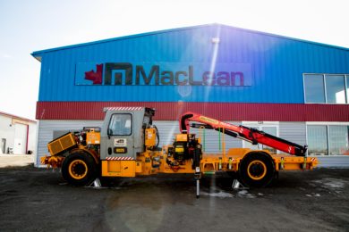
Anya Lamb, Marketing Manager @DroneDeploy notes that drone-based mapping is “already bringing enormous insights and efficiency gains to a variety of industries. The ability to quickly get an overhead view of a job site is very useful for site planning and communication — but for many industries, particularly mining, using drones to understand elevation data is even more valuable.
“In February, we released our initial elevation and volume tools, which gave users a way to capture relative elevation data and measure stockpile volumes in a way that was faster and more cost-effective than ever before. With just one 15 minute flight, users can collect elevation data that would have taken hours — if not days — to collect with traditional ground-based surveying methods.
“That initial release was just the beginning. In the last four months, we’ve worked with our users to better understand how they use elevation data in their businesses, and we are excited to announce several new improvements to help make the elevation data in DroneDeploy even more powerful.
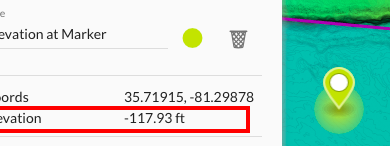
“It sounds like a simple thing, but the ability to immediately view the elevation of any point when you drop a marker on your map can be used for a variety of different purposes. With this new capability, it’s easy to measure the height of a structure or use the elevation and distance between points to calculate slopes, and more.” As shown in the diagram.
The original version of the volume tool released back in February allows users to outline a formation, e.g., a stockpile, and then instantly calculate the volume with a click of the button. Behind the scenes, DroneDeploy used the outline to define the “base” of the stockpile, and then compares the base to the surface of the pile to make the calculation.
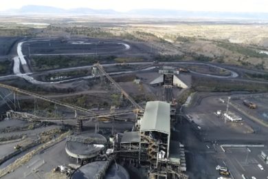
The first version of the tool worked great for calculating stand-alone stockpiles on flat surfaces. In one case study, drone service provider Dallas VanZanten discusses how he used the DroneDeploy volume tool to calculate stockpile volumes at a granite processing plant to within 1% accuracy in a fraction of the time compared to traditional methods.
“Drones are safer, faster, and about half the cost as compared to traditional ground-based volumetrics.” — VanZanten, Skymedia Northwest
But what if you need to calculate the volume of a bench in an open-pit mine or walled stockpile where the base of the structure can’t be easily defined by drawing a perimeter on the ground? A small adjustment to the volume tool now allows you to use the lowest selected point to define the base of the volume want to calculate, making the volume calculation useful and accurate for a broader range of volume calculations.