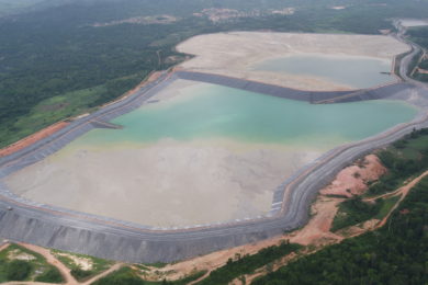
As part of its 2019 Sustainability Report Beyond the Mine that has just been released, Newmont says it has further strengthened its management of tailings, whilst enhancing transparency through a new tailings website (https://www.newmont.com/sustainability/environmental-responsibility/tailings-management/default.aspx) with details on all 104 tailings dam facilities at Newmont’s operating sites, joint ventures, subsidiaries and legacy sites.
To further improve its tailings management governance, Newmont has also developed a framework to clarify the roles and responsibilities for managing TSFs and to define the minimum competency and requirements for critical roles. Cross-functional tailings management training and implementation of this governance structure at its operations are a key focus area for the company in 2020 given the addition of the Goldcorp sites.
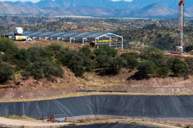
In 2019, Newmont also completed a landscape review of its monitoring program and states: “Although we use drones at most of our operations to monitor tailings beach development, we are exploring opportunities to use drones with additional sensors that better monitor the performance of our pit slopes, TSFs and water dams, and allow operators to focus more on assessments and management rather than visual inspections and ground surveys.” The Boddington mine in Australia has been testing the use of aerial drones for daily inspections and deformation maps for pit slopes, TSFs, site dams and other site features. This data will be incorporated into Newmont’s critical controls program.
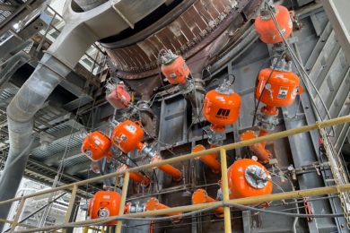
The company adds: “We are piloting an innovative proprietary online application that will support critical control verifications and enable improved real-time reporting and follow-up. Our Boddington and Porcupine operations piloted the critical control application in late 2019. We rolled out the system to the remaining sites in early 2020 along with a new guidance document on critical control reporting.”
In addition to real-time monitoring of TSFs and the use of aerial drones, Newmont is exploring InSAR (Interferometric Synthetic Aperture Radar) technology, which uses satellite data to study deformation. “In hindsight, InSAR provided advanced signs of deformation prior to the Vale tailings dam failure at Córrego do Feijão, Cadia (March 2018) and Samarco (November 2015). This type of monitoring will allow us to assess the performance of our facilities in real time, improving our response and reducing risks. It also aligns with the Global Tailings Standard. Our Boddington mine currently uses InSAR, and we are planning to expand usage at other sites in 2020.”