Tag Archives: Mineral exploration

Australia georesources sector set for further consolidation with QTEQ/WSG merger

Australia-based Qteq and Wireline Services Group (WSG) have agreed to join forces as they look to build a bigger domestic and overseas base in the georesources sector.

The merger, one of five corporate M&A transactions by Qteq in 2018, alone, signals an influx of innovative borehole measurement sensors and systems backed by two of the world’s leading geotechnical companies, Qtec said.

“The transaction will partner Qteq’s integrated technical services team with almost 80 field logging engineers across Australia and Canada,” the company added.

Qtec’s recent acquisition activity has seen it buy Surtech Systems and directional drilling and measurement-while-drilling (MWD) company WellServ, providing its clients with access to leading systems to collect accurate data on the composition and behaviour of subsurface rocks. WSG will complement this offering with its “safe, reliable and accurate” subsurface data acquisition and analysis services.

Qteq founder and CEO Simon Ashton said WSG shared the company’s vision for a “sustainable, environmentally responsible georesources sector”.

He added: “WSG’s 18 years of experience and dedicated team enhances Qteq’s national and international service capability beyond our current bases in every Australian state and core hubs overseas.”

The merger is supported by WSG founder and Managing Director Matthew Mayne, who will remain at Qteq as Managing Director of the Qteq Measurement Systems division, Qtec said. Mayne, who launched WSG more than 18 years ago, said the merger was a great opportunity for the company’s expertise to reach new markets.

“My first order of business will be driving the division’s regional and global growth, as Qteq continues to expand into South America, Africa and Canada,” Mayne said.

“The integration of the two companies will provide new opportunities across the georesources sector on a scale that has not been seen before. It will build and refine the skillset of our combined teams and provide our clients with direct access to Qteq’s innovative subsurface technologies.”

As a leading provider of subsurface geophysical and geotechnical measurement systems, and more than 30 logging units across Australia, Asia and Canada, WSG’s in-house data services team will work alongside Qteq’s client-focused team to increase the market uptake of Qteq’s technology portfolio, Qtec said.

Mayne said: “We aim to offer the most innovative, cutting edge subsurface data services and technology in the industry.

“Qteq’s research and development team, in Perth, is building a tech-based bridge from the oil and gas sector to the coal seam gas, mining and ground water industries, with elemental spectroscopy and MWD systems for RC drilling.”

Qtec said: “Qteq’s team is fully committed to providing an efficient and safe solution to the mine site automation trend that is changing the georesources industry. Measuring and monitoring the subsurface drives informed decision making, and protects the industry’s social licence to operate and meet community environmental expectations.”

Magnetic inversion data helps identify more gold at Nullagine

Millennium Minerals’ new exploration targeting methodology at the Nullagine gold project in Western Australia has come up trumps, with a new greenfield target identified 1.8 km southwest of its flagship Golden Eagle deposit.

The new target, which has already been the subject of reconnaissance drilling, was identified through a combination of 3D magnetic inversion, structural analysis and soil geochemistry.

Drilling has returned what Millennium calls a “significant” 12 m intercept comprising a broad zone of highly anomalous mineralisation with a similar alteration to Golden Eagle – where the company has defined 334,400 ounces of resources grading 1.4 g/t Au – including a narrow zone of high-grade gold.

The assay that so far best characterises this is a 12 m interval averaging 0.87 g/t Au from 184 m depth, which includes 1 m at 3.13 g/t Au from 191 m.

The 3D magnetic inversion models have also outlined an alteration zone measuring 400 m in strike Millennium is planning to follow up with drilling, it said.

This whole approach is something very new for Millennium, CEO Peter Cash said.

“While most of our exploration at Nullagine has historically been directed towards outcropping geochemical targets – which have been very successful in delivering ongoing increases in resources and reserves – we believe that an integrated targeting methodology based on a mineralised system approach has the potential to unlock major new discoveries,” he said.

“Three dimensional magnetic inversion data has never previously been used to identify gold mineralisation at Nullagine, and we are really excited to now have confirmation that this technology can successfully define new gold targets in the Mosquito Creek Basin.”

He said the use of 3D data represents an “enormously important technical breakthrough” for the area and Millennium.

Millennium produced 70,371 ounces of gold at Nullagine in the year to the end of June.

New survey to open up undercover exploration in South Australia’s Gawler Craton

New data collected from the Geological Survey of South Australia (GSSA) and the Commonwealth Scientific and Industrial Research Organisation (CSIRO) is set to open up undercover exploration in the Gawler Craton.

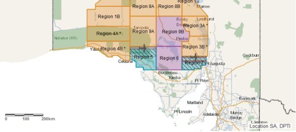
The Gawler Craton Airborne Survey has been designed to capture approximately 1.8 million line kilometres of new magnetic, radiometric and digital elevation geophysical data over an area of some 324,000 sq.km.

The data will far surpass the current patchwork of surveys and provide a single, uniform dataset that will be fundamental in reinterpreting the geological structure of the Gawler Craton, according to the South Australia Government.

The Gawler Craton is host to the world-class Olympic Dam iron ore copper gold deposit, which hosts the world’s largest uranium deposit, as well as sizeable copper and gold resources. Several major copper mines including Prominent Hill, Cairn Hill, Mount Gunson, Hillside and Kanmantoo are also located here, in addition to projects like Carrapateena, Khamsin, Emmie Bluff and Punt Hill.

This week, the first data release of rock depth from the programme – focused on the north-western Gawler Craton – was published.

Officially opening the South Australian Resources and Energy Investment Conference (SAREIC) in Adelaide on July 30, Minister for Energy and Mining Dan van Holst Pellekaan said the information “will give explorers a head start on their exploration programmes and save precious time and money”.

“When it comes to exploring undercover, knowing the depth of prospective rocks is critical, given the cost and expense involved in drilling. This project is an international standout bringing an amazing clarity and precision in seeing through earth’s cover,” he said.

Today’s release is the first of 16 packages to be rolled out by the GSSA over the next 12 months covering the remaining Gawler Craton survey, and builds on previous releases of magnetic, radiometric and digital elevation data across a vast region of South Australia.

Despite many mines and prospects, the Gawler province is largely underexplored due primarily to the cover of regolith making exploration difficult. Statistical analysis of the type of orebodies present in the Gawler Craton, compared to similar style deposits globally, suggests there is an opportunity for more economic mineral discoveries to be found.

SGS sets up shop in Quebec’s golden district

SGS has opened up a new sample preparation facility in Val-d’Or, Quebec, seeking to serve the growing needs of minerals exploration companies in the province.

This is the second Canada office opening for the company in a month having set up a sample prep lab in Whitehorse, Yukon, earlier in July.

The facility is equipped to provide drying, grinding, crushing, pulverising and soil screening capabilities. Sample preparation can be completed on RC chips, and core, rock, trend and soil samples.

Val d’Or, French for ‘valley of gold’, has a vibrant gold mining history. It is part of the Abitibi Greenstone Belt, which has produced more than 170 million ounces of the yellow metal since 1901.

The new Val-d’Or laboratory is SGS’ seventh in Canada, with four in Ontario, one in British Columbia and one in the Yukon.

SGS offers a wide range of services to the minerals sector including geochemical analysis, resource calculation, mineralogy, metallurgy, engineering, process design and engineering, process control, water treatment and trade services.

Minnovare sets sights on US market with Azimuth Aligner distribution deal

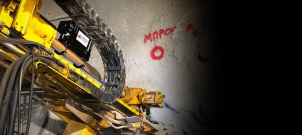
International Directional Services (IDS) has entered into an agreement with Australia’s Minnovare to distribute the Azimuth Aligner® drill rig alignment system.

The agreement will see the product available from IDS on a rental basis within its core distribution market of the US.

IDS, a wholly-owned subsidiary of Granite Construction Inc, said mining clients now had “an even greater selection of tools and brands from a single source…well-positioned to provide excellent service and coverage”.

The Azimuth Aligner is used in mining exploration and civil construction projects to automate the drill-rig alignment process. Minnovare claims it reduces rig setup times by up to 90%, increases drilled metres per shift by up to 20%, reduces costs per drilled metre by up to 15%, sets up 100% of holes within tolerance and increases revenue per rig by up to 10%.

The product is currently deployed at over 100 international mine sites and tunnelling projects, according to Minnovare.

Jason Smith, General Manager at IDS, said: “With this new alliance, IDS will continue to be able to supply its customers and the mining/drilling industries with some of the most innovative and advanced technology available for azimuth alignment systems.”

UNEXMIN’s UX-1a robot goes underwater at Kaatiala mine

The UNEXMIN team has come back from a trip to the flooded Kaatiala mine site in Finland excited after the first field trials with its UX-1 robot proved a success.

The two-week trial ended on June 22, with the first week involving dry and shallow water trials of the robot followed, in the second week, by deeper trials in the northern part of the Kaatiala lake where the entrances to the underground flooded workings are found.

UNEXMIN is an EU-funded project that is developing a novel robotic system, primarily for the autonomous exploration and mapping of Europe’s flooded mines. The Robotic Explorer platform, made by three robots – UX-1a, UX-1b and UX-1c – will use non-invasive methods for autonomous 3D mine mapping for gathering valuable geological, mineralogical and spatial information. This could possibly open up new exploration scenarios so strategic decisions on the re-opening of Europe’s abandoned mines could be supported by data that cannot currently be obtained by any other way, without major costs.

The Kaatiala mine is just one of four sites where the robots will be tested. The team are expected to move onto the Idrija mine in Slovenia later this year, followed by the Urgeiriça mine in Portugal (early-2019) and the Ecton mine in the UK (mid-2019). At Ecton, the robot will resurvey flooded mine floors that nobody has seen for more than 150 years.

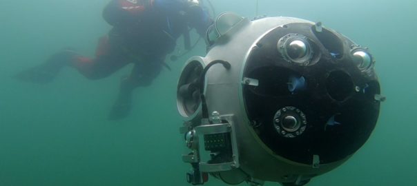
During the second week of trials at Kaatiala, in June, multiple dives were carried out with the robot (see photo), where UX-1 entered and successfully navigated the underground tunnels.

“Divers previously placed calibration objects in the tunnels to help with testing UX-1 capabilities: navigation, movement, control, mapping, amongst others,” UNEXMIN’s Communications Manager Luis Lopes said.

The tests allowed the UNEXMIN team to test different navigation sensors such as UV and SLS imaging units, multispectral and acoustic cameras, and laser scanners.

“These instruments are essential to gather spatial and geoscientific data,” Lopes said.

“The success of the Kaatiala trials is evident,” he said. “The UNEXMIN team is confident in further developing [and optimising] the technology…and that is the next step in the robotic platform development: to use the data acquired from this trial and improve the robot’s capabilities for the next trial at the Idrija mercury mine in Slovenia, in September.”

Once put together, the multi-robot platform will represent a new technology line only made possible by recent developments in autonomy research, allowing the development of a completely new class of mine explorer service robots, capable of operating without remote control. Such robots do not exist nowadays and UX-1 will be the first of its kind.

DDH1 to start drilling at Auroch’s Arden and Bonaventura projects

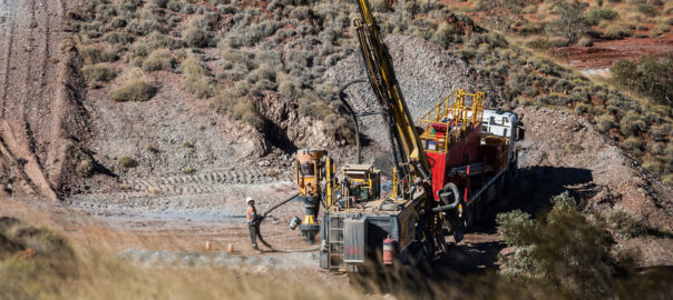
DDH1 Drilling has been selected by Auroch Minerals to carry out the maiden drilling programmes at the Arden and Bonaventura base and precious metal projects in South Australia.

The programmes will comprise up to 5,000m of drilling targeting high-grade base metals and/or gold mineralisation across seven high-priority target areas. Drilling is set to kick off this month.

Auroch CEO Aidan Platel said: “The company continues to build momentum following the results from its recent IP survey, and we are excited to be partnering with DDH1 Drilling for our maiden drilling programmes.”

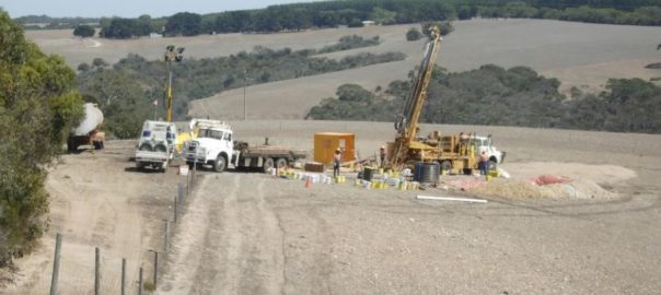
Platel said the company has seven high-priority targets with potential for high-grade mineralisation. Three of these are at Arden with the remainder at Bonaventura (pictured).

While the drilling will be a mix of reverse circulation and diamond holes, Auroch expects the latter to be used when more structural data is required from the holes, when a smaller drilling footprint is necessary, or where significant groundwater proves problematic for RC drilling.

Arden, located about 3.5 hours’ drive north of Adelaide, hosts 720km² of unexplored sedimentary exhalative mineralisation, according to Auroch. Results from initial exploration at the Ragless Range, Kanyaka and Radford Creek targets have unearthed promising prospects for large scale copper and zinc deposits.

Bonaventura sits in the northern part of Kangaroo Island and covers highly prospective geology and historic mines along 30 km of strike of the regional-scale Cygnet-Snelling Fault. Bonaventura has several high-grade zinc and gold targets that are drill ready, Auroch said.

Qtec sees benefits of M&A with BMR environmental logging order

Qteq is making the most of its recent acquisition of subsurface data logging company Surtech Systems, securing what it believes is the first of many expected contracts to provide borehole data using new measurement sensors and systems.

The contract for environmental logging in the Northern Territory, Australia, will use Qteq’s patented Borehole Magnetic Resonance (BMR) technology to provide real-time accurate measurement of the aquifer.

BMR technology, which has been used in the oil and gas industries since the early 1990s, is sensitive to both the fluid volumes present in a rock, and the geometry of the pores containing these fluids. It, thus, provides information on both storage and flow potential.

Not only does BMR provide fluid volume and porosity, independent of any lithology effects, it can also differentiate the volume fraction of mobile fluid that can be produced from the fluid volume fraction bound in place in the rock. The pore geometry information obtained directly from BMR measurements also allows permeability and hydraulic conductivity to be derived, providing an understanding of how effectively the fluids will produce.

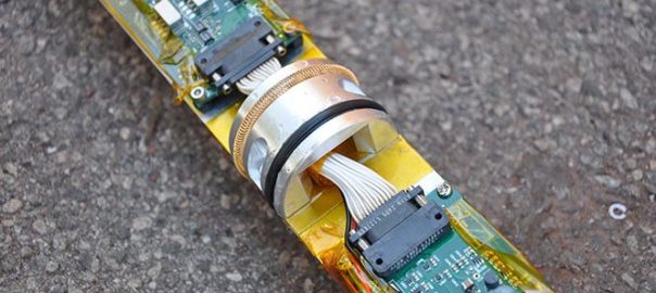
Tools developed for BMR application (Qtec’s own, pictured above) have typically been too large, too complex and too costly for use in other georesource sectors, however Qtec has developed fit-for-purpose tools that meet both the environmental and commercial requirements of a number of sectors.

Qteq said its recent acquisitions made its exploration analysis offering that much more complete.

“The addition of Surtech Systems and directional drilling and measurement while drilling company WellServ, means Qteq clients now have access to industry-leading systems to collect accurate data on the composition and behaviour of subsurface rocks.”

Qteq Chief Technology Officer Dr Tim Hopper said the two acquisitions, which will be re-branded as Qteq Measurement Systems, expanded the company’s operational footprint and market adoption of BMR, spectroscopy and logging while drilling services that are currently being developed.

“We now have a platform for commercialising a range of new technologies in our R&D pipeline,” Dr Hopper said.

Earlier this month, Qtec was one of eight recipients of government funding through the METS Ignited Collaborative Project Funds.

Orexplore

A first for Swick’s Orexplore scanning tech

Swick Mining Services has signed the first commercial agreement for its Orexplore mineral scanning technology.

The agreement, between Swick’s fully-owned subsidiary Orexplore Australia and exploration company Saturn Metals, has already led to the first batch of 30m of core from Saturn’s Apollo Hill gold project in Western Australia being processed by the patented GeoCore X10 scanning machine and technology.

The Apollo Hill gold project is made up of nearly 1,000km² of ground near Leonora in the Goldfields region.

Swick Managing Director Kent Swick said, although small in value, the agreement was a major milestone for the Orexplore technology.

“This deal comes barely two months after Swick officially launched the Orexplore mineral analysis technology in Australia and is a major step towards commercialisation of this world-first technology.”

Orexplore was developed over a seven-year period in Sweden and provides real-time, non-destructive assay and tomography results using whole of core data that is an improvement on the multiple weeks delay currently used in destructive chemical testing, according to Swick.

GeoCore X10 core scanning machines use patented attenuation and x-ray fluorescence combined measurement techniques to enhance the identification and understanding of key features within the entire core including:

• Geochemical composition and mineralogy
• 3D structures
• Texture, fabric and grain size
• Density
• Controls on mineralisation.

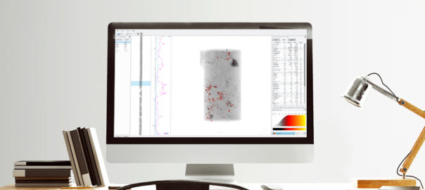
The scan results are made available to the client for viewing and analysis through Orexplore’s Insight software. This enables interactive 3D manipulation of the tomography data which can lead to accurate definition of geological structures, the ability to define lithological contacts and the true boundaries of mineralisation. It also provides element concentration data for further analysis.

Kent Swick said: “We have seen good levels of interest across a wide spectrum of potential clients who have been trialling the product since it was introduced. Many of those are now deciding how to use the technology in their current work flows and we are confident a number of proposals will be converted into laboratory scanning agreements soon.”