
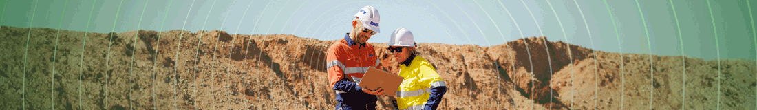
 An article in the October issue examines the research and outcomes of work being done by Canada’s Centre for Excellence in Mining Innovation. One section of this work for which there was not space in the article is CEMI’s ConstructMINE program. This supports projects for underground construction using both conventional drill and blast as well as mechanical excavation and focuses on five key aspects:
- Speed and quality of underground infrastructure construction including shaft sinking and tunnelling logistics
- Development and design of innovative support methods for different excavation systems including prototype development and testing
- Reliable prediction of rock behaviour to properly select and implement construction technologies including effective, advanced ground characterisation procedures
- Improvements of machine performance from an equipment and ground management perspective
- Use of smart (observational) approaches when working with the rock mass to minimise risks and uncertainties, including feedback processes to facilitate flexibility in matching construction to conditions encountered in complex orebodies.
CEMI has secured contracts with MIRARCO, Delft University of Technology, University of British Columbia, Itasca – USA, University of Toronto and University of Dalian in the field of ground support related to rapid development and sub-level caving. The projects completed to date cover shaft boring gripper stability and shotcrete shaft support for mechanised environments.
The GeoRisk project is evaluating and aims to mitigate the risks associated with underground mining in high stress, structurally complex ore zones. “Mining investors are increasingly sensitive to risk when making large capital expenditures. This can be alleviated if the time required to develop a mine and ramp-up production can be shortened and if the most appropriate mining method, means of access, and equipment type can be selected with confidence.” Work completed and underway:
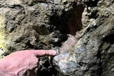
- Craig case history and Craig mine design review
- Structural guidelines for rockburst-prone ground
- GeoHazmap Tool – Mapping the hazard and identifying risks associated with rockbursts in underground mines
- Site characterisation – Monitoring the changes in rock mass quality due to the process of mining
- Burst Support Tool – Helping to address underground rock support needs in dynamic loading conditions.
Geohazmap Workflow provides a powerful solution for geotechnical hazard estimation and monitoring. Multiple criteria can be combined using a variety of knowledge-driven and data-driven methods to highlight hazardous ground.
The workflow interface guides the user through the construction of a hazard model for either underground or open-pit operations, and then applies it in either a standard or real-time monitoring mode. Hazard definitions, normalisations, and weightings under the main categories of geology, rock quality, mine seismicity, structure, stress, and geometry are completely user-defined.
The standard GOCAD® workflow interface is supplemented by a new, powerful dashboard interface. Geohazmap Workflow works closely in conjunction with Targeting Workflow for both 4D back-analysis and forecast of geotechnical hazard.
GOCAD Mining Suite Geohazmap Workflow is an extension of ParadigmTM GOCAD, which Mira Geoscience says is “the world’s most sophisticated geological modelling platform, adapted specifically for mining.”
Modelling of mine infrastructure, geology, structure, and geotechnical rock mass block models make full use of GOCAD’s intrinsic 3D surface modelling, solid modelling, and geostatistical functionality. Complex relationships amongst geology, structure, stress, and seismic data are handled by the underlying power of object data structures and modelling engine It handles any type of ground failure or hazard for which objective criteria can be developed. The user defines how criteria are spatially, temporally, and quantitatively related to hazards.
It allows selection of pre-defined hazard criteria such as rock type, rock quality, proximity to structure and structural intersections, fault slip tendency, kinematic planar and wedge failure, microseismic event density and source parameters, stress models. Any number of userspecified hazard criteria can be added. It provides real-time monitoring. All inputs can be specified as dynamic: availability of new data automatically triggers recomputation and display of the hazard estimate.
Fault slip control has been identified as one of the most strategic risk factors so CEMI’s GeoRisk program has been expanded to include a large parallel multi-million, multi-year program with a vision to develop a globally-recognised research initiative to improve fault slip control technologies and techniques. IFSCRI’s (International Fault Slip Control Research Initiative) objectives are:
- Better understand the mechanisms causing fault slip in underground mines and produce recommendations on how to minimise the risk to the safety of miners and the economic future of deep mines (minimise investor risk)
- Establish fault slip test sites as “living laboratories” for researchers to carry out projects designed to understand the causes of fault slip events and to develop energy release control techniques
- Provide test sites for technology developers to experiment with and verify new technologies designed to monitor failure processes and energy flow for release in underground mines.