


Leading fully-managed commercial drone provider Identified Technologies’ Boomerang UAV solution is now available with integrated Post-Processing Kinematic (PPK) for clients in mining. PPK dramatically reduces the need for laying of Ground Control Points (GCPs). It also, the company says, “saves companies thousands of man hours and drastically increases the ease, accuracy, and profitability of using a commercial drone solution. For applications like measuring stockpiles, PPK even eliminates the need for GCPs.”
“If we did not have to lay ground control points, that would save us about 75% of the time we spend on data gathering with the drone,” said Dustin Drost, Survey Party Chief at Keystone Consultants a Pittsburgh-based Engineering and Consulting firm.
PPK solves the biggest problem in the drone mapping process. Cassie Mittal, Drone Mapping Customer Success Manager added; “Laying ground control and surveying each target has been the largest pain point for a lot of our customers. I’m excited to see PPK streamline their workflow and dramatically improve their accuracy.”
PPK can be used anywhere drones can be used, providing the fast, painless, gathering of accurate data at the push of a button. PPK is a similar GPS-correction technology to RTK, but eliminates the need for radio lock, making it more robust.
Dick Zhang, CEO of Identified Technologies comments: “We are thrilled to be offering this ground-breaking technology to our clients. In addition to the 70-90% cost savings that drone mapping can provide, we are now able to help companies get that data faster, through easier and more intuitive process.”
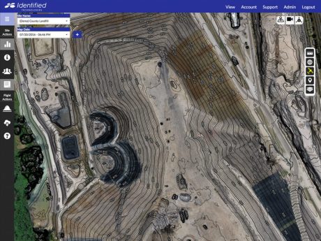
Identified Technologies’ integrated software and services take care of everything from FAA compliance and flight planning, to advanced analytics. Identified Technologies now has an alliance with DJI. Through this, Identified is now providing DJI’s world class technology to its clients in mining. It integrates its software and services with DJI’s Inspire aerial imaging platform to increase project visibility and team productivity. Identified says “clients typically improve their surveying speed and productivity by up to 90%.”
“Surveying projects that used to take months can now be safely gathered in minutes,” said Zhang. “Being able to map sites more quickly doesn’t just improve surveyor productivity, it also ensures management has all the information they need to make smart decisions. On any fast-moving job site, old data is wrong data, so speed and accuracy are everything.”
“DJI’s drones provide accurate aerial images and Identified Technologies’ software turns these images into a wide range of useful data products and analytics such as cost and progress forecasting,” said Jan Gasparic, Head of Enterprise Marketing at DJI. “We are excited to be working with a company that has such a breadth and depth of knowledge in excavation.”
Zhang added, “DJI is the undisputed world leader of unmanned aerial vehicle production. We are pleased to join forces, combining their drones with our leading software to offer our clients the best-in-class solution. We are proud DJI chose us as an official enterprise dealer, and look forward to a continued collaboration with DJI as our industry grows exponentially in the years ahead.”