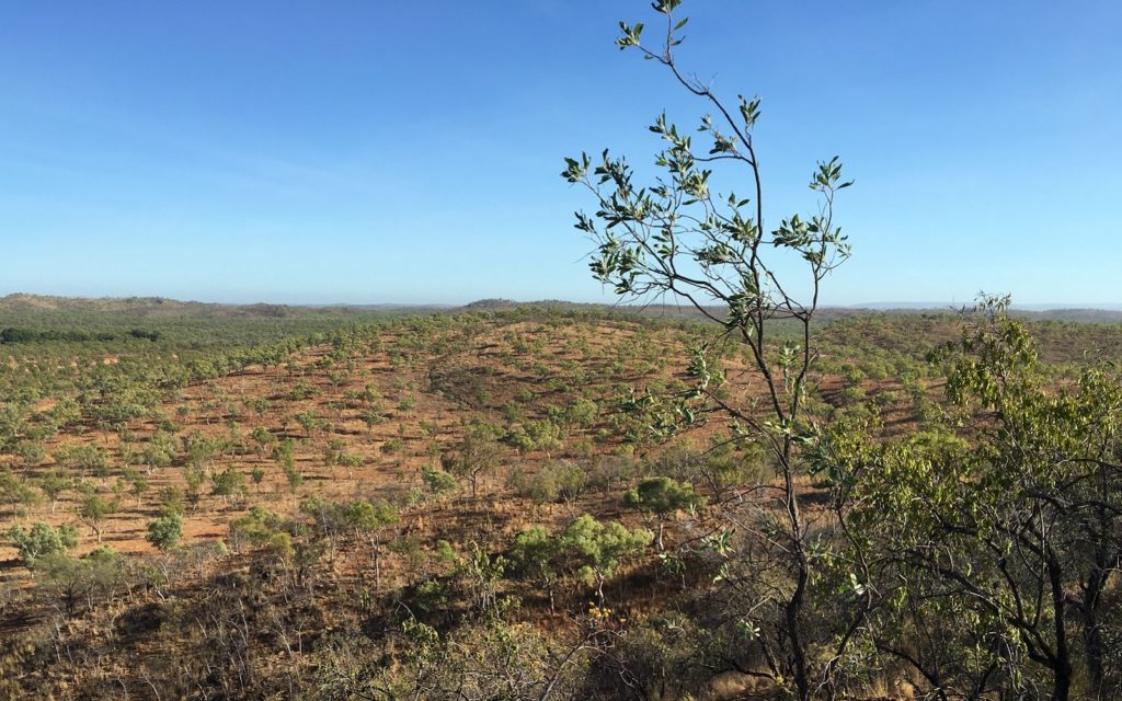
The remote, resource-rich McArthur Basin has been the focus of a three-year research collaboration between CSIRO and the Northern Territory Geological Survey (NTGS) that aims to unlock the secrets of the region’s geology and attract commercial exploration activity. When it comes to understanding one of the most resource-rich parts of Australia’s geology, the greater McArthur Basin in the Northern Territory would be among the country’s greatest challenges.
The soon-to-be completed three-year collaboration between CSIRO and the NTGS has gone some way into unlocking the many mineralogical and geological “black holes” of this massive region, which is situated south-east of Katherine and covers around 180,000 km2. Geologists describe this area with excitement – exploration potential can be challenging due to areas of remoteness, difficulty of access and by the fact that so much of its geological history and evolution has yet to be unravelled.
And, yet some of the world’s largest zinc-lead-silver deposits are known in the area between the NT and Queensland. There is huge potential for both mineral and gas resources.
When CSIRO and the NTGS conceived the joint project in 2014, they opted for a different form of collaboration, where CSIRO would embed two post doc researchers, Dr Marcus Kunzmann and Dr Teagan Blaikie into the NTGS in Darwin. The advantage of this kind of collaboration has been aligning the goals of the two organisations and better supporting collaborative research projects.
CSIRO’s role has been to apply its world class methodologies to identify the pathways and traps of metal-bearing fluids by combining different geoscience fields such as sedimentology, structural geology, geochemistry, geophysics and numerical modelling.
“We needed to gain a detailed understanding of the ingredients that are required to form zinc-lead-silver deposits,” Kunzmann says.
Of course, information has to flow two ways. The NTGS offered access to all the available local geophysical datasets, as well as collaboration with their geologists involved in other projects relating to the regional architecture and resource potential of the greater McArthur Basin, including the construction of regional scale 3D models, stratigraphic correlations and shale gas assessments.
Kunzmann says the two researchers also had access to historical drillcores that they interpreted in detail.
The project was linked to the NTGS’ four-year, A$23.8 million program called the Creating Opportunities for Resource Exploration (CORE) initiative, with the ultimate aim of building knowledge of the geology and resource potential in the basin.
CSIRO’s technical input related to regional and local scale interpretation and modelling of geophysical data including magnetics, gravity, radiometrics, airborne electromagnetics, and seismic data.
“This helped us map different geological features under cover and lead to a reconstruction of the basin’s architecture focusing on how the structural framework evolved through time,” Blaikie says.
The two CSIRO researchers were able to study the most important metal host unit in detail by using geological approaches that are more commonly used in petroleum exploration. This involved reconstructing depositional environments of the 1.6 billion year old rocks, as well as applying various stratigraphic techniques to identify and correlate potential metal traps across the basin.
“We were also able to integrate these results with geochemical data to better understand the chemical conditions under which these rocks formed and to look for distal footprints of mineralisation,” Kunzmann explains.
Dorothy Close, NTGS Director of Regional Geoscience, says that the aim has been to attract more commercial exploration, but all parties remain under no illusion that in terms of knowledge it is still at an early stage. “People don’t realise that the region is a third the size of the entire Northern Territory,” she says.
“We are asking: how can we bring enough knowledge and skills sets together to improve understanding and facilitate explorers to be more successful? We’re looking for a range of commodities in a basin with high mineral and gas potential but we still need to understand certain aspects of it.”
Close says that the CORE initiative, including the three-year CSIRO collaboration, delivered a record amount of data and has changed the way people perceive the geology and its potential. “You can’t directly link an upturn in exploration to what we do, because it could be controlled by other factors.
“However, we can say there has been a significant increase in exploration in this area in the last couple of years. We have managed to facilitate people’s understanding of the area and the response has been very encouraging.”
Blaikie says the modelling of the available geophysical datasets resulted in an improved understanding of the architecture of the basin and an interpretation of how the basin evolved. “We also identified a thick pile of potential zinc-lead source rocks about 7 to 10 km beneath the McArthur River deposit.
“If these rocks were really the source of the deposit, it highlights that metals must not have been transported far and that exploration needs to consider the vicinity of potential source rocks to suitable metal traps.”
The research has also showed that the most important host unit in the McArthur Basin is “heterogeneous” and that only certain intervals in certain areas seemed to be well-suited to have trapped a significant amount of metals.
“The good news is that we have been able to demonstrate how the distribution of these suitable intervals can be predicted using the previously mentioned techniques common in petroleum exploration,” Kunzmann says.
Knowing how certain faults formed and when they were active, helps to predict whether metal-bearing fluids could have moved along them or not.
Also, combining the sedimentological characterisation of the host unit with the results of the numerical fluid flow and geophysical modelling will offer valuable help to industry in evaluating which parts of the basin are likely to be the most prospective.
Close says the NTGS is looking at new programs and the possibility of another mutually beneficial collaboration with CSIRO. “Having the calibre of these researchers in our organisation has lifted our level of understanding and engagement – it’s been very positive for us.”


