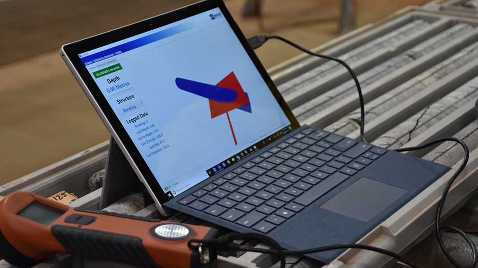
MICROMINE has announced the latest version of its field logging solution, Geobank Mobile 2019. Enhanced user interface control, data capture, camera integration, offline help and file exchange functionality are among the key features. Geobank Mobile 2019 is available for download now.
Geobank Product Strategy Manager, Ian Whitehouse explained the new version boasted enhanced product functionality for both Geobank Mobile’s infield and office-based global product users. Integration to link external DSLR cameras to Geobank Mobile includes a setting which can be configured for ‘hands-free’ capture of images from cameras and data from devices. The functionality includes Auto-advance; the ability to automatically go to the next/new row or cell after pressing the shutter on the camera, used to set-up logging patterns, making manual logging simpler.
Many mining and exploration sites use high-quality DSLR camaras to capture images: core tray photography; drill pads; stockpiles and environmental. With Geobank Mobile’s new ability to integrate with Canon and Nikon cameras, these high-resolution images, can be correctly named when they are taken; this means time does not need to be spent in laborious and error-prone renaming tasks. The additional KT-10 modes to read Conductivity or Magnetic Susceptibility together are now supported by Geobank Mobile, both attributes can be captured with a single reading, the benefit being that one rather than two reading runs are required.
Calculation errors now show with a warning triangle to differentiate them from validation errors, which allows the different type of errors and validation to be managed independently of calculation errors. A new option ‘Always use offline help’ has been added for use if the connection to the internet is slow or limited, such as when using a satellite connection. Users can now access help at anytime, if the internet connection is slow or limited, such as when using a satellite connection, the full benefit of synchronisation can still be achieved without expending resources of accessing web-based help.
Geobank Mobile now exports Micromine .dat files in the latest format allowing for increased interoperability between Geobank Mobile and Micromine. Rows in files exported from Geobank Mobile are now sorted based on the rules configured in the Logging Profile Editor. Many third party applications expect records to be sorted in a particular order, this feature allows the sorting order to be set up in advance, making the transfer of data from Geobank Mobile to other applications far more simple.
“We consulted our users and found they were seeking improvements to better integrate Geobank Mobile with their other tools and ways of working in the field,” Whitehouse explained. “The Geobank team addressed this feedback through a raft of product enhancements, while also correcting minor bugs and enhancing some backend functions for office-based database administrators. The changes make Geobank Mobile even easier to use, allowing users to spend more time reviewing the data captured and analysing insights.”
Key improvements featured in MICROMINE’s geological data acquisition and management solution, Geobank Mobile 2019, include:
• more screen space for easier data entry;
• better integration with external DSLR cameras;
• auto-complete functionality in lookup or dropdown cells;
• offline help for use in areas with slow or limited internet connection, plus expanded help documentation;
• enhanced file import to support .csv files;
• improved workflow when making profile design changes;
• improved logging profiles, including auto data population and more logical row sorting; and
• streamlined data entry, including automated image file naming based on expressions.
“We’ve built on the key features and advantages of the existing Geobank Mobile, including its rich data input controls, powerful calculation fields, flexible data validation rules, easy configuration and existing third-party tool integrations, and created an superior solution that works hard for users in the field and office,” Whitehouse added.
“Geobank Mobile 2019 provides a true infield solution with softkey licencing, which means there is no need for a dongle, and licences that can be transferred from one device to another.”
The new features of Geobank Mobile 2019 build on other improvements released by MICROMINE in 2018, which included:
• direct data capture from KT-10 Magnetic Susceptibility readers;
• Adams Technology Highland series scale alignment;
• increased versatility of interval and equality validation rules, as well as improved performance of background validation; and
• improvements to logging profiles and workflow for capturing data from devices.
Following the release of Geobank Mobile 2019, the team has already commenced the next series of upgrades, which further address user feedback and requests.
“As an industry leader, MICROMINE doesn’t rest on its laurels in this fast-moving and innovative sector,” Whitehouse added.


