


Micromine 2020 has officially hit the markets today, with its developer saying it will cover everything mine designers need from intuitive charting and 3D visualisations to rapid geological modelling and precision planning.
The release builds on MICROMINE’s already popular 3D mine design and planning solution, which is used in over 90 countries.
Micromine Technical Product Manager, Gordon Thomas, said: “Micromine 2020 offers intuitive, feature-rich solutions that meet our clients’ needs and delivers superior functionality across the entire mining value chain.
“Geologists, engineers, mine planners and production schedulers can all benefit from the enhanced speed, efficiency, tools and features of MICROMINE’s new software.”
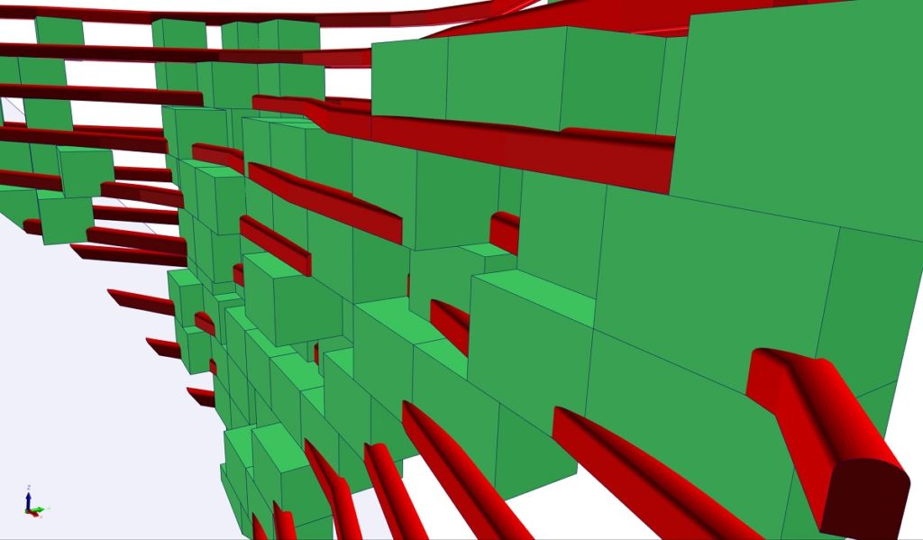
One of the most compelling added features in Micromine 2020 is the new stope optimisation tool, which MICROMINE previously delved into.
“The underground equivalent of Micromine’s existing pit optimiser module, stope optimiser gives mine planners the means to generate optimal stope outlines to meet design and economic parameters,” Thomas said.
“For open-pit miners, the stope optimiser can also generate the optimum diglines to suit minimum mining widths.”
The addition of new implicit modelling tools for geological modelling is another key upgrade promising to make Micromine 2020 users’ workflows even more efficient and reliable, according to the software developer.
“Micromine 2020’s implicit modelling module can speed up the domain modelling process by 100 times, when compared to manual sectional modelling, while ensuring an accurate result,” Thomas added.
“Conveniently integrated into geologists’ workflow, Micromine 2020 ensures all mining exploration and modelling activities can be done in one place, rather than switching between products and systems.”
Upgrades and new functionalities incorporated into Micromine’s existing scheduler tool also means planning engineers can access these scheduling tools.
“Micromine 2020’s scheduling tool accepts sets of tasks with properties presented in wireframes with attributes and criteria specific to each task – and provides facilities for sequencing the tasks to suit requirements,” Thomas said.
“The tasks are then displayed in a Gantt chart, with the option of creating 3D animations and reports. The updated scheduling tool integrates seamlessly with other Micromine functions and supports both the new expression editor and unit conversion facilities.
“Planners can rest assured they will have the means to satisfy specified objectives, maximise net present value and achieve production targets.”
The company said: “With Micromine’s charts being an integral part of its workflow, the addition of a range of new statistical chart and analysis functionalities in Micromine 2020 gives geologists the means to set up charts according to specific requirements, rather than configuring generic chart options.”
The additional charting tools include Multivariate Histogram Analysis, Ternary Diagram, Top Cut Graph, Boundary Analysis, Swath Plot, Search Neighbourhood, Quantitative Kriging Neighbourhood Analysis, and Grade Tonnage Curve.
Each chart is dedicated to a specific geological or geostatistical scenario, according to Thomas. “Together, in an interactive and visual way, they help geologists make informed decisions where there is no clear-cut answer,” he said.
Another key function of Micromine 2020 is the ring design tool for underground engineers, which enables planning engineers to define the size and configuration of the drill rigs to be used.
“The tool allows users to apply constraints, in accordance with rig specifications. This ensures the range and coverage limits of booms are not inadvertently exceeded during the design process,” Thomas explained. “Rings can be created, viewed, edited, mirrored, copied and replicated using the ring design tool, with feedback provided throughout the design process.”
Other noteworthy new additions in Micromine 2020 include:
- The ability for explorers and geologists to visualise private and government web map services layers in Vizex;
- User-friendly import and export options for OMF files, from or to, other GMPs; and
- An import option for ioGas files.
Enhancements made to the existing Micromine product, meanwhile, include faster block model reporting; faster wireframe assign functionality; enhanced draping and visualising images in Vizex; improved block model regularisation features; data selection functionality using a new lasso tool in Vizex; improved wireframe management tools; improved drill hole creation workflow; and major improvements in the creation and management of Python scripts.
Thomas concluded: “A lot of effort has gone into incorporating improvements and additions that will truly add value to our clients throughout the mining value chain – simplifying and speeding up processes, and helping clients deliver the very best results.”