


The team behind the EU Horizon 2020-backed Smart Exploration project says it is ready to introduce its prototypes and software to the market.
It said project representatives are getting ready for a Canada tour to present the results and innovative solutions they have come up with over the last two years to potential stakeholders and end-users.
The Smart Exploration project develops cost-effective, environmentally friendly tools and methods for geophysical exploration in highly challenging brownfield and greenfield areas to address ever-increasing community and environmental issues, as well as reduce the return time on investments, it says. It officially begun on December 1, 2017, and is due to conclude on December 1, 2020.
Since the inception of the project, the 27 partners comprising the project consortium have worked together to meet the challenging task of developing solutions for deep mineral exploration, the partners said. The solutions have been tested and validated under diverse mining conditions (surface, underground, open pit, brownfield, greenfield) over six test sites in Europe, it says.
Even though these solutions are developed for mineral exploration purposes, they have cross- and multi-disciplinary applications and can be used by other industries, the partners said.
To highlight the project’s advances, project representatives will be present at three events in Toronto, Canada, in February and March. This includes the Toronto MERC-Smart Exploration Workshop on Novel Seismics and Electromagnetic Methods for Mineral Exploration (February 27), the Toronto Special EAGE session at the KEGS 2020 PDAC Symposium (February 29) and the annual PDAC convention on March 1-4.
Smart Exploration has developed six software (methodologies) and five prototypes throughout the project lifetime, resulting in a complete package of solutions for deep mineral exploration, it says.
Its software includes:
- Three-dimensional frequency and time-domain electromagnetic modelling;
- Thin-sheet time domain modelling and IP responses;
- New solutions for near-surface problems and related deeper imaging improvements;
- Generation of additional data from sparse active-source data with lower environmental impact; and
- Scattering/diffractivity imaging for improved resolution depth imaging.
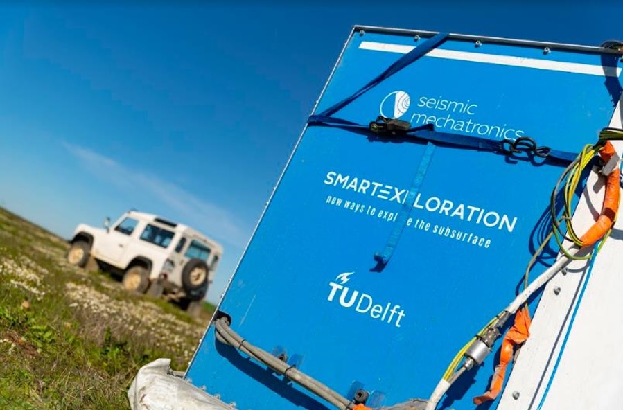
Three out of five prototypes have been validated and will launch in Canada, the partners said. This includes a GPS-time synchronisation system for denied environments such as underground mines; an electromagnetic broadband frequency seismic source (E-Vib, pictured); and a deep-probing time-domain electromagnetic helicopter-based system (HTEM).
The other two prototypes in the last phase of development are a slim hole modular system for mining boreholes and a UAV-Mag-EM for quickly obtaining data over difficult terrains.
Several presentations will be given during the events and the three validated prototypes will be showcased during the PDAC convention at the EU booth, the partners said.