


Highly accurate point cloud data sets from a Hovermap scan have allowed Petra Diamonds’ Finsch mine engineers to “see” the condition of ore passes for the first time and avoid an estimated five months and R5 million ($350,000) in remediation, Emesent says.
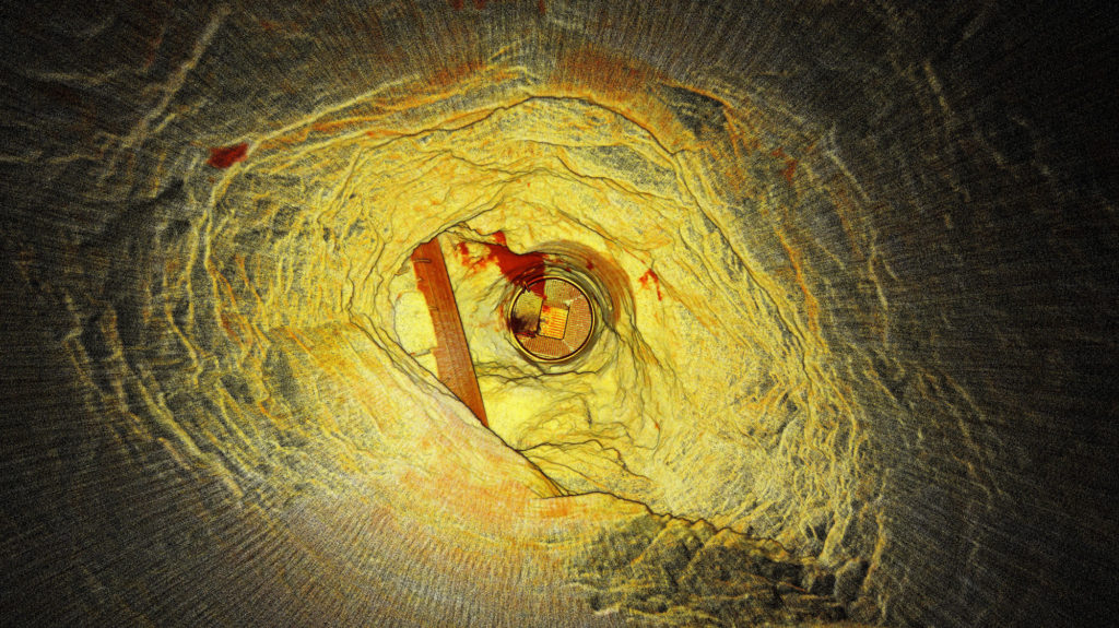
Finsch, in South Africa’s Northern Cape, uses ore passes and underground silos to transfer ore between levels or to redirect ore for load and haul to the surface. Blockages, hang-ups, overbreak or scaling can impact the structural integrity and result in extended downtime and significant remediation costs. Accurate imagery enables mine engineers to gauge the integrity of ore passes and plan timely and cost-effective remediation programs, according to Emesent.
Historically, however, scanning and mapping inaccessible shafts and voids has been a challenge for Petra.
The company’s management sought a means of obtaining accurate visualisations of underground voids, quickly and cost effectively, without endangering the safety of Petra personnel or contractors, Emesent says.
Petra management trialled the Hovermap multiple data capture methods with Emesent partner, Dwyka Mining Services, contracted to carry out multiple scans of an indoor stockpile, ore passes and vertical shafts, and a series of access tunnels and ramps.
Hovermap is a drone autonomy and LiDAR mapping payload. It uses the LiDAR data and advanced algorithms on-board, in real time, to provide reliable and accurate localisation and navigation without the need for GPS.
Dwyka spent a day on-site conducting a series of scans using Hovermap mounted to vehicles, a DJI drone, or lowered in a protective cage. Dwyka delivered point cloud data sets for Petra’s survey team to geo-reference and analyse, within 24 hours. It also provided visualisations of the ore passes, enabling the mine engineers to ‘see’ the condition of orepasses for the first time, Emesent said.
Alex Holder, Group Planning and Projects Lead at Petra Diamonds, explained: “We lowered Hovermap down ore passes, flew the drone into draw points and even scanned our shaft and ramps by fixing the scanner to one of our vehicles. The visualisation delivered exceeded all our expectations. The data captured in one ore pass saved us significant time and effort by confirming it was irreparable. That saved us millions.”
Using Hovermap led to an immediate decision to abandon plans to expend resources remediating a compromised ore shaft. This decision saved Petra an estimated five months and R5 million.
Heinrich Westermann, Mining Engineer at Petra Diamonds, said: “The ability to power and switch the Hovermap payload between the various applications meant that we were able to scan a considerable amount of the mine in one shift. Generally, this was either impossible and, if it were possible, it would take weeks to collect those datasets and months to see the final visuals.”
The data collected by Hovermap has become the basis of a data library for the site. It is augmented regularly and used to inform operational decision making by Petra’s mine planning and survey teams, according to Emesent.
Petra intends to deploy Hovermap scanning technology to map inaccessible locations at its other sites across Africa, Emesent says.