San Francisco-based Skycatch has been making waves in the drone space with a range of mapping solutions tailored for mining applications but, according to Chief Technology Officer, David Chen, it thinks of itself as a “software-first company”.
He explained to IM: “We are really a computer vision company, and we focus on building not only the drone solution, but the software that enables it.”
This sees the company provide data capture automation, processing, visualisation and analysis tools to the industry for efficient decision making.
Chen added: “We work with a number of the top mining companies across the globe, providing them with unique solutions that they are using every day to complement their existing survey processes.”
The company, which has become a leader in highwall mapping through these solutions, is expanding beyond surveys into other areas.
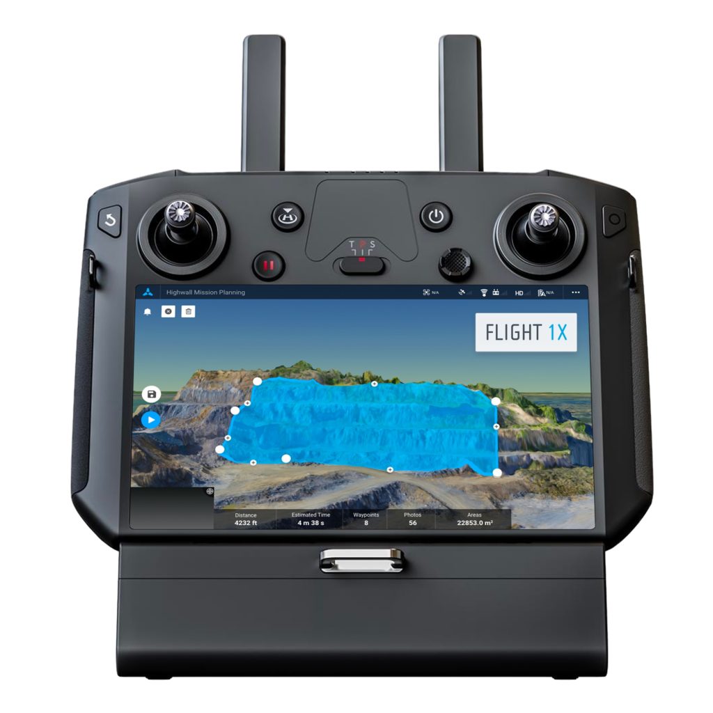
This will be facilitated through software like its Flight1X, a cloud-based solution designed specifically for the recently launched DJI M300 drone that, Skycatch says, delivers unprecedented drone mapping accuracy and inspection automation for operations like mines. The proprietary software offers the most complete end-to-end high precision industrial drone capabilities available today, according to the company.
Flight1X, launched at MINExpo 2021 today, comes with proven data and network security via Skycatch servers in the USA, with the Android-based flight planning application running on the M300 Smart Controller. When combined with Datahub, Skycatch’s cloud-based solution, the pair offer mission planning and data visualisation.
Chen expanded on some of these capabilities.
“The majority of drone software out there has been focused on 2D mapping, whereas we have seen that mining, which comes with dynamic and undulating terrain, requires something different.
“What we are building is an automated mission planner where the primary view is of 3D terrain. This planner allows you to bring in existing terrain data from elsewhere or capture and process data from our own platform. The user can then rotate around this map and see the exact mission profile in 3D for improved visualisation and decision making.”
This data integration piece, which hinges on the cloud-based Flight1X platform, could provide Skycatch with an ‘in’ to the tailings dam monitoring market.
“While we’re already providing some survey solutions for tailings dams, the combination of high precision survey (with cm-level precision) for dam movements, fully automated section missions based on RGB and thermal imaging, and machine learning could provide data on dam seepage, for instance,” Chen said.
“We also want to integrate IoT sensors around dam movement and other areas into this cloud-based platform to provide an overall view of the tailings management facility.”
Skycatch is currently working on integrating the DJI M300 and L1 & P1 sensors – purpose built for mapping and surveying – into its offering, with Chen seeing the process as just the next stage in facilitating the autonomous mine of the future.
“The one thing that fully autonomous mines need is a map of the mine for these autonomous machines to operate off,” he said. “We have a focus on making data more accurate, accessible and faster; making it faster is the key for fully autonomous mining.
“Right now, with the current photogrammetry process, it’s still: capture, process and wait a few hours for a map. To be fully autonomous, you need that dynamic map in near real time, which is what we can offer the industry.”


