


Exyn Technologies has unveiled what it says is the world’s first real-time colourised point cloud visualisation on a handheld LIDAR scanner, the ExynPak™.
This accomplishment marks one of Exyn’s many contributions to autonomous robotics across several industries including mining, infrastructure inspection and construction, it said.
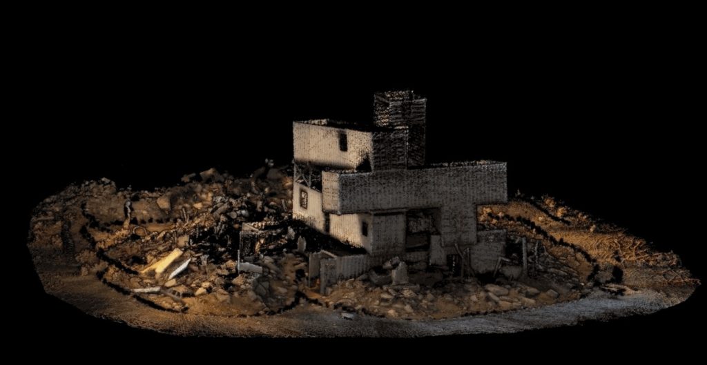
Even in its early beta phase, ExynPak users can capture precise, colourised 3D models 20-30 times faster than a traditional stationery tripod or terrestrial scanner, according to the company. Powered by ExynAI™, the ExynPak ‘drapes’ real-time RGB information captured through two hemispherical fixed cameras onto point clouds created by a gimballed Velodyne LIDAR Puck LITE, providing operators a complete colourised 360º view of their environment.
Coming with a three-hour battery life, the ExynPak is capable of capturing dozens of scans in a single shift with a real-time feed ensuring maximum coverage, Exyn said. And further refinement through Exyn’s proprietary post-processing pipeline, ExSLAM, can correct drift to circa-0.1% per distance travelled.
Jason Derenick, CTO, said: “We’ve seen photogrammetry and other post-processed LIDAR scans colorise point clouds through photos and/or RGB data, but this is the first time colourised point clouds have been streamed to an operator in real time. Even in its BETA phase, we’re thrilled with what the team has created.”
The untapped potential of high-fidelity, precise 3D models has already revolutionised workflows in geological studies (mining) and will continue to revolutionise workflows in construction, reality capture, digital twinning, industrial inspection and more, according to Exyn. Equipped with a colorised ExynPak, a one-to-two person surveying team will be capable of capturing entire structures, tunnels and GPS-denied environments in a matter of hours, rather than days or even weeks.
Nader Elm, CEO: “The ExynPak is a powerful new tool with broad applications in many ‘physical’ industries such as construction, infrastructure development and inspection, mining and much more. You can set it down, initialise and begin capturing a realistic 3D model of your environment in minutes and with minimal training.”