


Intertek, a Total Quality Assurance provider to industries worldwide, has announced an agreement with Minalyze to install a Minalyzer CS patented drill core scanner at Intertek’s new Minerals Global Centre of Excellence in Perth, Western Australia.
The Minerals Global Centre of Excellence opened in July 2021, which consolidated Intertek’s Minerals operations into a single 19,000 cu.m building and houses over 500 employees. With the introduction of the Minalyzer CS, the centre’s state-of-the-art laboratory will support the mining and exploration industry allowing its customer’s geological data acquisition and access to related software for data visualisation, Intertek says.
John Fowler, Intertek’s Senior Vice President of Minerals and Exploration and Production, said: “Our new Minerals Global Centre of Excellence is designed to provide instant and efficient access to world-class technology, expertise and service. Incorporating the Minalyzer CS into this exciting new facility delivers on our commitment to investing in advanced technology to continuously improve quality, sustainability, safety, efficiency and deliver value for our clients.”
Minalyze CEO, Annelie Lundström, added: “We are excited for this new agreement with Intertek which demonstrates Intertek’s commitment to bring value to the industry through state-of-the-art technology and through the new Minerals Global Centre of Excellence in Perth. Our strategic collaboration provides our clients with the tools that will enable faster and more efficient discoveries needed for a sustainable green transition.”
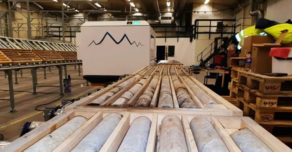
Minalyzer CS is a scanner offering a contactless and non-destructive service able to generate geochemistry, high-resolution images, rock quality designation (RQD), structures, specific gravity and bulk density for drill cores and other drill samples. The patented scanner is designed for handling large volumes of drill samples and is capable of scanning drill cores directly in core trays. A laser (LiDAR) generates a 3D model of the topology of the core and trays, and enables the control and precision of the continuous XRF scanning. RQD and structures are also derived based on the 3D model.
The objective, continuous and consistent nature of the datasets as well as the high but compact data density generated by the scanning technology is paramount in machine learning and deep learning applications and approaches to geology, according to Minalyze.