


The latest addition to Orica Digital Solution’s range of fragmentation analysis technology, FRAGTrack™ GeoSpatial it says is an industry-first innovation “that unlocks unprecedented insights by automatically georeferencing samples, correlating blast design and orebody information to blasting performance.”
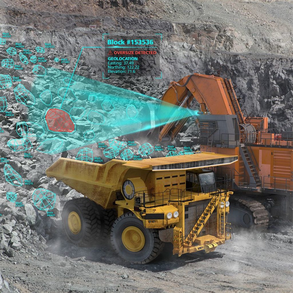
A key metric for drill and blast performance is the fragmentation particle size distribution (PSD) at the muckpile. This provides feedback for optimising drill and blast processes that significantly affect downstream processes. FRAGTrack GeoSpatial is a fragmentation, georeferencing technology that provides an accurate location for fragmentation samples. The ability to georeference PSD samples Orica says provides significant opportunities to derive insights that have not previously been possible. This enables customers to obtain fragmentation information in a region or in sub-domains of a blast, thereby enabling continuous improvement of blast outcomes.
Importing FRAGTrack GeoSpatial data into CAD software “empowers engineers to analyse particle size distribution, rock mass, and blast design parameters. This analysis enhances blast improvement evaluation and facilitates continuous improvement.” Overlaying FRAGTrack GeoSpatial samples with ore control polygons or post-blast orebody data reveals true fragmentation insights, aiding targeted blasting for optimal results.
Achieving georeferencing accuracy of ± 1m in X, Y, and Z, FRAGTrack GeoSpatial identifies poor fragmentation by enabling spatial comparison between measured P80 and blast design. This data allows for direct identification of the problematic areas and enables adjustments for improvement.