Mapping the unknown: Capturing survey-grade 3D models with autonomous robots
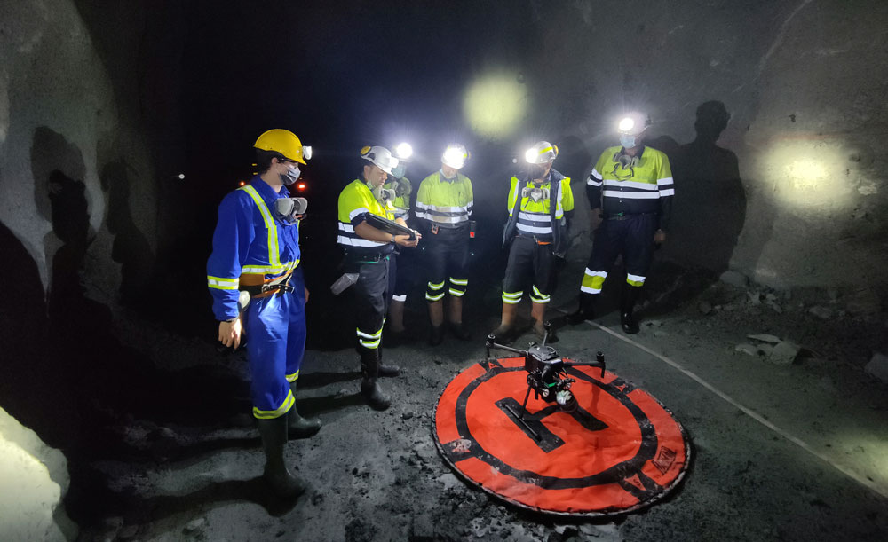
Chief surveyors across the mining industry are increasingly relying on mobile Simultaneous Localization and Mapping (SLAM) capture devices and autonomous solutions to efficiently and transparently keep track of underground workings, explains Trevor Olson, Business Development Representative for Exyn Technologies.
Throughout history, mining has been one of the most important industries in the world. It has also been one of the most labour-intensive and dangerous. Copper, coal, gold, potash, magnesium, iron ore and other resources extracted from below the earth’s surface have made immeasurable contributions to our quality of life and have led to critical advances in our civilisation. And now we look to rare earth metals to power essential future technology like cell phones, guidance systems and autonomous hybrid/electric vehicles.
Given the importance of mining and the inherent dangers and challenges involved in the work, it’s no surprise that the industry has embraced drones and other autonomous systems. The ability to travel deep into dark and dangerous mines to extract resources, collect vast amounts of data and keep workers safe has made drones a central component of today’s industry. As uncrewed technology continues to advance and the need for mined resources remains high, it’s clear that the industry will find new and better ways to integrate these systems.
How autonomous drones are used in mining today
Some images come to mind when many of us think about the mining industry. We think of workers with shovels and picks, toiling away for endless hours in cramped filthy shafts, filling wheelbarrows and hand carts with coal or ore, faces covered in soot and sweat, flickering light from oil lamps barely illuminating the scene.
Those images were certainly accurate 100 years ago — and they are accurate in some parts of the world today — but the wider mining sector has come very far, very fast. Advances in how mines are designed, in regulations for the modern age, in the protective equipment worn by miners, and in lighting and transportation systems have made mines safer, more efficient and more productive.
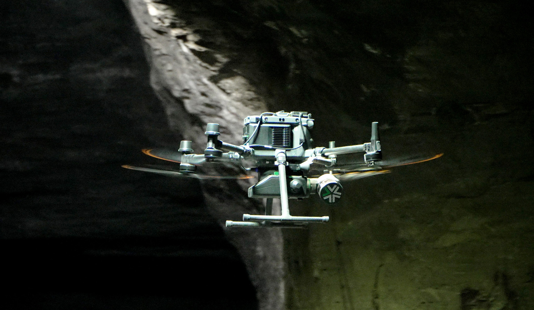
In recent years, drones have been a critical part of that modernisation. That’s because drones can travel into areas that are too dangerous for human miners or beyond their reach. Equipped with sophisticated cameras and sensors and armed with the technology that enables them to travel into GPS-denied environments and collect valuable data, drones are dramatically changing the way mining is carried out.
Adding to their versatility, payloads like the Nexys from Exyn Technologies can be detached from an robot airframe and mounted to a vehicle to further map underground workings for convergence monitoring and updating old legacy maps.
As a result, mining firms are increasingly turning to drones. According to the Global Data 2022 Mine-Site Survey, 70% of large mining companies have started using drones since 2016. A closer look at that survey reveals that 83% of those companies were using the technology for surveying and mapping, and nearly 70% used the systems for monitoring and inspection work. Survey respondents also said they are adopting drones and related systems to improve safety, facilitate route logistics and manage stockpiles of mined resources.
Cost savings and efficiency are also large factors in drone adoption. As an article in The Drone Life stated, “In one estimate, the savings to mining firms was found to be up to 90% of the per hour cost over using manned aircraft for the same task. In an industry with almost $1 trillion in revenue on $700 billion in operating expenses, a 90% savings on any expense is not something that can be easily overlooked by any firm, no matter what the size.”
Autonomous drone uncovers ROI with a single flight
Dundee Precious Metals (DPM) is known for being technology-forward and always on the lookout for innovative solutions to enhance the safety and efficiency of its underground operations. The traditional methods of collecting geospatial data in an underground mine are not only time-consuming but also limited in terms of the amount and accuracy of data they can gather. Additionally, there are areas in the mine that are difficult or impossible to access with existing technology, which limits the company’s ability to make fully informed decisions and introduces possible inefficiencies.
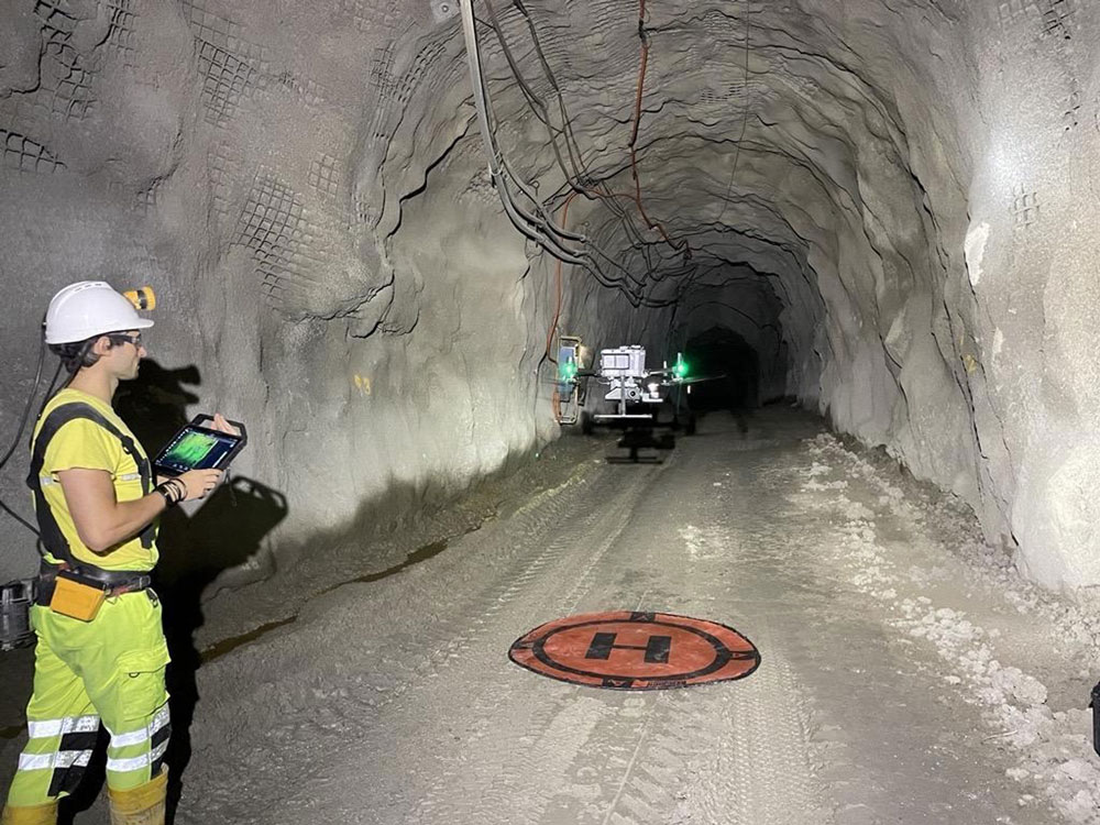
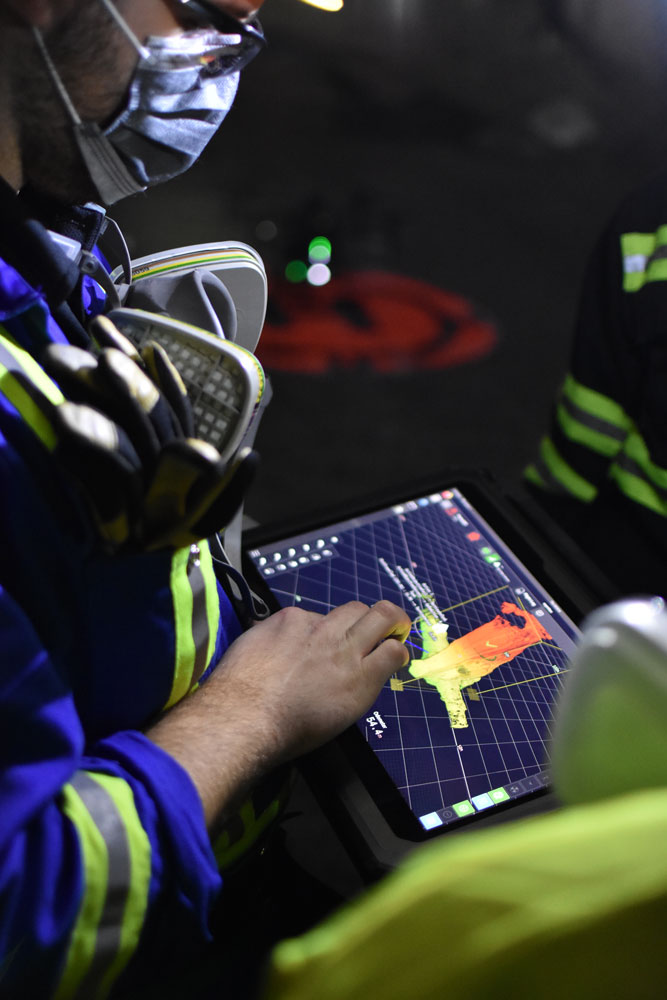
As a long-time technology partner of Exyn, DPM was keen to test the new Nexys — a modular 3D mapping solution with integrated aerial robotic autonomy — designed to reduce time to capture, increase safety and drive efficiency for challenging, complex or dangerous environments.
Using the Exyn Nexys allows DPM to collect geospatial data from the underground mine workings in the safest and most modern manner possible. Safety is its highest priority, and this is one of the main benefits they report from using the system.
The system enables surveyors to safely reach and scan areas that were previously inaccessible, allowing them to make more informed decisions across different mining processes. Tsvetan Balov, Senior Drilling and Blasting (D&B) Engineer, notes “Using the Nexys to autonomously scan the stopes gives us greater accuracy. This greater accuracy helps us to more precisely design adjacent stopes or, in the case of blasting issues, to design additional blast holes.”
One notable example of the benefits of using the Exyn Nexys system for geospatial mapping in an underground mine is a recent stope with only one access point and a very complicated shape. Due to its complexity, conventional methods were unable to perform a detailed scan of the void. Traditionally, this void would be classified as complete as all of the ore would have appeared to be mined and recovered. However, when the team deployed the Exyn Nexys, they discovered a section of the stope that had not been mined, commonly referred to as an underbreak.
Deviations between 5-7% are typical and expected with traditional techniques, however with more complete data, exact deviations can be measured for each and every cavity leading to more informed, complete and efficient mining practices, reducing situations where money is being left on the table. DPM has found 10-15% of its stopes have additional ore that is discovered when the stope is completely scanned with the Exyn solution. With approximately 60 stopes mined annually, the value of the additional ore quickly adds up.
Experience true aerial autonomy underground
Since adopting the Nexys system, the survey team has significantly increased the number of scans conducted on production stopes. One of the key reasons for this increase is the user-friendly nature of the system — according to the survey team, they look forward to operating it, making safety and efficiency “fun”. Typically, for a stope with an average lifecycle of 30 days, five to six scans are conducted. This frequency allows them to gather very detailed information throughout the stope’s lifecycle, making it easy for the team to make informed, data-driven decisions to optimise the mining processes.
According to Hristo Dobrev, Senior Mine Surveyor, “The ability to use it in different configurations, such as a handheld scanner, vehicle-mounted device and scanning drone, makes it practical and easy to use. It saves the team time and effort, with the final result delivering high quality, actionable data.”
Autonomous surveying and inspection is much more than just an interesting development in the industry; it is having real business impact and is creating returns on investment. More frequent scans in less time translates to surveyor teams recommending decisions faster, and the ability to easily and frequently repeat data capture provides a more robust dataset to track trends and changes over time.
By reducing the cognitive load of survey teams who no longer have to be expert drone operators, they become even more strategic partners to the organisation. The human aspect of surveying is not going anywhere. Rather, their impact becomes magnified and tied to revenue outcomes through closer ties to decision making.
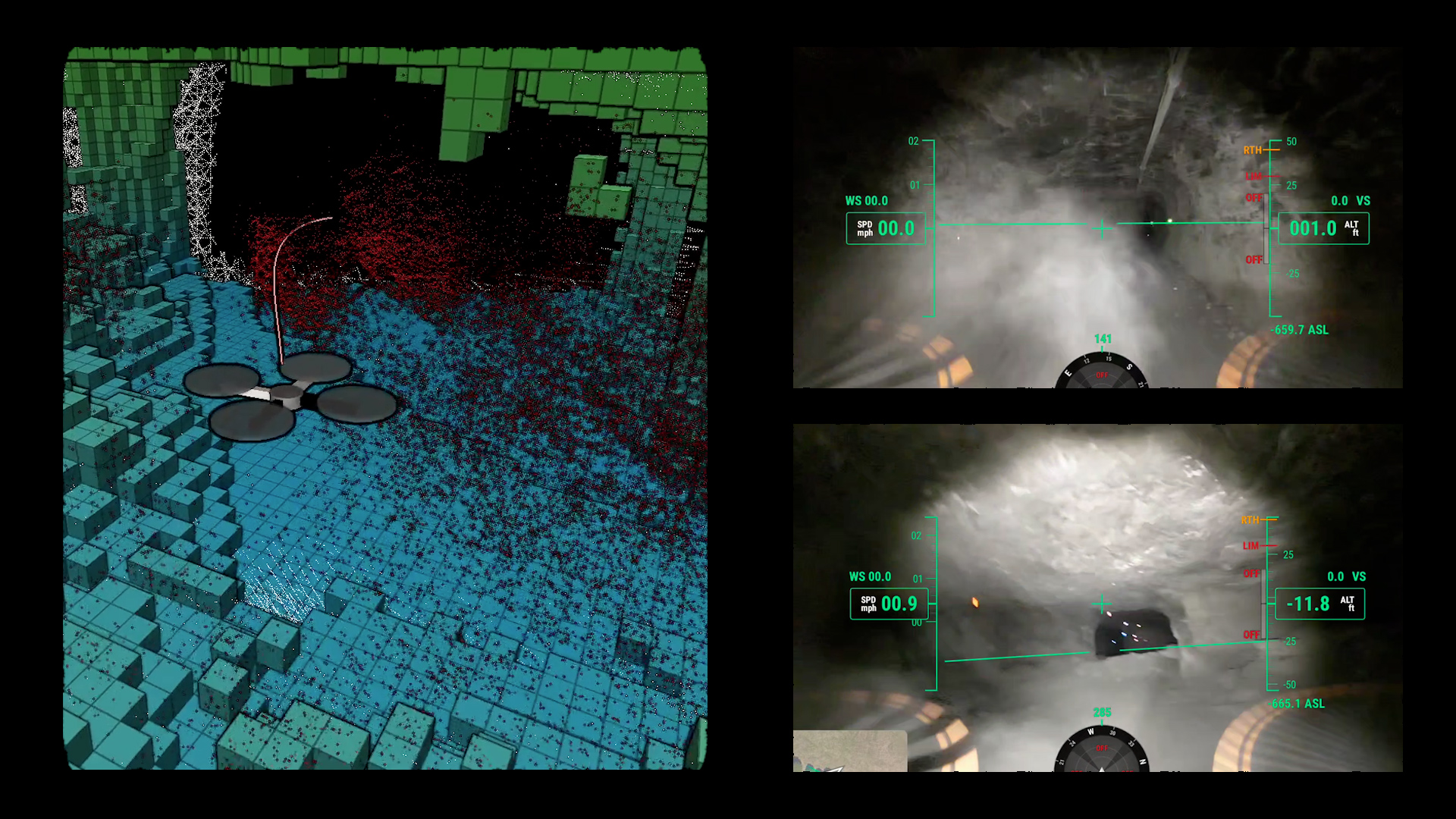
Explainer video about how Nexys can parse dust in real-time while flying in a GPS-denied environment
Mobile mapping has changed the scope of projects in construction, geospatial projects, infrastructure inspection and many more. This impact, combined with the way autonomous systems are already impacting the bottom line, is set to grow rapidly as the technology becomes better and faster over time.
To learn more about how autonomous robots are being used across the mining industry and delivering a return on investment—sometimes even within a single stope flight – read our latest whitepaper or contact us here.


