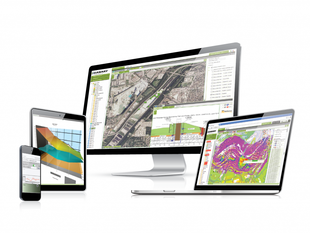
Canary Systems has a major update to its MultiLogger® Suite software platform for automated data acquisition. The 2016 release version provides over 30 new enhancements to one of the leading data integration, data reduction and data visualization tools on the market, programmed by engineers, for engineers. This includes dozens of completely new major features that further enhance the ability to integrate geo-monitoring data from a multitude of sources – and locations – into a single, combined, easy to use software platform. MultiLogger Suite 2016 is free for existing customers.
Below is a sampling of just the top five most important new features in MultiLogger Suite 2016.
3D Element Charts allow for quick 3D visualization of data, such as ground water contours and more.
Automatically generate contour lines and color-coded overlays from any data type on any type of view. Sample applications include generating ground water contours from piezometer data, ground movement overlays for 3D data such as prisms and GPS, or even load and pressure data from load cells and pressure cells.
Enhanced Applications Mode for 3D Data Analysis – working with and analyzing 3D data (e.g. GPS, Prisms) has never been easier, right within the browser. With dozens of calculations supported for 3D ground movement, velocity, inverse velocity, scatter plots, just to name a few, and support for custom calculations, MLWeb becomes the only integrated data analysis tool you’ll need, the company says.
Additional database management operations are now available in MLWeb browser client. New web features include database operations such as backup and restore, auditing, upgrading, validating data and setting tolerances, just to name a few.
Active Directory support – there is no need to remember your login – Active Directory integration means: automatic single-sign on with your Windows credentials
MultiLogger Suite is, Canary Systems says, “the most versatile integrated data management platform in the market, with an intuitive interface to collect, view and analyze all your monitoring data. MLSuite is suited for projects of all sizes, including very large deployments, and can be used seamlessly for manual and automated data collection. MultiLogger interfaces directly with most types of dataloggers, allowing you to program your data collection directly in a simple point-and-click interface without the need for third party tools (though it works with many third-party tools, too).
“Easy to deploy without the need for web programming or development, MLSuite can be run over intranet/Internet, or installed locally on a desktop. MLSuite offers more data visualization and management options than anybody else, including: powerful notifications and reporting features that help translate raw date into decisions and actions quickly, full GIS map server integration, 3D visualization, comprehensive document management including photos and videos, and a free field data entry app, MLField®.
“MLSuite is used in thousands of projects worldwide across a number of markets and applications, including mining, dam safety, structural, environmental, industrial and others, as web based application, workstation tool, and on mobile devices.”


