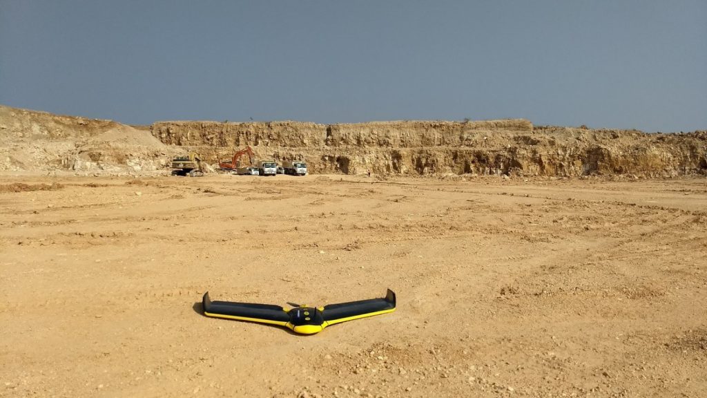
Inspired by the unmanned aircraft use of its Nigerian sister company, cement producer LafargeHolcim Tanzania recently turned to senseFly’s eBee UAV technology to help its team better manage its stockpile inventory and optimise its blast planning.
LafargeHolcim’s Tanzania operation, near the border of northern Malawi, Burundi, and the DRC, includes both a cement plant and a nearby limestone quarry. From there, the company produces, and sells, cement to a broad range of clients, both within and outside Tanzania. In 2016, its management team began examining what benefits using survey drone technology might bring, following the successful adoption of senseFly mapping drones at LafargeHolcim’s operation in Nigeria.
“We saw that the UAVs provided a lot of value to that operation. That’s where the idea started to evolve,” says Hossam Elzohery, LafargeHolcim Tanzania’s Plant Manager. “We spent a lot of money in the past year, before the drones, to make our surveys, to bring accurate surveyors into the country here, from outside. But sometimes, we would still have errors.”
The appeal of bringing drones on-board was therefore financial, about improving the accuracy of the team’s stockpile measurements and, says its quarry geologist Paul Mandatta, a safety consideration. “Previously, our contractors would use total stations and it would take them almost two days to complete the job,” he says. “This work was unsafe, because it needed someone to climb all of these stockpiles. With the drone now though it’s easy. It takes us half an hour of flying the drone, plus overnight processing. Then, in the drone’s point cloud we can see the stockpiles very clearly and achieve a very high accuracy.”
Today, Mandatta flies one of the firm’s two eBee drones each month (the second aircraft is predominantly a backup system). After agreeing on flight timings with the local Songwe airport, his UAV photographs the entire plant at a height of 120 m (400 ft). His eBee typically captures 320 high-resolution RGB photos per 25-30-minute flight.
These images are then transformed into a digital point cloud, using Pix4Dmapper software. It’s within this data output that Mandatta measures the firm’s 14 different piles of materials. Lastly, a density formula is applied to each volume measurement, based on the material in question – clinker, gypsum, coal, etc – to calculate the total tonnage of each stockpile.
“The drone measurements give us the balance, or the opening stock, for the next month,” Mandatta says, “and they let us know how much material we have consumed within the past month.” The drone is also used to confirm the amount of material moved by contractors, who are paid by weight, and to measure surface areas when looking to reshuffle stockpile locations.
In addition to stockpile inventory management, Mandatta also puts his eBee to work at the company’s limestone quarry. “At the quarry, we take the drone’s contour map, which is a .dxf file, and we import that into our SURPAC mining software. There, we overlay the contours on our existing block model. That cuts away all the blocks we’ve mined, leaving us with the blocks that remain to be blasted and excavated,” Mandatta explains. “With this new map, we can examine the quality of the blocks and decide where to mine next. As we also employ a contractor to remove two metres of overburden, we also use the drone to confirm how much they’ve removed, flying the eBee before and after their work, instead of using our weighbridge. And in the dry season we also want to produce a digital terrain model – a map of the ground – to check where the rocks are exposed. This will help us locate the different types of rock on the site.”
According to plant manager Elzohery, the team’s drones have proved to be a very positive investment. “The target, of course, for any investment that you turn, is that you have a breakeven point after a few months. With the drone technology, I believe we have paid back both UAVs in almost four months, compared to the cost of using our previous survey contractor every month,” he confirms.
The move to drones has “changed our operation” he concludes. “Now, our measurements are smooth and accurate. We can make our surveys every week if we want, whenever we need them. We can also produce a full picture of the plant, if required, for housekeeping. For example, if we need to move the mobile equipment inside the plant; if we need to agree or decide anything, in fact, related to our investment or expansion of the plant. Even to revisit the historical site, digitally. This was really the main point of adopting the drone technology; it’s about making life easier, reducing costs, and reducing the time you spend doing things.”


