Join us at The Electric Mine 2026
The Electric Mine 2026
Get IM Free
DOWNLOAD IM
Videos/Webinars
Interviews
Webinars
Videos
2025 Media Pack
Events
Pay Online
Contact
The Electric Mine 2026
Get IM Free
DOWNLOAD IM
Videos/Webinars
Interviews
Webinars
Videos
2025 Media Pack
Events
Pay Online
Contact
IM Magazine
IM Magazine Archives
Past Events
The Electric Mine | Perth 2024 photos
The Electric Mine | Tucson 2023 photos
The Electric Mine | Toronto 2019 photos
Event Papers
The Electric Mine 2023 Conference Papers and Videos
The Electric Mine 2022 Conference Papers
The Electric Mine Virtual Conference 2020 Papers
The Electric Mine 2019 Papers
Helpful Links
Filter by:
All Topics
Automation
Base metals
Bulk handling
Careers in mining
Coal technology
Comminution of minerals
Communications in mining
Diamond mining
Energy minerals
Environmental
Equipment maintenance
Explosives and blasting
Gem stone mining
General
High tech minerals
History of mining
HOF
Industrial minerals
IoT
Marine mining
Metallurgy
Mine operation news
Mine shafts and equipment
Mine surveying
Mine ventilation
Mineral commodities
Mineral exploration
Mineral processing
Mineral project development
Mining consumables
Mining equipment
Mining events
Mining finance
Mining industry recognition
Mining maintenance
Mining mergers and acquisitions
Mining people
Mining policy
Mining project news
Mining safety
Mining services
Mining software
Mining techniques
Power supply for mines
Precious metals
Spotlight Feature Article
Steel and iron ore
Sustainable mining
Uncategorised
Uncategorized
Undersea mining
Videos
Water management
27 Feb 2025
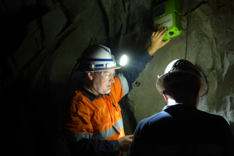
GeoMoby integrates real-time monitoring solution into Ventsim CONTROL
Australia-based GeoMoby says its Real-Time Location and Communication System (RTLCS) has been successfully integrated with...
Read More
11 Oct 2024
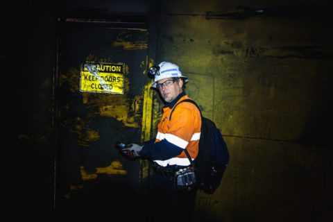
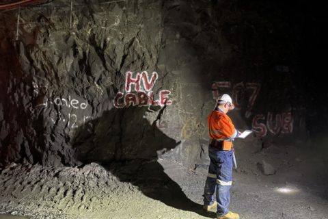
GeoMoby communication system boosts Gordon Sirdar mine’s safety, efficiency processes
GeoMoby says its real-time, location-based communication system is keeping workers safe and improving operational efficiencies...
Read More
06 Nov 2023
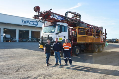
Topdrill subsidiary to use GeoMoby Protect for ESG reporting purposes
Australian technology company GeoMoby has been contracted by Kalgoorlie-based Topdrill’s wholly-owned subsidiary, JBC Contracting, to...
Read More
01 May 2023
GeoMoby and Digital Terrain to provide real-time environmental monitoring in underground mines
Mining location technology company GeoMoby has partnered with fellow Australia-based Digital Terrain to, it says,...
Read More
15 Dec 2022
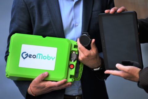
GeoMoby to accelerate rollout of location intelligence platform with new funds
Mining location technology company GeoMoby has secured A$3 million ($2.03 million) to fund the further...
Read More
01 Apr 2022
GeoMoby geolocation technology receives plaudits at Karora’s Beta Hunt mine
Having developed what it says is world-first geolocation technology for mining that could improve safety...
Read More
22 Nov 2021
GeoMoby looks to improve underground mining safety and communications
A Western Australia-based company has developed what it says is world-first geolocation technology for mining...
Read More