Join us at The Electric Mine 2026
The Electric Mine 2026
Get IM Free
DOWNLOAD IM
Videos/Webinars
Interviews
Webinars
Videos
2025 Media Pack
Events
Pay Online
Contact
The Electric Mine 2026
Get IM Free
DOWNLOAD IM
Videos/Webinars
Interviews
Webinars
Videos
2025 Media Pack
Events
Pay Online
Contact
IM Magazine
IM Magazine Archives
Past Events
The Electric Mine | Perth 2024 photos
The Electric Mine | Tucson 2023 photos
The Electric Mine | Toronto 2019 photos
Event Papers
The Electric Mine 2023 Conference Papers and Videos
The Electric Mine 2022 Conference Papers
The Electric Mine Virtual Conference 2020 Papers
The Electric Mine 2019 Papers
Helpful Links
Filter by:
All Topics
Automation
Base metals
Bulk handling
Careers in mining
Coal technology
Comminution of minerals
Communications in mining
Diamond mining
Energy minerals
Environmental
Equipment maintenance
Explosives and blasting
Gem stone mining
General
High tech minerals
History of mining
HOF
Industrial minerals
IoT
Marine mining
Metallurgy
Mine operation news
Mine shafts and equipment
Mine surveying
Mine ventilation
Mineral commodities
Mineral exploration
Mineral processing
Mineral project development
Mining consumables
Mining equipment
Mining events
Mining finance
Mining industry recognition
Mining maintenance
Mining mergers and acquisitions
Mining people
Mining policy
Mining project news
Mining safety
Mining services
Mining software
Mining techniques
Power supply for mines
Precious metals
Spotlight Feature Article
Steel and iron ore
Sustainable mining
Uncategorised
Uncategorized
Undersea mining
Videos
Water management
17 Dec 2024
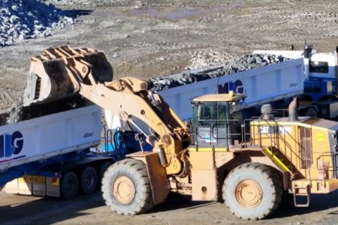
MLG Oz reports on A$80 million of contracts with Evolution, Norton Gold Fields
MLG Oz Limited has been awarded a civil project to construct a 26 km all-weather...
Read More
28 Nov 2024
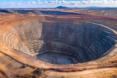
MLG Oz wins five-year contract extension at Evolution’s Mungari gold operations
MLG Oz Limited says it has extended its relationship with Evolution Mining through the signing...
Read More
24 Oct 2023
HydraGEN, Railveyor, BluVein, BEVs, hybrid vehicles being assessed by Evolution
Evolution Mining is considering the application of a number of technologies to displace diesel in...
Read More
29 Sep 2023
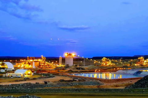
GR Engineering wins EPC work on Evolution’s Mungari Future Growth project
Evolution Mining has awarded a contract to GR Engineering Services Limited to complete the plant...
Read More
24 Jun 2022
MLG Oz extends service ties with Evolution Mining at Mungari operations
MLG Oz Ltd is set to extend its relationship with Evolution Mining Limited after being...
Read More
21 Sep 2020
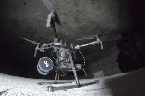
Emesent builds mining connections as Hovermap autonomy takes off
Having recently helped DJI’s M300 drone fly autonomously underground (through its Hovermap Autonomy Level 2...
Read More
02 Sep 2020
RCT helps Evolution Mining transition to fully-autonomous operations at Mungari
RCT says it has successfully commissioned Evolution Mining’s underground LHD fleet at the Mungari gold...
Read More