Join us at The Electric Mine 2025
The Electric Mine 2025
Get IM Free
Download IM
Videos/Webinars
Interviews
Webinars
Videos
2025 Media Pack
Events
Pay Online
Contact
The Electric Mine 2025
Get IM Free
Download IM
Videos/Webinars
Interviews
Webinars
Videos
2025 Media Pack
Events
Pay Online
Contact
IM Magazine
IM Magazine Archives
Past Events
The Electric Mine | Perth 2024 photos
The Electric Mine | Tucson 2023 photos
The Electric Mine | Toronto 2019 photos
Event Papers
The Electric Mine 2023 Conference Papers and Videos
The Electric Mine 2022 Conference Papers
The Electric Mine Virtual Conference 2020 Papers
The Electric Mine 2019 Papers
Helpful Links
Filter by:
All Topics
Automation
Base metals
Bulk handling
Careers in mining
Coal technology
Comminution of minerals
Communications in mining
Diamond mining
Energy minerals
Environmental
Equipment maintenance
Explosives and blasting
Gem stone mining
General
High tech minerals
History of mining
HOF
Industrial minerals
IoT
Marine mining
Metallurgy
Mine operation news
Mine shafts and equipment
Mine surveying
Mine ventilation
Mineral commodities
Mineral exploration
Mineral processing
Mineral project development
Mining consumables
Mining equipment
Mining events
Mining finance
Mining industry recognition
Mining maintenance
Mining mergers and acquisitions
Mining people
Mining policy
Mining project news
Mining safety
Mining services
Mining software
Mining techniques
Power supply for mines
Precious metals
Spotlight Feature Article
Steel and iron ore
Sustainable mining
Uncategorised
Uncategorized
Undersea mining
Videos
Water management
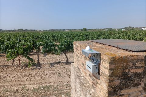
23 Sep 2024
Trimble and Worldsensing unveil new solution for long-term 3D ground and structural monitoring movement
TrimbleⓇ and Worldsensing have announced the introduction of a solution for long term 3D ground...
Read More
11 Sep 2024
Trimble Reality Capture to optimise scanning, mapping and UAV survey data
Trimble has announced its new Trimble® Reality Capture platform service to, it says, enable more...
Read More
07 Nov 2022
Trimble and Exyn pool technologies to create autonomous site surveying solution
Trimble and Exyn Technologies have announced a strategic collaboration to explore the use of autonomous...
Read More
31 Oct 2022
Trimble scanning solution helps steer Havieron copper-gold project progress
A unique underground mine tunnel scope, a tight schedule and demanding conformance specifications made the...
Read More
16 Jun 2022
Trimble deploys customised Applanix POS LV system for truck automation project
Trimble has deployed its first map-based localisation system for land-based autonomous vehicle applications, with the...
Read More
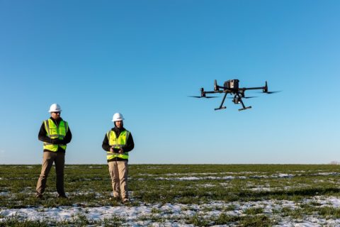
07 Sep 2021
Propeller Aero to integrate with new DJI drone, sensor for rapid and precise site mapping
Propeller Aero, the drone data visualisation and analytics platform, and DJI, a leader in civilian...
Read More
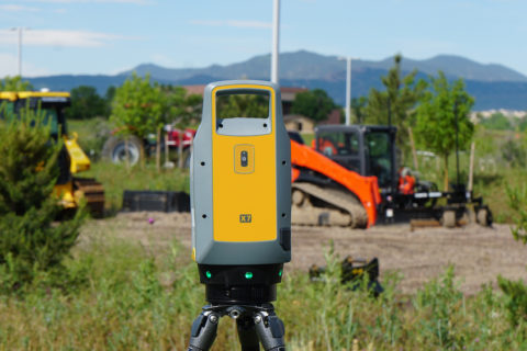
17 Feb 2021
Trimble expands surveying, 3D modelling capabilities with SX12 Scanning Total Station
Trimble has introduced the Trimble® SX12 Scanning Total Station, the next iteration of its 3D...
Read More
17 Sep 2019
Trimble improves project visualisation with new laser scanner and AR technology
Trimble has introduced a new laser scanning system that, it says, enables professionals of all...
Read More