Join us at The Electric Mine 2026
The Electric Mine 2026
Get IM Free
DOWNLOAD IM
Videos/Webinars
Interviews
Webinars
Videos
2025 Media Pack
Events
Pay Online
Contact
The Electric Mine 2026
Get IM Free
DOWNLOAD IM
Videos/Webinars
Interviews
Webinars
Videos
2025 Media Pack
Events
Pay Online
Contact
IM Magazine
IM Magazine Archives
Past Events
The Electric Mine | Perth 2024 photos
The Electric Mine | Tucson 2023 photos
The Electric Mine | Toronto 2019 photos
Event Papers
The Electric Mine 2023 Conference Papers and Videos
The Electric Mine 2022 Conference Papers
The Electric Mine Virtual Conference 2020 Papers
The Electric Mine 2019 Papers
Helpful Links
Filter by:
All Topics
Automation
Base metals
Bulk handling
Careers in mining
Coal technology
Comminution of minerals
Communications in mining
Diamond mining
Energy minerals
Environmental
Equipment maintenance
Explosives and blasting
Gem stone mining
General
High tech minerals
History of mining
HOF
Industrial minerals
IoT
Marine mining
Metallurgy
Mine operation news
Mine shafts and equipment
Mine surveying
Mine ventilation
Mineral commodities
Mineral exploration
Mineral processing
Mineral project development
Mining consumables
Mining equipment
Mining events
Mining finance
Mining industry recognition
Mining maintenance
Mining mergers and acquisitions
Mining people
Mining policy
Mining project news
Mining safety
Mining services
Mining software
Mining techniques
Power supply for mines
Precious metals
Spotlight Feature Article
Steel and iron ore
Sustainable mining
Uncategorised
Uncategorized
Undersea mining
Videos
Water management
16 Dec 2024
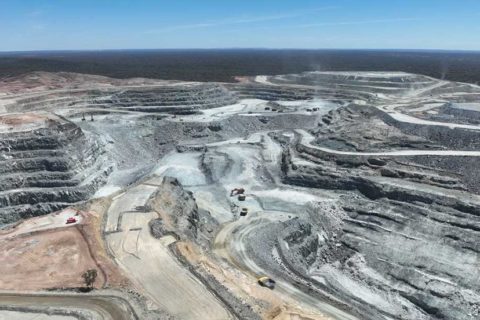
MinRes transforms Mount Marion survey approach with Maptek laser scanner, PointStudio
Implementing a Maptek laser scanner and Maptek PointStudio software has transformed the previous conventional survey...
Read More
14 Jun 2022
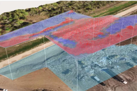
Propeller Aero and Quantum Systems team up to improve drone survey accuracy and time
Propeller Aero, the drone data visualisation and analytics platform, and Quantum-Systems, the Unmanned Aircraft Systems...
Read More
24 Nov 2021
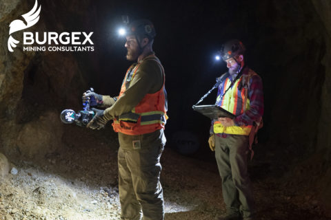
Burgex adds ExynPak LiDAR capabilities to mine mapping offering
Burgex Inc Mining Consultants has announced newly acquired in-house capabilities to provide high accuracy mapping...
Read More
20 Feb 2019
Alpha Unmanned Systems to take part in Inmarsat UAV Pop-up lab
Alpha Unmanned Systems, a Spain-based designer and manufacturer of remotely piloted gasoline-powered unmanned aerial vehicle...
Read More
11 Oct 2018
Japan’s Terra Drone invests in underground aerial robotics startup Inkonova
Terra Drone, a leading global commercial drone technology company, has acquired a significant stake in...
Read More