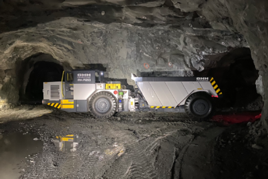


Clickmox technology can make it easier for mines to use drones and autonomous vehicles underground thanks to 3D mapping technology. Navigation is still a problem underground where no GPS is available. The company believes the solution is to use 3D-scanning technology to create digital maps of underground mines.
Autonomous machines can then have those maps uploaded to their memories, and know exactly where they are in the mine. They can then move around without bumping into walls or other objects. The Clickmox state-of-the-art laser-based real time vehicle positioning system can be installed on any vehicle. The system provides positioning information of the vehicle in GPS-denied environments, such as underground mine drifts.
The system is based on the ZEB1 laser scanner from 3D Laser Mapping and uses an intelligent algorithm to maximise point cloud density by controlling actuator speed with respect of speed of vehicle.
This LiDAR system can be installed on any vehicle and can be used outdoors and underground. The mobile 3D laser performs automated 3D laser scanning of drifts with minimal operator intervention. Key features:
- Automated data storage
- Positioning using SLAM algorithm
- Cost effective Accuracy better than 10 mm
- Highly efficient and less time consuming than traditional static LiDAR profilers
- Mountable on any vehicle used in underground mines
Typical uses would be to survey underground mine openings; scan underground pillars, mine drifts and stopes; convergence monitoring in underground mine openings; and undercut/overcut measurements during lateral development underground.
Through Clickmox, Professor Syed Naeem Ahmed and his team have worked to develop a low-cost system that is much lighter, and can be attached to a drone so it knows exactly where it’s going in real-time. Using off-the-shelf parts they’ve taken a relatively cheap 2D laser scanner, and have attached it to a small pivoting platform. The motion from the platform adds the third dimension.
Clickmox has also developed an algorithm in-house to make sense of the data the scanner collects and create detailed 3D maps that are accurate up to 10 mm.
The team has also modified a small drone (UAV) so it can carry a 3D scanner. This drone can be flown underground, and using the laser scanner can inspect mine drifts.
Clickmox has also worked with Glencore on a small robot that can clear raise holes. The robot is equipped with a drill, which it uses to break up blockages in raises.