Join us at The Electric Mine 2025
The Electric Mine 2025
Get IM Free
Download IM
Videos/Webinars
Interviews
Webinars
Videos
2025 Media Pack
Events
Pay Online
Contact
The Electric Mine 2025
Get IM Free
Download IM
Videos/Webinars
Interviews
Webinars
Videos
2025 Media Pack
Events
Pay Online
Contact
IM Magazine
IM Magazine Archives
Past Events
The Electric Mine | Perth 2024 photos
The Electric Mine | Tucson 2023 photos
The Electric Mine | Toronto 2019 photos
Event Papers
The Electric Mine 2023 Conference Papers and Videos
The Electric Mine 2022 Conference Papers
The Electric Mine Virtual Conference 2020 Papers
The Electric Mine 2019 Papers
Helpful Links
Filter by:
All Topics
Automation
Base metals
Bulk handling
Careers in mining
Coal technology
Comminution of minerals
Communications in mining
Diamond mining
Energy minerals
Environmental
Equipment maintenance
Explosives and blasting
Gem stone mining
General
High tech minerals
History of mining
HOF
Industrial minerals
IoT
Marine mining
Metallurgy
Mine operation news
Mine shafts and equipment
Mine surveying
Mine ventilation
Mineral commodities
Mineral exploration
Mineral processing
Mineral project development
Mining consumables
Mining equipment
Mining events
Mining finance
Mining industry recognition
Mining maintenance
Mining mergers and acquisitions
Mining people
Mining policy
Mining project news
Mining safety
Mining services
Mining software
Mining techniques
Power supply for mines
Precious metals
Spotlight Feature Article
Steel and iron ore
Sustainable mining
Uncategorised
Uncategorized
Undersea mining
Videos
Water management
06 Dec 2024
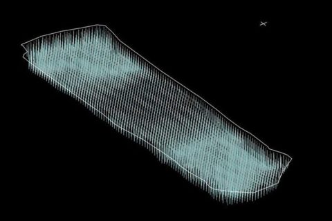
Maptek VisionV2X proximity detection system boosts safety measures at Oyu Tolgoi Underground
The implementation of Maptek's VisionV2X proximity detection system has increased confidence in safety measures at...
Read More
13 Nov 2024
Maptek presents new platform for automation and orchestration, Vestrex
On the back of successful demonstrations at MINExpo International in Las Vegas in September, Maptek...
Read More
31 Oct 2024
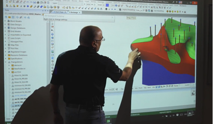
Multivariable modelling study wins Maptek Geology Challenge 2024
First prize in this year’s Maptek Geology Challenge has been awarded to Miguel Aliaga Oblitas,...
Read More
16 Sep 2024
Maptek looks to ‘lighten the engineering load’ with automated blast design solution
Maptek will soon release BlastMCF for automated blast design in a move that, it says,...
Read More
23 Aug 2022
K2fly bolsters Resource Governance Platform with ESG, Maptek Vulcan credentials
K2fly is adding to its Resource Governance Platform with an update that will address multiple...
Read More
08 Apr 2022
Maptek invests in ESG-focused K2fly
Maptek has announced a strategic investment in Western Australian-based K2fly, a leading provider of resource governance...
Read More
24 Mar 2022
Maptek SR3 MkII underground scanner updates to reduce scanning tasks by more than half
An update to Maptek's SR3 MkII underground scanner as well as a new and improved...
Read More
10 Sep 2021
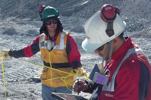
Maptek helps Anglo American with continuous drill and blast process improvements
Maptek’s BlastLogic drill and blast software is helping Anglo American's mines significantly improve its processes,...
Read More
07 Sep 2021
Maptek brings mining software knowledge to CEEC
Maptek has become the latest company to join the Coalition for Eco Efficient Comminution (CEEC)...
Read More
14 Jul 2021
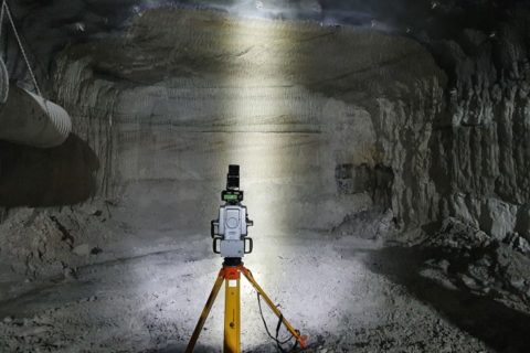
Maptek cuts data capture time with new dual-window laser scanner
Maptek has released a new dual-window scanner that, it says, halves data capture time as...
Read More
24 Feb 2021
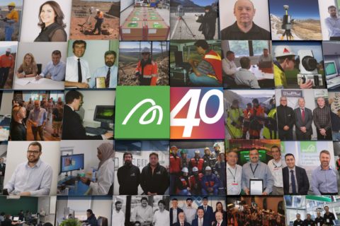
Maptek looks back on 40 years of mining software advances
Maptek is looking back on its roots, 40 years after geologist Bob Johnson laid foundations...
Read More
03 Dec 2020
Maptek scanners, software boosts efficiency and safety at Kirkland Lake’s Fosterville mine
Maptek's underground laser scanners and software have been helping geology and geotechnical engineering teams save...
Read More
Prev
1
2
Next