Join us at The Electric Mine 2026
The Electric Mine 2026
Get IM Free
DOWNLOAD IM
Videos/Webinars
Interviews
Webinars
Videos
2025 Media Pack
Events
Pay Online
Contact
The Electric Mine 2026
Get IM Free
DOWNLOAD IM
Videos/Webinars
Interviews
Webinars
Videos
2025 Media Pack
Events
Pay Online
Contact
IM Magazine
IM Magazine Archives
Past Events
The Electric Mine | Perth 2024 photos
The Electric Mine | Tucson 2023 photos
The Electric Mine | Toronto 2019 photos
Event Papers
The Electric Mine 2023 Conference Papers and Videos
The Electric Mine 2022 Conference Papers
The Electric Mine Virtual Conference 2020 Papers
The Electric Mine 2019 Papers
Helpful Links
Filter by:
All Topics
Automation
Base metals
Bulk handling
Careers in mining
Coal technology
Comminution of minerals
Communications in mining
Diamond mining
Energy minerals
Environmental
Equipment maintenance
Explosives and blasting
Gem stone mining
General
High tech minerals
History of mining
HOF
Industrial minerals
IoT
Marine mining
Metallurgy
Mine operation news
Mine shafts and equipment
Mine surveying
Mine ventilation
Mineral commodities
Mineral exploration
Mineral processing
Mineral project development
Mining consumables
Mining equipment
Mining events
Mining finance
Mining industry recognition
Mining maintenance
Mining mergers and acquisitions
Mining people
Mining policy
Mining project news
Mining safety
Mining services
Mining software
Mining techniques
Power supply for mines
Precious metals
Spotlight Feature Article
Steel and iron ore
Sustainable mining
Uncategorised
Uncategorized
Undersea mining
Videos
Water management
17 Dec 2024
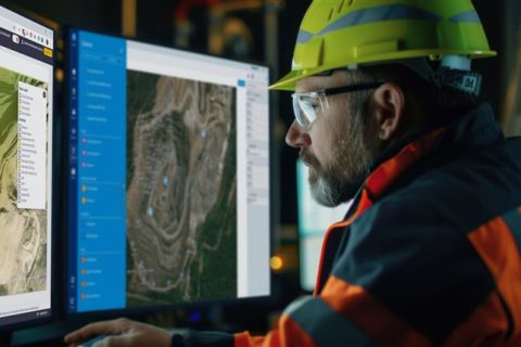
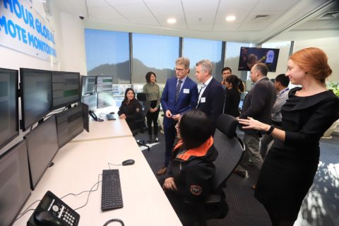
Trimble, GroundProbe collaborate on complete slope stability monitoring portfolio
Trimble® and GroundProbe, part of Orica Digital Solutions specialising in real-time solutions for measuring and...
Read More
10 Nov 2023
Orica and Caterpillar set for mine to mill collaboration
Orica’s Digital Solutions segment continues to make major inroads across the mining value chain, with...
Read More
16 Nov 2022
GroundProbe chooses Tucson for location of second manufacturing facility
GroundProbe has announced plans to build a second dedicated manufacturing facility in Tucson, Arizona, USA,...
Read More
21 Oct 2022
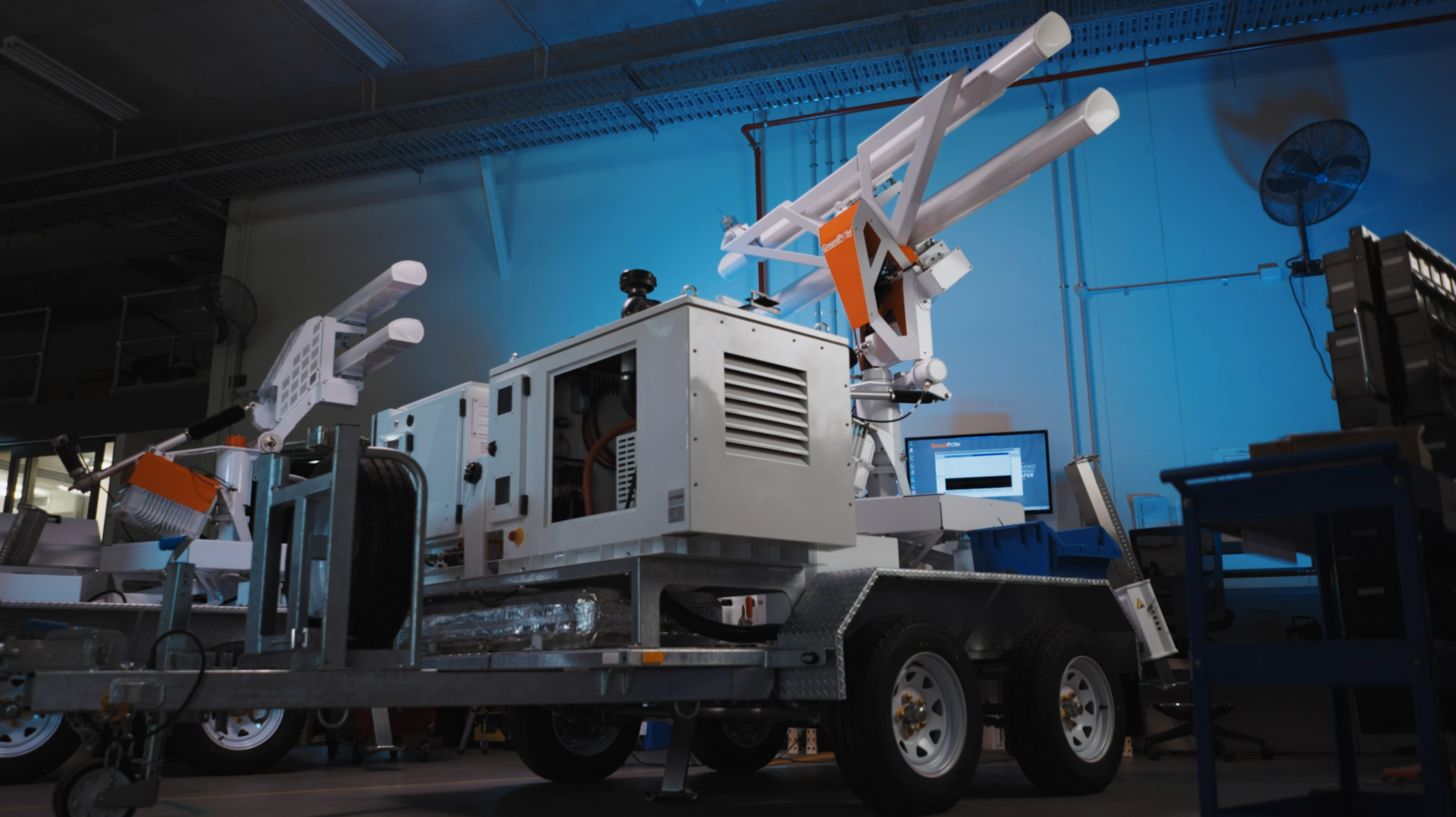
GroundProbe cancels out atmospheric ‘noise’ with new slope stability monitoring algorithm
A collaboration with mining operations across the globe has resulted in the development of a...
Read More
21 Oct 2022
GroundProbe and Orica collaborate on ‘world-first’ BlastVision solution
GroundProbe, a member of the Orica Group, has launched BlastVision®, a world-first solution that, it...
Read More
22 Oct 2021
GroundProbe reflects on geohazard monitoring developments on 20th anniversary
GroundProbe says it is immensely proud to be celebrating 20 years of operation and 20...
Read More
26 Aug 2021
GroundProbe offers Brazilian customers dedicated geotechnical monitoring option
GroundProbe has opened a dedicated Geotechnical Support Service (GSS) monitoring centre in Belo Horizonte, Brazil,...
Read More
16 Jun 2021
GroundProbe reacts to geohazard monitoring concerns with RGR-Velox
GroundProbe says it has launched the industry’s most advanced doppler radar for reactive geohazard monitoring,...
Read More
16 Sep 2020
GroundProbe’s SSR-Omni slope stability tech recognised at AEEA event
GroundProbe has taken out Queensland’s top award at the Australian Engineering Excellence Awards (AEEA), hosted...
Read More
19 Nov 2019
GroundProbe’s GML geotechnical monitoring tool wins IET award
GroundProbe is celebrating taking out the Technology Transfer Award at the 2019 Institution of Engineering...
Read More
28 Aug 2019
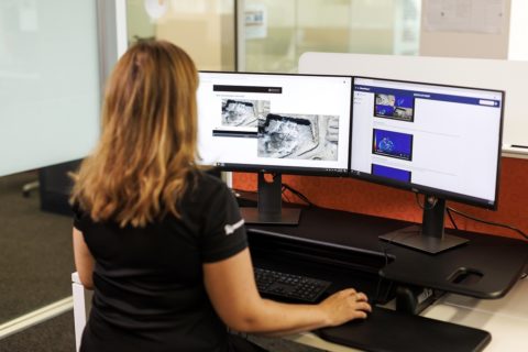
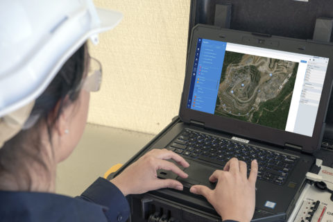
GroundProbe aggregates geotechnical data with MonitorIQ
GroundProbe says it has launched a new data aggregation software for geotechnical sensor monitoring, MonitorIQ. MonitorIQ...
Read More
05 Aug 2019
GroundProbe extends Americas mine, tailings dam monitoring reach with Santiago centre
GroundProbe has launched a dedicated monitoring centre in Santiago, Chile, to, it says, provide 24/7...
Read More
Prev
1
2
Next