Tag Archives: mining drones

Eyxn expands presence in Latin America with new Chile office

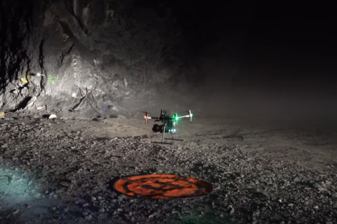
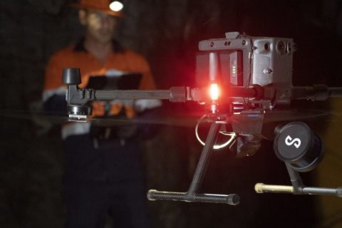
Exyn, a company focused on multi-platform robotic autonomy for complex, GPS-denied environments, has opened its new office in Chile.

This strategic expansion, the company says, will enable Exyn to deliver its innovative technologies to an established mining market eager to enhance safety, efficiency and productivity through advanced technology solutions.

Exyn says it has established itself as a leading provider of cutting-edge technology solutions for the mining industry. Its approach to multi-platform robotic autonomy has revolutionised operations in complex and GPS-denied environments, enabling unprecedented efficiency and safety, the company claims.

Exyn calls itself a pioneer in artificial intelligence-backed technology, having commercialised the highest level of aerial drone autonomy in the world, Autonomy Level 4. Exyn’s robots can autonomously navigate previously inaccessible environments without a prior map, existing infrastructure (GPS, communications, etc), or an operator in the loop, according to the company.

The new Chile office demonstrates Exyn’s commitment to serving the Latin American (LATAM) region with expanded and faster support.

The office will be led by Cristian Ramirez, who brings over 20 years of experience deploying, marketing and selling technology and services for the mining industry in Chile and Latin America. Ramirez’s expertise in fleet and energy management, coupled with his drive to make the mining industry smarter, safer and more efficient through innovation, will be instrumental in driving Exyn’s growth in the region, the company says.

Nader Elm, CEO of Exyn Technologies, said: “The opening of our new office in Chile marks a major milestone for Exyn. We are excited to bring our leading-edge technology further to the South American market, hungry to leverage advanced solutions to enhance safety, efficiency and productivity in their operations. With our expanded presence in Chile, we can now provide even faster support and tailor our offerings to meet the specific needs of our LATAM customers.”

The Chile office represents Exyn’s commitment to global expansion and solidifies its position as a leader in multi-platform robotic autonomy, it says. By establishing a strong presence in the LATAM region, Exyn aims to empower mining, agriculture, logistics and construction companies with transformative technologies, driving a new era of innovation and growth in the industry.

Exyn and Easy Aerial join forces on new ExynAero EA6 flagship airframe

Exyn Technologies has announced it will be partnering with Easy Aerial to launch its new flagship airframe, the ExynAero™ EA6, integrated with ExynAI™ and optimised for Exyn’s diverse use cases.

Exyn has been using the DJI M210 as its main airframe for mining and commercial customers. However, with the M210 product transitioning to end of life, Exyn needed to source its new flagship airframe.

This airframe needed to continue to meet its commercial customer demands, and be US-made to comply with US Government customer requirements. Beyond sourcing a new airframe manufacturer, Exyn was searching for a new partner with a product that would be capable of evolving with the company, it said.

After an extensive evaluation of different airframe manufacturers, Easy Aerial was selected as the preferred partner. By stepping into a new, customised platform Exyn has greater flexibility on future adaptations of the product based on customer feedback, it said. Exyn also benefits from the option to expand its offerings to include Easy Aerial’s drone-in-a-box solution, automated charging and remote operations to further automate its autonomous robot.

Exyn said: “Easy Aerial and Exyn, both agile and dynamic startups, were able to quickly and nimbly adjust to customer feature requests, supply chain constraints, new sensors and specialised configurations. In addition, Easy Aerial and Exyn are ISO-9001 certified and Easy Aerial is AS9100 certified, which will help facilitate quality production of the ExynAero EA6.”

Nader Elm, CEO of Exyn Technologies, said: “We sought out to find a product partner that shared our mission and would be an active collaborator in building an ExynAI-specific robot to be used across the industry verticals we address. In our search, we found a compatible airframe in the Easy Aerial Osprey and an incredible team behind it that would jointly propel us forward.”

The Osprey platform is beneficial to Exyn in its business verticals like mining and construction. The Osprey is a hexarotor airframe that provides motor redundancy in case of failure. The platform offers longer airborne endurance, while maintaining a slightly smaller form factor than the M210 and accommodates increased thrust capabilities.

Ido Gur, CEO of Easy Aerial, added: “Exyn and Easy Aerial share a common vision of automating monitoring solutions. Many of our customers share the same operational needs of autonomous drone-based robotics to operate in the most demanding environments, so this partnership was a no-brainer. We’re ecstatic to be working alongside Exyn, supporting our enterprise and government customer base.”

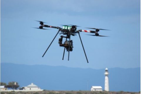
UQ’s Sustainable Minerals Institute to push limits of drone-based hyperspectral imaging tech

Next-generation drone technology will be put to the test in Australia’s mining industry as University of Queensland (UQ) researchers aim to make hyperspectral imaging more accessible than ever before, UQ says.

Funded by the European Union’s Horizon Europe program, the m4mining project will see UQ’s Sustainable Minerals Institute (SMI) and eight European organisations collaborate on hardware and software that will make hyperspectral remote sensing, from drones and satellites, more effective and accessible for mining industry professionals, it says.

Improving the accessibility of hyperspectral imaging is a particular focus as it enables extremely high-resolution mapping of rock minerals, plant health, soil water chemistry and more using infrared radiation, according to UQ.

SMI Principal Research Fellow Associate Professor, Steven Micklethwaite, said an integrated hyperspectral sensing platform has the potential to benefit processes across the entire mining value chain.

“The beauty of hyperspectral drone technology is that, with a single instrument, you can capture multi-dimensional data with comprehensive environmental and mineral information,” Micklethwaite said. “One flyover of an open pit gives chemical, physical and mineralogical insights that can be used to optimise decision making around everything from resource management and pit operations to mineral processing and tailings disposal.

“Likewise, a single scan of the landscape surrounding an operation can provide [mine] closure professionals and environmental scientists with data on plants, soil and water.

“It can also provide early-stage upstream information on what future mine waste will look like – an increasingly important topic for companies and society – and then be used to characterise the waste and even inform the prospects for re-mining that waste for secondary value.”

As the only non-European organisation involved in the consortium, the SMI team has the task of ensuring hardware and software development is informed by real mining experience.

Micklethwaite said: “In order for the products being developed by our European partners to be successful, they need to be grounded in real-world mining experiences and guided by industry engagement – that is why SMI’s close relationship to industry will be so important. There will be a number of Australian case studies to demonstrate the new hardware and software, and we are actively looking for industry partners to engage.”

SMI Research Fellow and hyperspectral imaging expert, Katerina Savinova, said there are many technical challenges that will need to be addressed.

“The organisations involved in m4mining largely specialise in the technical aspects of drones, imaging and software, which shows you the complexity of the challenges we face. To start with, hyperspectral sensors need to be tailor-made to fit to a drone and, once it’s attached, require a massive amount of data storage to deal with the terabytes produced in a single flight.

“That data itself is also very complicated and difficult to process for non-experts, with atmospheric moisture content, cloud cover, the shape of the ground’s surface and vegetation potentially distorting it. To overcome those challenges, our partners are building a multi-sensor drone hardware infrastructure, as well as software that will, in real time, correct and calibrate the initial hyperspectral data and then interpret the data in terms of material distribution and its chemical composition.

“The idea is that, with the hardware and data processing made far more accessible, experts will be able to look at the information layers much more easily, identifying the key features and accelerate their decision making.”

The project coincides with new infrastructure funded by AuScope for the establishment of a drone hub that will see long-range drones equipped with laser, multispectral and high-end digital camera sensors based at the university.

GroundProbe and Orica collaborate on ‘world-first’ BlastVision solution

GroundProbe, a member of the Orica Group, has launched BlastVision®, a world-first solution that, it says, delivers actionable blast performance insights for optimal safety and productivity.

The crucial data aids in the detection of potential misfires and out-of-sequence firing and in identifying and tracking fly rock, according to the company. Intra-blast monitoring also adds valuable wall control insights, such as monitoring and mapping instantaneous blast damage to slopes and identifying movement on significant structures.

GroundProbe, a specialist in geotechnical monitoring, leveraged the partnership with Orica, a leading mining and blasting solutions provider, to gain information around current blast monitoring methods through interviews with engineers, according to GroundProbe CEO, David Noon.

“Through talking to mine site engineers responsible for blasting on the ground, we identified that many sites were still using quite simple and sometimes unsafe methods for blast analysis.

“Techniques included recording blasts with ground-based camera systems and conducting visual inspections of this footage to determine areas of concern.

“From this, the idea of using drone footage and automated algorithms to quickly identify key areas of interest was born.”

BlastVision takes custom high-speed drone footage of a blast as it happens, using world-first advanced proprietary algorithms and modern AI frameworks to convert the footage into analytics data, according to GroundProbe. Data is then remotely analysed in its custom software platform, with insights swiftly reported back to the site. From these insights, mine site personnel can optimise blasting and monitor the impacts of blasting, improving both safety and productivity, the company said.

The solution has been tested, trialled or demonstrated across over 60 mine sites around the globe, positively impacting hundreds of drill and blast team members across these mine sites, according to GroundProbe.

GroundProbe’s VP – Technology, Fernanda Carrea, said that no other solution provides the range of insights from the whole blast area that BlastVision provides, from start to finish.

“BlastVision provides an increased level of safety, efficiency, accuracy and productivity through our software algorithm automatically identifying key areas and issues,” Carrea said.

“Data is also able to be captured before, during and after a blast, and covers the blast area in its entirety.

“We can proudly say that this patent-pending technology is a world first.”

Exyn partners with drone data capture company EROCK Associates

Exyn Technologies has announced a distribution partnership with EROCK Associates that, it says, highlights the increasing availability of Exyn’s aerial drone and portable SLAM mapping products across critical infrastructure projects and complex mining.

The partnership will make the ExynAero™ and ExynPak™ available to a host of new customers seeking best-in-class aerial autonomy and 3D SLAM mapping for capturing critical data in high-risk environments, Exyn says.

EROCK Associates is a drone data capture company specialising in inspection for major construction infrastructure projects, multiple large-scale operations and emergency responses to time-sensitive situations. In short, EROCK “boldly drones where no one has gone before”, the company says, making Exyn a perfect partner.

Nader Elm, CEO and Co-Founder of Exyn Technologies, said: “We’re thrilled to welcome EROCK Associates as our newest channel partner of the ExynAero and ExynPak to deliver the key benefits of real-time data capturing, safety and operational efficiency in critical industries and mining. By offering world-class software and technology, we expand their capabilities to great levels, enabling them to tap into a new customer base and explore geographic areas never before reached. We aim to be integral to fully autonomous critical infrastructure projects and mining operations.”

Eric Bennett, Founder of EROCK Associates, said: “This partnership with Exyn will unlock a new world of capabilities for EROCK Associates. We look forward, with much excitement, to offering our customers Exyn’s cutting-edge products. A long time in the making, we feel confident that we can meet and exceed levels of safety and efficiency, like never before.”

Exyn’s autonomous aerial robot systems are commonly used for industrial applications such as mining, construction, infrastructure inspection and military surveillance/reconnaissance, Eyxn says. With this new distribution partnership, Exyn says it is looking forward to working alongside public sectors to unlock key capabilities of robotic 3D mapping.

Emesent unveils ‘new standard’ in survey-grade autonomous LiDAR mapping

Emesent, today, unveiled Hovermap ST, the latest version of its leading Hovermap autonomy and mapping payload, at the SME MineXchange Conference & Expo in Salt Lake City, Utah.

The tough, lightweight, IP65 rated Hovermap ST includes Emesent’s new automated ground control feature.

This powerful combination is poised to set the standard for survey-grade autonomous LiDAR mapping in challenging environments, it said.

Since its 2019 launch, Hovermap, the company says, has made significant impacts in mining and other verticals, earning a reputation for its versatility, ease of use and mapping data quality. With thousands of hours of autonomous flight logged by customers around the world, it is the most proven LiDAR mapping and autonomy solution for challenging GPS-denied environments, Emesent claims.

Hovermap ST with the ground control feature builds on this reputation with significant improvements, allowing autonomous data capture in even harsher environments and for a wider range of use cases.

“We’re excited to be providing our customers with a new robust and reliable autonomous mapping tool for challenging environments, including those that were previously not well suited to SLAM-based mapping,” Emesent CEO and Co Founder Dr Stefan Hrabar, said.

Simultaneous localisation and mapping (SLAM) based systems have proved their value for rapid mapping of complex environments, but achieving survey grade accuracy and repeatability has been a challenge in some environments. Surveyors were faced with a compromise between fast data capture and data accuracy, depending on the job requirements, the company said.

“This is no longer the case with Hovermap ST and the automated ground control feature, as the feature enhances the SLAM solution to remove SLAM drift and produce survey grade, georeferenced point clouds,” Emesent said

“This is a huge step forward for mobile mapping, providing unrivaled SLAM accuracy and workflow efficiencies,” Dr Hrabar added.

Emesent ground control targets are placed in the environment and captured in a continuous scan with Hovermap ST. There is no need to stop or place Hovermap on the targets, ensuring the capture process remains as efficient as before. The targets are automatically detected by Emesent’s SLAM processing engine and used to both improve the SLAM result and automatically georeference the point cloud to the control points. The process includes automated constellation matching between detected targets and known survey coordinates, eliminating cumbersome manual work which can introduce errors.

Hovermap ST features a lightweight, IP65 weather sealed design, a powerful embedded computer for autonomy and mapping, and an accessory expansion port to further enhance its capabilities. The rotating LiDAR produces up to 600,000 points per second in dual return mode, covering a near spherical field of view.

Hovermap’s Tap-to-Fly autonomy feature enables Guided Exploration in previously inaccessible areas beyond line of sight and communication range. The omni-directional collision avoidance and smart Return-To-Home functions ensure assets are kept safe and valuable equipment isn’t damaged or lost, Emesent says.

Delta Drone to run UAV surveying, mapping at Anglo’s Mogalakwena

Australia-based drones-as-a-service provider, Delta Drone International Ltd, is expanding its enterprise mining operations after being appointed by Rustenberg Platinum Mines Limited, a subsidiary of Anglo American Platinum, to provide surveying and mapping services at the Mogalakwena PGM mine in South Africa’s Bushveld Complex.

The contract, secured via Delta Drone’s Rocketmine brand, will see it manage end-to-end mine surveying and mapping services at the mine, including blast monitoring and inspection services. The 2021 contract is expected to generate some A$120,000 ($87,919) in revenue.

Mogalakwena’s PGM production increased by 11% year-on-year to 308,400 oz in the June quarter, owing to higher concentrator throughput, and no COVID-19 impact on production, Anglo American Platinum reported today.

Exyn Tech to bring autonomous drones to Africa with help of OPTRON

Exyn Technologies has announced a partnership with OPTRON, a leading supplier of the latest geospatial technology in the African market, as its first ever distributor in Africa.

Together, this partnership will highlight the availability of Exyn’s underground drone products in the African market to bring safer working conditions for the local mining industry, the company said.

The ExynAero, an autonomous and self-piloting aerial drone, was the industry-leading product that helped open the door to the relationship, according to Exyn. The company’s full-stack solution enables flexible deployment of single or multi-robots that can intelligently navigate and dynamically adapt to complex environments in real-time.

With OPTRON supplying and supporting products in most countries across sub-Saharan Africa, directly and indirectly with the assistance of a select network of resellers and agents, it is perfectly positioned to help Exyn expand its product across the continent, Exyn said.

Sean Dane, Head of New Business Technology & Development at OPTRON, said: “We are excited to be part of the Exyn dealer network. Their ground-breaking autonomous drone system is the ideal solution to safely and easily capture accurate 3D data in the hazardous underground mining environment.”

Exyn says it brings a new level of autonomy never before seen in Africa, as well as new portable mapping solutions available in the African market, more efficient and safer mapping practices, easy-to-use high tech tools, beyond-line-of-sight data capture, and increased workflow and on-site data processing. These features will enhance suitability for the underground mining environment, and infrastructure inspection and maintenance, and will offer increased safety to mining operations.

Nader Elm, CEO & Co-Founder of Exyn Technologies, said: “We’re excited to be expanding into new markets by replacing legacy technology with a simple, autonomous solution. Safety is the number one concern in mining and I’m confident that, through our partnership with OPTRON, we’re one step closer to achieving fully autonomous mining operations.”

Exyn’s underground drones to get more Canadian air time with NSS agreement

Exyn Technologies, a pioneer in autonomous aerial robot systems for complex, GPS-denied industrial environments, has announced a partnership with NSS (Northern Survey Supply) to distribute Exyn’s underground drone products in the Canadian market through NSS Canada.

Canadian underground mining companies looking for ways to increase safety and efficiency by using cutting-edge autonomous robots now have a viable solution for their needs, Exyn said.

“Exyn offers a full-stack solution that enables flexible deployment of single or multi-robots that can intelligently navigate and dynamically adapt to complex environments in real time,” it explained.

ExynAero, an autonomous and self-piloting aerial drone, operates using a high level of autonomy (Autonomy Level 4) to access complex, GPS-denied environments, predominantly within the mining industry. It replaces legacy CMS systems for safer and more efficient workflow.

Nader Elm, CEO and Co-Founder of Exyn Technologies, said: “We’re proud to expand our worldwide footprint with this partnership by empowering surveyors with a suite of highly accurate cavity monitoring tools. More Aeros & Paks in the field means more safety for mine workers in Canada and beyond.”

The thematic synergy of the partnership can be seen in the prioritisation of safety and efficiency from both companies, they said.

NSS Canada provides tools and solutions, such as MOSS (Miner Operated Survey System), to ensure underground procedures can be done safer, faster and with more accuracy. ExynAero autonomous drones, meanwhile, allow data to be collected without humans subjecting themselves to potentially hazardous locations and situations.

“The partnership allows mining customers to benefit from comprehensive underground aerial 3D mapping with progressive visualisation that increases overall transparency of mining operations – including for GPS-denied, hard-to-reach, or hazardous areas, or locations that would be time-consuming to survey and inspect using conventional methods,” the companies said.

Bruno Lalonde, President, NSS Canada: “NSS Canada believes in the rapid adoption of cutting-edge technologies that can revolutionise the mining industry by increasing safety, speed, and accuracy. Exyn Technologies is a pioneer in the industrial drone space, whose autonomous drone technology reduces the possibility of human error in potentially dangerous environments. Our mutual dedication to safety and innovation through technology is why we believe this is the perfect partnership!”

Freespace Operations’ Callisto to soar higher in mining drone space

Victoria, Australia-based Freespace Operations has recently customised its drone technology to address some of the challenges associated with modern mining, resulting in the production of its Callisto Modular Industrial Multirotor.

The Callisto is an autonomous modular and multipurpose industrial drone with benefits for the resources sector including increased productivity and worker safety.

Freespace Operations Managing Director, Ken King, said: “The Callisto was designed from the ground up to be an industrial system prioritising function over form,” he said. “It’s overall levels of performance and capability exceed all other comparable systems currently available.”

King says the Callisto completes aerial surveying using advanced LiDAR sensor technologies previously only available with manned aviation. It can also deliver cargo across sites and lift product out of mines autonomously.

“The result is increased productivity because tasks can be completed quicker, with precision repeatability and without the need to place people in risky environments,” he said.

According to King, the drone system offers most benefit at sites that are remote and face logistical challenges like poor weather, undulating topography, dense vegetation and poor access.

“The Callisto has been designed for typical mine sites, so safety, durability and serviceability are built into the system,” he said. “At IMARC Online we’ll be demonstrating the Callisto to companies that undertake LiDAR aerial surveying and require long-range cargo delivery.”

IMARC Online is on now until November 27, 2020.