Join us at The Electric Mine 2026
The Electric Mine 2026
Get IM Free
DOWNLOAD IM
Videos/Webinars
Interviews
Webinars
Videos
2025 Media Pack
Events
Pay Online
Contact
The Electric Mine 2026
Get IM Free
DOWNLOAD IM
Videos/Webinars
Interviews
Webinars
Videos
2025 Media Pack
Events
Pay Online
Contact
IM Magazine
IM Magazine Archives
Past Events
The Electric Mine | Perth 2024 photos
The Electric Mine | Tucson 2023 photos
The Electric Mine | Toronto 2019 photos
Event Papers
The Electric Mine 2023 Conference Papers and Videos
The Electric Mine 2022 Conference Papers
The Electric Mine Virtual Conference 2020 Papers
The Electric Mine 2019 Papers
Helpful Links
Filter by:
All Topics
Automation
Base metals
Bulk handling
Careers in mining
Coal technology
Comminution of minerals
Communications in mining
Diamond mining
Energy minerals
Environmental
Equipment maintenance
Explosives and blasting
Gem stone mining
General
High tech minerals
History of mining
HOF
Industrial minerals
IoT
Marine mining
Metallurgy
Mine operation news
Mine shafts and equipment
Mine surveying
Mine ventilation
Mineral commodities
Mineral exploration
Mineral processing
Mineral project development
Mining consumables
Mining equipment
Mining events
Mining finance
Mining industry recognition
Mining maintenance
Mining mergers and acquisitions
Mining people
Mining policy
Mining project news
Mining safety
Mining services
Mining software
Mining techniques
Power supply for mines
Precious metals
Spotlight Feature Article
Steel and iron ore
Sustainable mining
Uncategorised
Uncategorized
Undersea mining
Videos
Water management
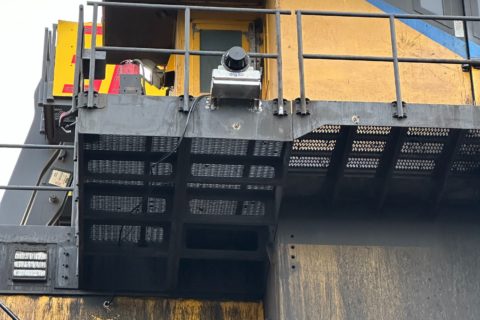
03 Apr 2025
Hummingbird showcases new dig3D potential at EVR’s Elkview operation
The trial of a next-generation shovel guidance system is showing the potential to accurately achieve...
Read More
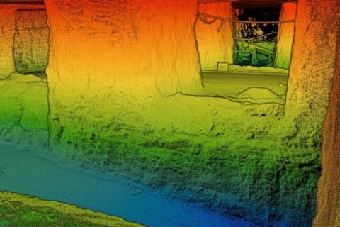
25 Aug 2024
Exyn to open up to 3D mapping access with Stitch3D partnership
Exyn Technologies, a pioneer in multi-platform robotic autonomy for complex, GPS-denied environments, has announced a...
Read More
07 Mar 2024
Exyn Technologies providing speed and safety benefits for mine surveyors
Exyn Technologies says it is helping mines all over the world to become safer and...
Read More
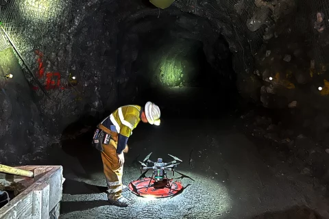
28 Feb 2024
Exyn launches Nexys, a modular 3D mapping solution for mining sector
Exyn Technologies has announced Exyn Nexys, a cutting-edge modular 3D mapping solution specifically designed to...
Read More
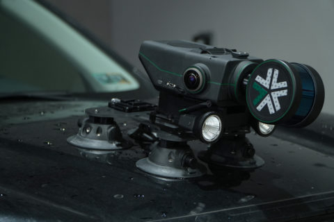
13 Sep 2023
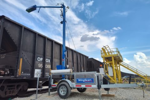
Wingfield and LASE partner on next generation load volume scanner solution
With the introduction of WingScan Advanced LiDAR technology to its existing offering, Wingfield Scale &...
Read More
15 Jun 2023
U&M and Hexagon ready to deploy AHS solution at Brazil mine
U&M Mineração e Construção S/A, as the largest native open-pit mining contractor in the Americas...
Read More
11 Apr 2023
South32 and Emesent collaborate on LiDAR-equipped Spot trials at Cannington
South32's Cannington Mine, in Queensland, Australia, says it is supporting Emesent in its pursuit of...
Read More
16 Nov 2022
Delta Drone and Strayos team up to improve mine site decision making
Drone-based data provider, Delta Drone International Limited, has announced a new product addition to its...
Read More
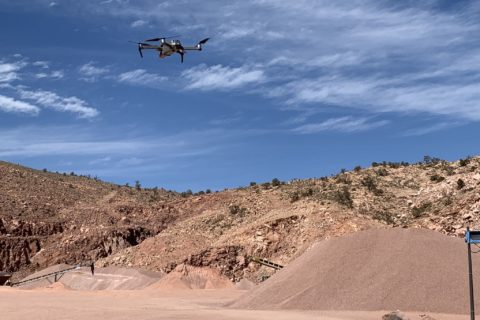
03 Oct 2022
Exyn’s drone-based mining autonomy ambitions taking flight
Having already achieved the highest documented level of aerial autonomy – level 4A – with...
Read More
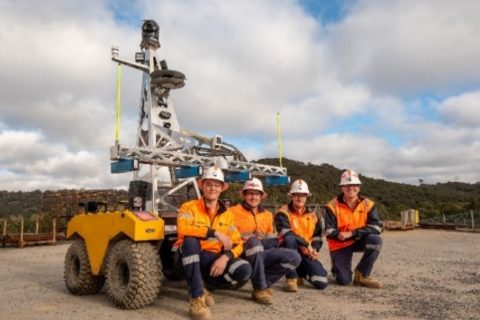
04 Aug 2022
Newcrest grads underline automation possibilities with SmartHog development
The use of an all-terrain unmanned ground vehicle, incorporation of military spec hardware and sensors,...
Read More
28 Jun 2022
Blickfeld to expand LiDAR sensing tech roots into North America
Blickfeld, the Germany-based LiDAR sensor technology company, is set to expand its operations into the...
Read More
16 Jun 2022
Trimble deploys customised Applanix POS LV system for truck automation project
Trimble has deployed its first map-based localisation system for land-based autonomous vehicle applications, with the...
Read More
Prev
1
2
3
Next