Join us at The Electric Mine 2026
The Electric Mine 2026
Get IM Free
DOWNLOAD IM
Videos/Webinars
Interviews
Webinars
Videos
2025 Media Pack
Events
Pay Online
Contact
The Electric Mine 2026
Get IM Free
DOWNLOAD IM
Videos/Webinars
Interviews
Webinars
Videos
2025 Media Pack
Events
Pay Online
Contact
IM Magazine
IM Magazine Archives
Past Events
The Electric Mine | Perth 2024 photos
The Electric Mine | Tucson 2023 photos
The Electric Mine | Toronto 2019 photos
Event Papers
The Electric Mine 2023 Conference Papers and Videos
The Electric Mine 2022 Conference Papers
The Electric Mine Virtual Conference 2020 Papers
The Electric Mine 2019 Papers
Helpful Links
Filter by:
All Topics
Automation
Base metals
Bulk handling
Careers in mining
Coal technology
Comminution of minerals
Communications in mining
Diamond mining
Energy minerals
Environmental
Equipment maintenance
Explosives and blasting
Gem stone mining
General
High tech minerals
History of mining
HOF
Industrial minerals
IoT
Marine mining
Metallurgy
Mine operation news
Mine shafts and equipment
Mine surveying
Mine ventilation
Mineral commodities
Mineral exploration
Mineral processing
Mineral project development
Mining consumables
Mining equipment
Mining events
Mining finance
Mining industry recognition
Mining maintenance
Mining mergers and acquisitions
Mining people
Mining policy
Mining project news
Mining safety
Mining services
Mining software
Mining techniques
Power supply for mines
Precious metals
Spotlight Feature Article
Steel and iron ore
Sustainable mining
Uncategorised
Uncategorized
Undersea mining
Videos
Water management
23 Sep 2020
Nord Gold begins IT system transition to Deswik platform
Nord Gold says it has started re-platforming its mine planning IT systems to Deswik, the...
Read More
21 Sep 2020
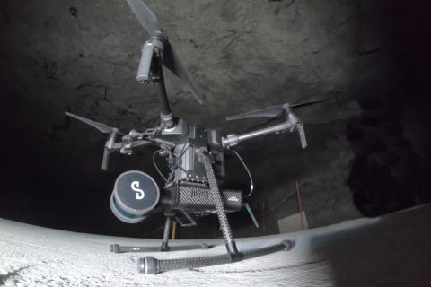
Emesent builds mining connections as Hovermap autonomy takes off
Having recently helped DJI’s M300 drone fly autonomously underground (through its Hovermap Autonomy Level 2...
Read More
22 Jul 2020
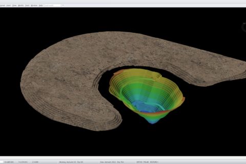
Emesent’s Hovermap to provide Deswik with complete underground mine picture
Emesent has partnered with leading software developer Deswik to, it says, enable mining companies to...
Read More
17 Apr 2020
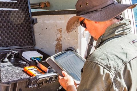
SUEK-Kuzbass takes to the skies for surveying and land management surveys
SUEK says it has purchased six unmanned aerial vehicles (UAVs) with various modifications intended for...
Read More
07 Apr 2020
CSIRO looks to drones, apps for survey success
Australia’s CSIRO believes the use of apps and drones could make surveying even the most...
Read More
19 Nov 2019
GroundProbe’s GML geotechnical monitoring tool wins IET award
GroundProbe is celebrating taking out the Technology Transfer Award at the 2019 Institution of Engineering...
Read More
18 Nov 2019
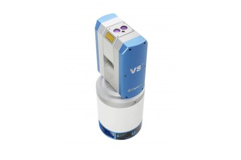
Carlson fills the underground Void with new scanning system
Carlson Software recently released its new Void Scanner+ wireless surveying system for underground surveying, building...
Read More
17 Sep 2019
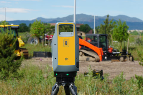
Trimble improves project visualisation with new laser scanner and AR technology
Trimble has introduced a new laser scanning system that, it says, enables professionals of all...
Read More
01 Aug 2019
Kespry and DroneBase combine expertise for improved drone-based analytics
Kespry and DroneBase have announced a partnership that, they say, enables insurance, mining, and aggregates...
Read More
26 Jul 2019
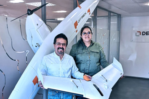
Geoforma helps Delair expand its Mexico offering
Delair, a supplier of commercial drone solutions to markets including mining, has announced an agreement...
Read More
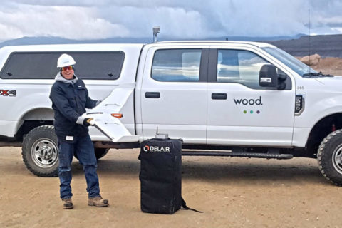
08 May 2019
Wood takes flight in western US with Delair UAVs for mine surveying
Delair and its regional reseller Frontier Precision have signed an agreement with Wood that will...
Read More
27 Mar 2019
Clearpath survey robots receive value added LiDAR capability
Velodyne Lidar says the combination of its LiDAR sensor expertise with Clearpath Robotics’ mobile robots...
Read More
Prev
1
2
3
Next