Join us at The Electric Mine 2026
The Electric Mine 2026
Get IM Free
DOWNLOAD IM
Videos/Webinars
Interviews
Webinars
Videos
2025 Media Pack
Events
Pay Online
Contact
The Electric Mine 2026
Get IM Free
DOWNLOAD IM
Videos/Webinars
Interviews
Webinars
Videos
2025 Media Pack
Events
Pay Online
Contact
IM Magazine
IM Magazine Archives
Past Events
The Electric Mine | Perth 2024 photos
The Electric Mine | Tucson 2023 photos
The Electric Mine | Toronto 2019 photos
Event Papers
The Electric Mine 2023 Conference Papers and Videos
The Electric Mine 2022 Conference Papers
The Electric Mine Virtual Conference 2020 Papers
The Electric Mine 2019 Papers
Helpful Links
Filter by:
All Topics
Automation
Base metals
Bulk handling
Careers in mining
Coal technology
Comminution of minerals
Communications in mining
Diamond mining
Energy minerals
Environmental
Equipment maintenance
Explosives and blasting
Gem stone mining
General
High tech minerals
History of mining
HOF
Industrial minerals
IoT
Marine mining
Metallurgy
Mine operation news
Mine shafts and equipment
Mine surveying
Mine ventilation
Mineral commodities
Mineral exploration
Mineral processing
Mineral project development
Mining consumables
Mining equipment
Mining events
Mining finance
Mining industry recognition
Mining maintenance
Mining mergers and acquisitions
Mining people
Mining policy
Mining project news
Mining safety
Mining services
Mining software
Mining techniques
Power supply for mines
Precious metals
Spotlight Feature Article
Steel and iron ore
Sustainable mining
Uncategorised
Uncategorized
Undersea mining
Videos
Water management
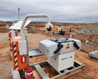
28 Mar 2024
RocketDNA Ltd seals first autonomous xBot contract with Calidus Resources subsidiary
RocketDNA Ltd (RKT), a global drones-as-a-service provider, says it has signed its first long-term contract...
Read More
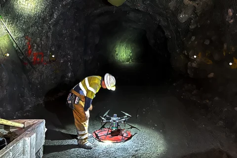
07 Mar 2024
Exyn Technologies providing speed and safety benefits for mine surveyors
Exyn Technologies says it is helping mines all over the world to become safer and...
Read More
14 Nov 2023
Exyn Technologies brings in Brandon Torres Declet for next growth drive
Exyn Technologies has appointed Brandon Torres Declet as CEO to drive its next phase of...
Read More
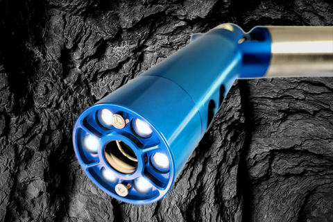
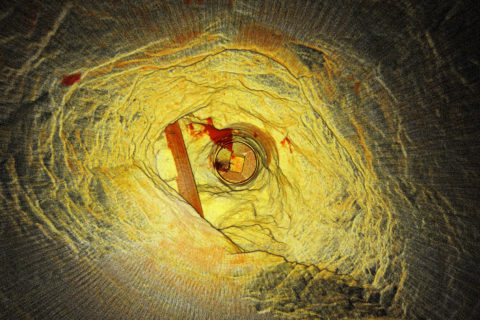
07 Jul 2023
Carlson releases new laser scanning system for improved underground void mapping
Carlson Software has released the Carlson C-ALS HD auto-scanning laser system, the successor to the...
Read More
09 Jun 2022
Delta Drone to provide aerial support to Red 5 at KOTH, Darlot
Global drones-as-a-service provider, Delta Drone International Limited, says it has signed a contract with Red...
Read More
13 Sep 2021
Sandvik, Exyn combine capabilities in new autonomous mine inspection concept
Sandvik Mining and Rock Solutions and Exyn Technologies have furthered their strategic partnership looking at...
Read More
29 Jul 2021
GeoSLAM expands geospatial mapping solutions to underground mining sector
Global geospatial mapping specialist, GeoSLAM, has expanded its mining offering, building on its reputation in...
Read More
29 Mar 2021
STRYDE and Explor project cuts seismic image survey times in mountainous terrains
A collaboration between STRYDE, a seismic technology provider, and Explor, a geophysical technology and data...
Read More
11 Jan 2021
Emesent’s Hovermap aids ore pass decision making at Petra’s Finsch diamond mine
Highly accurate point cloud data sets from a Hovermap scan have allowed Petra Diamonds’ Finsch...
Read More
03 Dec 2020
Maptek scanners, software boosts efficiency and safety at Kirkland Lake’s Fosterville mine
Maptek's underground laser scanners and software have been helping geology and geotechnical engineering teams save...
Read More
26 Nov 2020
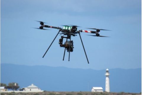
Freespace Operations’ Callisto to soar higher in mining drone space
Victoria, Australia-based Freespace Operations has recently customised its drone technology to address some of the...
Read More
17 Nov 2020
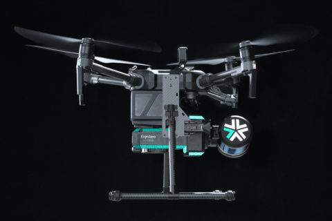
Exyn Technologies gains Australia mining market exposure with C.R. Kennedy pact
Exyn Technologies, a pioneer in autonomous aerial robot systems for complex, GPS-denied industrial environments, has announced...
Read More
Prev
1
2
3
Next