Tag Archives: mine surveying

Kespry and DroneBase combine expertise for improved drone-based analytics

Kespry and DroneBase have announced a partnership that, they say, enables insurance, mining, and aggregates enterprises across North America to expand aerial analytics implementation across their work sites.

Kespry’s customers will now be able to leverage DroneBase’s service offering to manage their Kespry deployments as part of Kespry’s new Bring Your Own Drone (BYOD) program, Kespry said. BYOD includes a new platform pricing model designed to meet the expanding enterprise aerial intelligence requirements of multi-site mining and aggregates companies, as well as large-scale residential and commercial property insurers, it explained.

“The combination of Kespry and DroneBase brings the best of the platform and services worlds together, offering a cost-effective, productive way of using drone-based analytics across the largest insurance, mining, and aggregates businesses,” Kespry said.

George Mathew, CEO, Kespry, said: “The combination of Kespry and DroneBase delivers serious value to companies across North America looking for a partner to help scale their usage of Kespry’s aerial intelligence platform and benefit from its granularly-accurate inspection, inventory management and mine planning capabilities.”

Dan Burton, Founder and CEO of DroneBase, said: “With our global pilot network in all 50 states and over 70 countries, DroneBase will enable Kespry clients to scale their drone programs across North America without the cost of investing in hardware. By combining our strengths, DroneBase and Kespry will solve a need within these industries.”

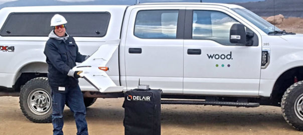
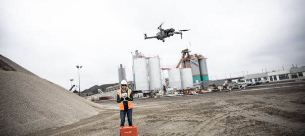
Kespry’s BYOD program gives companies flexibility in how they source their aerial data, the company says, whether customers use Kespry-sourced drone hardware, DroneBase, or their own existing DJI drone fleet, including the DJI Mavic 2 Pro and the DJI Phantom series.

DroneBase, the largest global drone operations company, according to Kespry, can either manage customers’ Kespry deployments or have DroneBase’s global pilot network fly their missions, which can be turned around in 48-72 hours, according to the company. “Kespry now offers a single fee for its platform, including unlimited access to industry-leading, vertically-integrated applications, the Kespry Cloud and AI and ML-based analytics,” it said.

Kespry’s aerial intelligence platform is now deployed at 220 mining and aggregates customers that use its platform across 3,311 worksites across North America, with 22,987 missions in 2018 alone, it said. These companies typically use Kespry for inventory management, mine planning, materials management, contractor benchmarking, and boosting employee safety.

Geoforma helps Delair expand its Mexico offering

Delair, a supplier of commercial drone solutions to markets including mining, has announced an agreement with Geoforma SA de CV, a provider of UAV sales and support to commercial surveyors in Mexico.

As part of the agreement, Geoforma will operate Delair’s first service centres on the ground in Latin America, expanding the company’s international network of sales and support, Delair said.

“Delair has made strong inroads into the Latin American market, with a line of commercial UAV platforms aimed at specific markets such as utilities, power, agriculture and farming, mining, construction, transportation and geospatial,” the company said. “Through the expanded agreement with Geoforma, which has provided sales support for Delair for two years, customers in Mexico will have a highly skilled service operation to assist with repair, maintenance, training and operational optimisation.”

The service centre is located in Mexico City and will offer certified repair and maintenance services, as well as on-line and call support to Delair customers.

Delair worked with Geoforma technicians to certify them on the latest maintenance and repairs processes required to optimise the operations of its UX11 drone. The training took place at Delair’s main manufacturing facility and company headquarters in Toulouse, France.

The Delair UX11 UAV, introduced commercially last year, is one of Delair’s top-of-the-line drones. The fixed-wing unit is a hardware-software platform that provides highly accurate images for survey-grade mapping, with on-board processing capabilities and real-time, long-range control via 3G/4G cellular networks or radio links. The platform’s centimeter-level precision, along with its efficient operational characteristics, make it the most cost-effective solution for large area surveying and mapping.

Stefanie David, Channel Marketing Manager at Delair, said: “Geoforma has distinguished itself as a highly reliable and service-oriented supplier to commercial drone users in key industries in the Mexico market. Their expertise and professionalism are great assets for us as we expand further into Latin America and it’s important that our customers in this region have access to local expert service and support so we can we minimise downtime when their drones require maintenance or repairs.

“Having a team of trained and qualified technicians like Geoforma on the ground in Mexico will ensure a much more efficient service process and reduce the amount of time that our customers’ drones are out of operation due to either routine maintenance or damage from operations.”

All of Delair’s solutions are designed to make it easy for enterprises to adopt commercial drones, and support a seamlessly integrated workflow, from hardware to data acquisition services, and data processing software, the company said. This integrated approach enables industrial enterprises to automatically collect the aerial intelligence, analyse it and quickly integrate it into their daily business processes, with immediate return on investment.

Wood takes flight in western US with Delair UAVs for mine surveying

Delair and its regional reseller Frontier Precision have signed an agreement with Wood that will see the engineering and project service company adopt the Delair UX11 high-performance unmanned aerial vehicle (UAV) for its work in site planning and asset management in mining and quarry projects in the western US.

Delair said Wood was initially deploying the drone to do high accuracy, 3D topographic surveys and materials quantification for mining projects in Idaho and Wyoming. It is the first fixed-wing UAV Wood has deployed in the Western US, according to the company.

“For the scale of the projects we are performing, and the accuracy required, adopting the Delair UX11 was a logical choice,” Greg Meinecke, Technical Services Manager at Wood, said. “Its long-range capabilities allow us to cover areas not feasible with other data collection methods like hover craft drones or by foot, so it reduces the cost and time involved. It integrates well with our existing work flows, and features such as the PPK (post processed kinematic) function deliver additional benefits in terms of the precision and flexibility required in challenging environments.”

He added: “We have received excellent support from Frontier Precision and Delair in helping us deploy our first fixed-wing UAV missions and are already seeing results.”

According to Delair, Wood is deploying the UAV in remote areas where its heavy civils team is performing extensive excavation and site preparation for phosphate mining activities, a project covering more than 200 acres (81 ha). “Of critical importance for operations is an ability to precisely quantify the volume of materials being removed to ensure a high degree of accuracy in planning and invoicing,” Delair said.

Wood turned to the Delair fixed-wing UAV to deal with the scale of the terrain that needed to be surveyed, as well as the challenge of taking measurements in an active mine site area, including the safety hazards of having personnel on the ground in rough terrain and around large, moving equipment, Delair said.

“Flying at 400 feet (122 m) above the project areas and often at times using beyond visual line of sight flight plans, Wood technicians were able to use the precision data collection features of the Delair UX11 to acquire large amounts of highly accurate imagery that could be processed to generate detailed topographical reports,” the company said.

Meinecke said the company was able to get surveys covering large tracts of land done in a very short amount of time, which ends up being much more cost effective to the company and its client.

“More importantly, we can provide the mine owners a great deal of confidence in the accuracy of the work being performed and the quantities of resources involved. In the end, everyone agreed on the material quantities as the technology is very reliable,” he said.

Frontier Precision worked alongside Wood’s engineering and field experts to evaluate the Delair drone, and ensure it met the firm’s requirements, Delair said. This included integration with other tools the firm uses such as AutoCad, Trimble Business Center, and the Pix4D photogrammetry suite.

“Wood’s team noted the ease of use of the Delair UAV, especially given this was their first experience with fixed-wing flying,” Delair said. “The firm was able to train several pilots who specialise in different types of projects, and expects to deploy the drone on other infrastructure, mining and construction projects around the US.

“The team also noted the Delair UX11’s embedded global shutter camera as well as its PPK capabilities as key to ensuring greater precision in its data collection. With PPK, GPS data from both on-board and off-board systems can be matched after the mission, providing higher degrees of accuracy of the images collected.”

The Delair UX11 UAV, introduced commercially last year, is one of Delair’s top-of-the-line drones. The fixed-wing drone is an innovative hardware-software platform that provides highly accurate images for survey-grade mapping, with on-board processing capabilities and real-time, long-range control via 3G/4G cellular networks or radio links.

“The platform’s enhanced centimetre-level precision along with its efficient operational characteristics make it the most cost-effective solution for large area surveying and mapping,” Delair said.

Clearpath survey robots receive value added LiDAR capability

Velodyne Lidar says the combination of its LiDAR sensor expertise with Clearpath Robotics’ mobile robots for survey and inspection will offer customers a “value-added” service, allowing them to get maximum value from the high-resolution, 3D data these machines capture.

Clearpath’s robotic solutions now use Velodyne’s state-of-the-art LiDAR technology, which, Velodyne said, boasts industry-leading resolution, range, and field of view. “Velodyne sensors create a 360° real-time map of the environment, allowing the robot to detect and avoid obstacles for safe autonomous navigation,” the company said.

Julian Ware, General Manager of Clearpath Robotics, said: “We have been recommending and integrating Velodyne products on our robotic platforms for almost a decade. Velodyne sensors have proven to handle challenging automation tasks and flawlessly function in unfamiliar and unpredictable settings.”

Velodyne’s LiDAR sensors are designed for seamless integration with robotic platforms by being easy to mount, having low-power consumption, and including a web configuration tool, the company said. “They are meticulously designed to perform in high-stress environmental conditions like inclement weather, which is essential for outdoor deployments.

“Clearpath provides value-added services for Velodyne with wide-ranging expertise integrating its sensors in customised robotics systems. The company has extensive experience supporting Robot Operating System (ROS)-ready mobile robotics platforms by developing and maintaining ROS drivers, and providing step-by-step ROS tutorials.”

Mike Jellen, President and CCO, Velodyne Lidar, said: “Clearpath brings the skill set and experience necessary to help customers derive maximum value from high-resolution, 3D data provided by Velodyne Lidar to create innovative ground-based mobile robot solutions.”

Clearpath Robotics provides hardware, software, and services to enable self-driving vehicle development, deployment, and operation, serving markets that span industrial materials handling, mining, military, agriculture, aerospace, and academia.

Inmarsat and Knight Piésold join forces for remote tailings dam monitoring

Inmarsat says it will partner with Knight Piésold UK to deliver highly accurate tailings dam monitoring, analysis and real-time management capabilities for the mining industry.

The collaboration agreement with Knight Piésold, a member of the international geotechnical, tailings management and engineering consulting group, will combine Inmarsat’s satellite-enabled Internet of Things (IoT) solution, with Knight Piésold’s leading consultancy, Inmarsat said. “This will enable smarter decision making, improved safety standards and will support regulatory compliance; offering a new approach to the way tailings dams are currently audited and managed,” it added.

This pact comes only weeks after the tragic breach to the tailings dam at the Vale-owned Feijão mine in Brumadinho, Brazil, and a number of mining companies have published data on how they monitor these facilities.

Inmarsat said: “Mine tailing audits are typically carried out at infrequent intervals, with employees and third-party consultants making long distance trips to collect data and audit the status of the dam.

“The solution makes data available between site visits to any accredited users, anywhere in the world. This means that current, on-site auditing practices can now be supplemented with a remote, customisable, ‘daily management cycle’, with auditor recommendations and real-time decision-making now available to on-site engineers.”

Inmarsat’s solution collects data from a range of industry standard sensors via edge connectivity such as Long Range Wide Area Network, before it is transferred across Inmarsat’s L-band satellite network to a single cloud dashboard. This enables mining companies and national regulators to gain a comprehensive view of the status of their dams with granular metrics such as pond elevation, piezometric pressures, inclinometer readings and weather conditions displayed in one place, no matter where the mine is located, according to the company. The solution is also highly versatile and features sensor-agnostic capabilities, so it will work with both existing sensors and new devices, Inmarsat said.

Richard Elmer, Regional Manager for Knight Piésold UK, said: “The current tailings auditing and management business consists of semi-annual or annual site visits with recommendations based on these visits. Instrumentation data is often collected on-site and mining companies are largely reliant on human activity for the collection, storage and analysis of the data.

“Our collaboration with Inmarsat provides our clients access to the latest and best available technology for real time data collection and analysis. We see this as a game changing improvement in how companies monitor their current tailings storage facilities and we are proud to be at the forefront of this latest industry innovation.”

Paul Gudonis, President of Inmarsat Enterprise, said: “We have been working with Knight Piésold’s UK practice since 2017 to develop an approach to tailings dam monitoring that supports smarter, safer and more regulated mining practices. Following successful trials, we are pleased to be able to bring what we believe to be a truly disruptive solution to market. We know that the industry is committed to zero harm and, by teaming with Knight Piésold to launch this tailings dam solution, this is another step towards achieving complete health, safety and operational success in the mining sector.”

Airobotics automated drones permitted to go beyond line of sight in Australia

Airobotics has made Australia aviation history by obtaining the nation’s first and only Civil Aviation Safety Authority approval to operate automated multi-rotor drones from its remote operations centre (ROC) beyond visual line of sight (BVLOS) with no aircrew needed at the client site, the startup reports.

Alternatively, remote pilots can be located within Airobotics Australia’s ROC, at a designated remote pilot station, operating more than 1,000 km away from onsite systems at the customer sites. This new “man on the loop” level of operations enables human operators to supervise flights, but without requiring “man in the loop” pilots to intervene in flight operations, according to Airobotics.

Niv Russo, Airobotics’ Vice President of Aviation and Compliance, said the approval was a major achievement for the company and its future growth across Australia. “Removing aircrews from potentially dangerous environments, like mines, enables customers to extract maximum value and reduce risk from their business operations by leveraging technology and automation. This progression marks the next step for Airobotics as we continue to break new ground in unmanned drone technology to deliver safer and more accurate, data-driven solutions.”

Joe Urli, Airobotics’ Director of Flight Operations and Chief Remote Pilot, said the ROC approval set a new benchmark for unmanned drone operations for the Asia-Pacific region. “Airobotics’ unmanned drone platform significantly benefits our clients, providing them with operations that increase efficiency whilst saving operational costs and empowering flight crews to operate in secure locations hundreds of miles away from hazardous sites.”

Airobotics says its automated solution represents the next generation of drone operations, overtaking standard piloted services which can be prohibitive, imprecise and not always available.

The company claims to be the first and only drone solution worldwide permitted to fly without a human operator, having now added Australia approval to the certifications it had already received in Israel and the US.

Terra Drone lifts off in South Africa with Sibanye-Stillwater underground demonstration

Terra Drone South Africa has shown off its surveying expertise to Sibanye-Stillwater, with one of its drones successfully navigating a 3m x 3 m tunnel at one of the gold and PGM miner’s underground assets.

A simultaneous localisation and mapping-equipped drone was able to realise “stable automatic navigation” under a “non-GPS environment,” Terra Drone said. The result was the generation of a highly accurate 3D model.

Terra Drone said the many injuries caused by fall of rock incidents in Africa could be somewhat alleviated through the use of accurate surveying and inspection.

“We believe that this technology (drone mapping) will improve safety and work efficiency in Africa’s mining industry in the future,” the company said.

Teppei Seki, Terra Drone Chief Operating Officer, said he was delighted to have carried out such a demonstration with Sibanye-Stillwater. He said the company would now focus on volume calculation by “making 3D measurements of stopes, survey and inspection for ore path and vertical shaft with Sibanye-Stillwater”.

The collaboration is expected to be a “giant step” towards opening up the development of more underground mines in Africa in the future, he added.

Terra Drone is a leading commercial drone technology company that is expanding. It has a branch in South Africa along with nine others in the world covering mining, oil & gas and electricity solutions.

Skeye is not the limit for Terra Drone as it continues globalisation drive

Terra Drone has continued its acquisition drive with the purchase of a majority stake in leading European drone service provider Skeye.

With this acquisition, Terra Drone has become one of the largest drone service companies with more than 250 employees and a presence in all continents. As part of the acquisition, Skeye will become the European headquarters of Terra Drone.

This is Terra Drone’s second acquisition in a matter of months. Back in October, it invested in Inkonova AB, a Swedish startup developing aerial robotics for underground mining and, earlier this month, it opened a branch in South Africa.

Terra Drone serves its clients with safer, better and more efficient surveys and inspections by using and developing cutting-edge technologies in the fields of unmanned aerial vehicles, better known as drones, the company says. It has 10 subsidiaries in Japan, APAC, EU, Africa, North America, and South America and focuses on mining, construction, energy utilities, and oil and gas applications.

Skeye, meanwhile, is an aerial survey and inspection company with a focus on drones in the oil and gas market. It has headquarters in the Netherlands and offices in the UK and Belgium.

Toru Tokushige, CEO of Terra Drone, said the company had discussions with many drone operators in Europe but were especially impressed with the track record and professionalism of Skeye.

“Skeye has an excellent track record and vast professional experience in the on- and offshore oil and gas market, in both inspections and 3D surveys using drones. We consider Skeye to be the best partner to bring our technologies to the European and African market.”

Pieter Franken, managing director of Skeye, said: “Terra Drone will bring a wealth of new technologies and a global network that we can use to better serve our international clients. This will ensure we can keep on providing our customers with the most cutting-edge technologies, now and in the future.

“The TerraUTM operating platform, 4G capabilities for guiding drones over large distances, in-house developed Terra-LiDAR, smart learning inspection software, and their proprietary mapping software, Terra-Mapper, are but a few of examples of technologies that this partnership will bring.”

Drones go to sea at BHP’s ocean freight operations

BHP was an early adopter of drones across its mine sites, employing the aerial technology across the group for post-blasting clearance, traffic monitoring, building inspections and operation surveillance. Now, the major diversified miner is looking to drones to improve safety and provide efficiency gains at its ocean freight operations.

While still in the trial phase, BHP’s Vice President of Marketing Freight, Rashpal Bhatti, sees the potential for drones to be a key part of a tablet-based technological package, incorporating artificial intelligence that provides captains a digital view of their ship.

“All of our chartered ships receive a tablet when they berth. And on the tablet they can read the tension of the mooring line which has major safety benefits,” he said.

“The question now is: can the same tablet become a holistic technological package by also delivering ship hold inspection data, draft readings and other critical information captured by drones? It’s all a bit futuristic but that is the direction we are going.”

BHP ships more than 300 Mt/y of iron ore, coal and copper to customers around the world. More than 1,500 voyages are made, making BHP one of the largest charterers of dry bulk carriers in the world.

Like the drones being used across other parts of BHP’s operations, marine drones can be programed to carry a range of specific tasks, the company said.

“In the ocean freight business, there are clear and immediate advantages from using drones in the inspection of holds and in the taking of draft readings. Then there is their nimbleness in the seemingly simple but important task of advising the ship’s bridge on the water position of the rudder,” BHP said.

Hold inspection reports would continue to be independent assessments, but the use of drones promises to cut inspection times per hold from an hour to 15 minutes, according to the company.

Bhatti said: “The hold inspection process involves ships which have five to nine holds which a person checks by climbing down ladders. The inspector has to be physically fit, use fall protection, and carry a parrot (oxygen meter) to make sure there is enough air in the hold. And it takes a lot of time.

“With drones, we can fly them into a hold and capture 4K images, but also infra-red, and other types of cameras that can show cracks or other specific parameters that cannot be seen with the naked eye.”

There are essentially three or four types of ships with hold sizes about the same, according to Bhatti. “So once you programme a drone to go in to a certain ship, it can become an autonomous process.’’

This provides a better way to assess the condition of the hold, and removes a person from a potentially hazardous situation, Bhatti said.

BHP is also testing the use of drones to improve the safety, time and cost of ship draft readings. This is usually done from a boat when the ship is berthed and ready for a cargo.

One of the logistical challenges to overcome is to get the drones on ships when they are offshore at anchorage, as distinct from being berthed.

“We are working with ship owners on this and other ways to use technology to improve safety and productivity,’’ Bhatti said.

Japan’s Terra Drone invests in underground aerial robotics startup Inkonova

Terra Drone, a leading global commercial drone technology company, has acquired a significant stake in Inkonova AB, a Swedish startup developing aerial robotics for underground mining.

The deal, comprised of a cash injection, will see changes to the management team, as well as technical, business development, and operational collaborations, Inkonova said.

Terra Drone’s UAV inspection, survey, and other service provisions cover various industries globally including mining, which just happens to be Inkonova’s main market.

Ahmed AlNomany, Inkonova AB Co-Founder and CEO, said: “Terra Drone’s global network of clients, post-processing domain, service-based business model, customer experience, technical personnel, and human and financial resources, will help us dramatically ramp up our business development and commercial-readiness efforts, taking our technology to the next level.”

Under the deal, Inkonova will supply Terra Drone with its UAV core technology, including anti-dust and waterproof platforms (as in the TILT Ranger, pictured) and infrastructure-denied autonomous navigation (as in the Batonomous technology), while Terra Drone – apart from providing finance – will employ its global clients, local offices, pilots, post-processing capacity, and broader commercial and technical domain expertise.

Toru Tokushige, Founder and CEO of Terra Motors Corp and Terra Drone Corp, who will be appointed as an Inkonova board member, said the company had been looking to partner with other companies in the mining field in order to expand.

“Underground mining still has huge issues. According to the statistics from The National Institute for Occupational Safety and Health (NIOSH), the number of lost-time injuries in 2015 was 4,517 in America, and those of other developing counties were incomparably high.

“So, I hope the cooperation between Terra Drone, with its broad network and innovative technologies, and Inkonova, the eminent company for mining drone services, contributes to the rapid and further technical improvements for underground safety and productivity.”

In line with the partnership, Inkonova’s products will undergo rebranding to streamline with Terra Drone products, details of which will be announced later this month.

Inkonova’s products include aerial platforms, and aerial autonomous navigation/mapping solutions customised to the constraints of underground mines, and subterranean or constricted industrial spaces.

Earlier this year, Inkonova demoed the Batonomous navigation system for its TILT Ranger and TILT Scout underground drones in Gällivare with LKAB. It has since also worked with Barrick Gold on the Golden Sunlight mine in Nevada.