Join us at The Electric Mine 2026
The Electric Mine 2026
Get IM Free
DOWNLOAD IM
Videos/Webinars
Interviews
Webinars
Videos
2025 Media Pack
Events
Pay Online
Contact
The Electric Mine 2026
Get IM Free
DOWNLOAD IM
Videos/Webinars
Interviews
Webinars
Videos
2025 Media Pack
Events
Pay Online
Contact
IM Magazine
IM Magazine Archives
Past Events
The Electric Mine | Perth 2024 photos
The Electric Mine | Tucson 2023 photos
The Electric Mine | Toronto 2019 photos
Event Papers
The Electric Mine 2023 Conference Papers and Videos
The Electric Mine 2022 Conference Papers
The Electric Mine Virtual Conference 2020 Papers
The Electric Mine 2019 Papers
Helpful Links
Filter by:
All Topics
Automation
Base metals
Bulk handling
Careers in mining
Coal technology
Comminution of minerals
Communications in mining
Diamond mining
Energy minerals
Environmental
Equipment maintenance
Explosives and blasting
Gem stone mining
General
High tech minerals
History of mining
HOF
Industrial minerals
IoT
Marine mining
Metallurgy
Mine operation news
Mine shafts and equipment
Mine surveying
Mine ventilation
Mineral commodities
Mineral exploration
Mineral processing
Mineral project development
Mining consumables
Mining equipment
Mining events
Mining finance
Mining industry recognition
Mining maintenance
Mining mergers and acquisitions
Mining people
Mining policy
Mining project news
Mining safety
Mining services
Mining software
Mining techniques
Power supply for mines
Precious metals
Spotlight Feature Article
Steel and iron ore
Sustainable mining
Uncategorised
Uncategorized
Undersea mining
Videos
Water management
23 Dec 2022
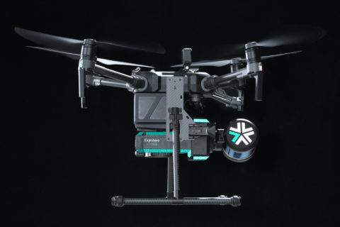
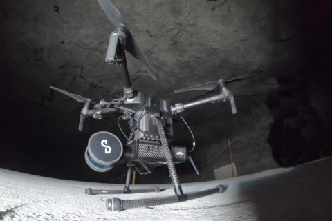
Exyn Technologies out for further AI-backed drone growth with latest financing
Exyn Technologies has announced a successful $35 million Series B round of funding that will,...
Read More
26 May 2022
Flight Safety Foundation helping miners assess drone risks
Flight Safety Foundation’s Basic Aviation Risk Standard (BARS) Program, working in collaboration with some of...
Read More
13 Sep 2021
Sandvik, Exyn combine capabilities in new autonomous mine inspection concept
Sandvik Mining and Rock Solutions and Exyn Technologies have furthered their strategic partnership looking at...
Read More
13 Sep 2021
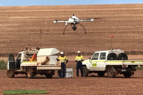
Skycatch maps out autonomous mining future with DJI M300 mapping, analytics solution
San Francisco-based Skycatch has been making waves in the drone space with a range of...
Read More
13 Aug 2021
Delta Drone to fly UAV-based LiDAR units at Newmont’s Ahafo gold mine
Global drones-as-a-service provider Delta Drone International says it has been re-appointed by Newmont Ghana Gold...
Read More
23 Jun 2021
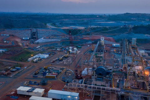
Bentley’s cloud-based tech aids AAEngineering in Altynalmas gold plant design
AAEngineering Group, utilising Bentley Systems' cloud-based technology, has helped Altynalmas come up with a new...
Read More
02 Feb 2021
Blast Movement Technologies bolsters post-blast data acquisition with FED 2.0
Blast Movement Technologies, part of Hexagon, has released a new flight enabled detector to safely...
Read More
09 Dec 2020
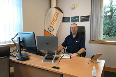
RIEGL expands laser measurement services with new UK office
RIEGL now has direct representation throughout the UK and Ireland with its new office in...
Read More
17 Nov 2020
Exyn Technologies gains Australia mining market exposure with C.R. Kennedy pact
Exyn Technologies, a pioneer in autonomous aerial robot systems for complex, GPS-denied industrial environments, has announced...
Read More
27 Oct 2020
Exyn Technologies expands mapping reach with two new products
Exyn Technologies has announced two new products to expand its ability to collect data from...
Read More
21 Sep 2020
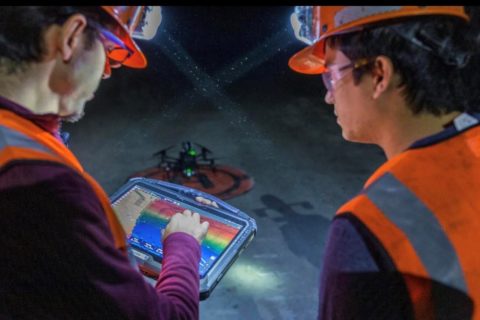
Emesent builds mining connections as Hovermap autonomy takes off
Having recently helped DJI’s M300 drone fly autonomously underground (through its Hovermap Autonomy Level 2...
Read More
08 Sep 2020
Komatsu iMC dozers, drone tech help RHT Contracting revolutionise tailings dam build
When long-time friends Joe Riccardo, Mike Heddon and Mark Tyler set up RHT Contracting in...
Read More
Prev
1
2
3
Next