Tag Archives: UAVs

Terra Drone branches out into Kazakhstan UAV market

Japan-based Terra Drone has continued with its global expansion, having invested in a leading UAV company in Kazakhstan, KazUAV.

With this investment, KazUAV joins Terra Drone’s network of over 25 group companies and technology partners committed to providing cutting-edge yet cost-effective drone services across the globe, the leading drone solution said.

Terra Drone said: “Established in 2016, KazUAV is a known name in Kazakhstan’s drone ecosystem, having provided GIS services to several government agencies and private companies.”

In 2018, at the request of the International Civil Aviation Organization, KazUAV mapped six airports in the country, totalling a surveyed area of 4 million hectares. The company is also registered to provide surveillance drone services to the Kazakhstan special forces.

As part of the Terra Drone group, KazUAV will be able to leverage technologies to provide various drone-based services and solutions in Kazakhstan, Terra Drone said. These include power line inspection and vegetation management for the energy sector; onshore/offshore infrastructure inspections, tanks inspections, and non-destructive testing for the oil and gas industry; and open-pit and underground mapping services for the mining sector.

Terra Drone already has more than 25 group companies in its network. Just last year, Terra Drone acquired a majority stake in Europe-based drone service provider Skeye, in addition to making an investment in Sweden-based Inkonova.


Airobotics Trion payload to improve drone inspection and security capabilities

Automated drone startup, Airobotics, has unveiled a highly “drone-stabilised” payload for inspection and security applications at ADS’ 2019 Warrior Expo East, in Virginia, USA.

Named Trion, this payload marks Airobotics’ first in-house developed and manufactured sensor for the market – available both with and independent of – its leading automated drone hardware and data insights platform, the company said.

Airobotics’ Trion weighs less than 1.2 kg and has small dimensions, according to Airobotics. This is on top of being a “high-definition, electro-optical and infrared gyro-stabilised payload.”

The company said: “Trion pushes the limits on existing and competing capabilities of stabilised payloads available today. Designed for superior performance, Trion carries a unique set of advanced capabilities for object identification, real-time tracking and comprehensive data harvesting.”

In addition to this, Airobotics has signed an agreement with ADS, a leading operational equipment and logistics provider serving US Military, Federal agencies, international and coalition partners, and defence industry partners.

The Trion payload provides day-and-night observation, surveillance, and targeting capabilities at long ranges and in adverse conditions, according to Airobotics. Integrated with Airobotics data insights platform, additional features include tag and tracking of security incidents, allowing for real-time insights to fuel informed decision making. Additionally, Trion offers a high-resolution HD day camera with powerful continuous optical zoom and continuous 360° panoramic capabilities.

Airobotics said: “Designed for maximum versatility, Trion can be seamlessly integrated into Airobotics’ automated drone platform, or other UAS, vehicles, platforms and ground applications, enabling increased flexibility for data collection, detection and analysis to obtain valuable insights.”

Ryan Angold, ADS’ Vice President of Markets, said: “We believe that our partnership with Airobotics will greatly enhance the customer experience and provide a market-leading solution for critical security and inspection applications.”

Ran Krauss, CEO and Co-Founder at Airobotics, said: “We are pleased to offer Airobotics’ powerful and highly stabilised Trion payload to the broader market that will grant professionals with the ability to capture more accurate data for fast decision-making in the most demanding circumstances.”

Airobotics has achieved a number of milestones across the business, including integration of LiDAR into its Automated Drone Platform, obtaining CASA approval for Beyond Visual Line of Sight (BVLOS) Drone Flights from remote operations centres in Australia and making advancements of aviation regulation with a US FAA BVLOS waiver.

Wood takes flight in western US with Delair UAVs for mine surveying

Delair and its regional reseller Frontier Precision have signed an agreement with Wood that will see the engineering and project service company adopt the Delair UX11 high-performance unmanned aerial vehicle (UAV) for its work in site planning and asset management in mining and quarry projects in the western US.

Delair said Wood was initially deploying the drone to do high accuracy, 3D topographic surveys and materials quantification for mining projects in Idaho and Wyoming. It is the first fixed-wing UAV Wood has deployed in the Western US, according to the company.

“For the scale of the projects we are performing, and the accuracy required, adopting the Delair UX11 was a logical choice,” Greg Meinecke, Technical Services Manager at Wood, said. “Its long-range capabilities allow us to cover areas not feasible with other data collection methods like hover craft drones or by foot, so it reduces the cost and time involved. It integrates well with our existing work flows, and features such as the PPK (post processed kinematic) function deliver additional benefits in terms of the precision and flexibility required in challenging environments.”

He added: “We have received excellent support from Frontier Precision and Delair in helping us deploy our first fixed-wing UAV missions and are already seeing results.”

According to Delair, Wood is deploying the UAV in remote areas where its heavy civils team is performing extensive excavation and site preparation for phosphate mining activities, a project covering more than 200 acres (81 ha). “Of critical importance for operations is an ability to precisely quantify the volume of materials being removed to ensure a high degree of accuracy in planning and invoicing,” Delair said.

Wood turned to the Delair fixed-wing UAV to deal with the scale of the terrain that needed to be surveyed, as well as the challenge of taking measurements in an active mine site area, including the safety hazards of having personnel on the ground in rough terrain and around large, moving equipment, Delair said.

“Flying at 400 feet (122 m) above the project areas and often at times using beyond visual line of sight flight plans, Wood technicians were able to use the precision data collection features of the Delair UX11 to acquire large amounts of highly accurate imagery that could be processed to generate detailed topographical reports,” the company said.

Meinecke said the company was able to get surveys covering large tracts of land done in a very short amount of time, which ends up being much more cost effective to the company and its client.

“More importantly, we can provide the mine owners a great deal of confidence in the accuracy of the work being performed and the quantities of resources involved. In the end, everyone agreed on the material quantities as the technology is very reliable,” he said.

Frontier Precision worked alongside Wood’s engineering and field experts to evaluate the Delair drone, and ensure it met the firm’s requirements, Delair said. This included integration with other tools the firm uses such as AutoCad, Trimble Business Center, and the Pix4D photogrammetry suite.

“Wood’s team noted the ease of use of the Delair UAV, especially given this was their first experience with fixed-wing flying,” Delair said. “The firm was able to train several pilots who specialise in different types of projects, and expects to deploy the drone on other infrastructure, mining and construction projects around the US.

“The team also noted the Delair UX11’s embedded global shutter camera as well as its PPK capabilities as key to ensuring greater precision in its data collection. With PPK, GPS data from both on-board and off-board systems can be matched after the mission, providing higher degrees of accuracy of the images collected.”

The Delair UX11 UAV, introduced commercially last year, is one of Delair’s top-of-the-line drones. The fixed-wing drone is an innovative hardware-software platform that provides highly accurate images for survey-grade mapping, with on-board processing capabilities and real-time, long-range control via 3G/4G cellular networks or radio links.

“The platform’s enhanced centimetre-level precision along with its efficient operational characteristics make it the most cost-effective solution for large area surveying and mapping,” Delair said.

Drones continue to make mining activities safer, Anglo American says

Anglo American, in its 2018 annual report, says its use of drones for safety, surveying and security is continuing to expand as it looks to remote-control more of its mining activities.

The company has used drones attached to manned aerial-reconnaissance planes for many years and, today, considers itself an industry leader when it comes to drone use.

Anglo said it has an expanding fleet of drones, from fixed-wing aircraft to quadcopters, with about 50 skilled operators and another 30 people working in drone maintenance across the group. This is spread across its platinum group metal operations in South Africa, the Kumba iron ore mines (also in South Africa), and at De Beers diamond asset sites in Canada, Namibia and South Africa.

“Drones are an important part of our drive to remote-control many of our mining activities while gathering enhanced data and real-time operational performance metrics,” Anglo said. “They provide rapid visual access and multiple views, with smaller drones being used to inspect confined spaces on mines and in processing plants, while bigger aircraft are able to fly at night and stay aloft for up to eight hours.”

Drones are being used in varied tasks such as exploration, mine mapping and calculating the volume of stockpiles, Anglo said, adding that they are proving to be cost effective.

“The deployment of drones is assisting in making our activities safer. Crucially, their use avoids the need for people in potentially hazardous areas,” the company said.

Drones are now being used to inspect and monitor high-risk areas, including stockpiles, mine slopes, ore passes, tailings dams and chemical-storage facilities, Anglo said. They can check for the presence of personnel in a blast area, and measure fragmentation or the direction of dust movement after a blast. By employing them in such applications, it removes the possibility of Anglo personnel entering dangerous areas.

Other applications the company is using them on include traffic management at operations, as well as monitoring rehabilitation activity, including in areas where it can be difficult and risky for people on the ground to gain access.

Frans Kruger, Anglo American’s Global Aviation Safety Principal, said: “Drones increase our safety and efficiency, and they let us take human beings out of potentially dangerous environments.”

Anglo concluded: “Drone technology is evolving fast and, as a responsible operator, we are working closely with other drone operators and South Africa’s Civil Aviation Authority, for example, to develop appropriate standards, while also serving with other mining companies on the technical advisory committee of the Flight Safety Foundation.”

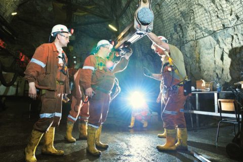
Dundee Precious Metals to map underground mines with Exyn A3R autonomous drones

Exyn Technologies says it has signed up Dundee Precious Metals as the first commercial customer for its Autonomy Aerial Robots (A3Rs).

Dundee will use the fully autonomous aerial system for data collection in GPS-denied environments to advance its initiatives focused on the digitisation and automation of its underground mining operations, according to Exyn.

Theophile Yameogo, Vice President Digital Innovation, Dundee Precious Metals, said, “The Exyn A3Rs allow frequent and hi-resolution mapping of underground environments while reducing risks to personnel.”

Yameogo said the company was already very excited at the results of the maps it was seeing. “As we further integrate the A3Rs into our workflow, we anticipate a transformation of operations compared to today’s models,” he added.

Exyn’s A3Rs are driven by the company’s proprietary software, exynAI™, a robust commercially available software platform enabling full autonomy for aerial robots. Exyn has deployed its A3Rs as a service for customers in the US, Latin America and Europe.

By using Exyn’s aerial robots to automate mapping and surveying, Dundee is, Exyn says, transforming its underground operations in three vital areas:

  • Improving the quality of mapping data captured when compared with traditional surveying techniques;
  • Improving safety by reducing the amount of time spent underground by human operators, and;
  • Increasing operational efficiency by having more accurate and up-to-date information for mine planning.

Exyn’s A3Rs operate without the need for a human pilot and in GPS-denied environments. The company said: “They are fully self-contained, intelligent systems designed to operate without the need for any prior information, persistent communication, or GPS. With all intelligence on board, the vehicle is capable of carrying out high-level missions in complex and completely unknown spaces.”

Exyn’s multi-sensor data fusion pipeline allows each robot to assimilate measurements from a variety of on-board sensors including 3D LIDAR, cameras, and inertial sensors to “generate a robust state estimate of itself and surrounding environments”.

When married with Exyn’s real-time navigation software stack, the robots can safely avoid collisions with both stationary and moving obstacles during requested missions, according to the company. “Moreover, its robots are also able to do real-time Simultaneous Localisation and Mapping to enable highly accurate map generation.”

Dundee operates the Chelopech underground copper-gold mine in Bulgaria and is soon to be producing gold at the Krumovgrad project, also in Bulgaria.

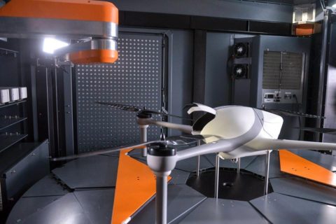
Airobotics boosts autonomous drone offering with new LiDAR capabilities

Airobotics has introduced LiDAR capabilities to its lineup of automated drone solutions, significantly reducing the time it takes for aerial data to be collected.

The announcement came at the same time as it declared record growth in 2018 and an expansion of its executive team in its new Scottsdale, Arizona headquarters.

Until a few years ago, the use of LiDAR was not possible with an aircraft as the sensors were hefty and required manual data processing, according to Airobotics. “Today, LiDAR images are captured and processed quickly in the cloud, allowing Airobotics’ customers to make effective decisions based on high-frequency, consistent data capture,” the company said.

These new capabilities will provide rapid precision scans across the value chain for industries such as mining and construction, according to Airobotics. Applications typically involve tailing dams monitoring, infrastructure inspections, haul road safety compliance, stockpile volume analytics, tracking rehabilitation progress, and more.

“The use of LiDAR significantly reduces the time it takes for aerial data to be collected, even at night or in low light, and allows for rapid turnaround time on data processing,” the company said. “Airobotics’ drones can work with various payloads. In addition to LiDAR, spatial data can also be captured using photogrammetry, video, and infra-red (thermal).”

In addition to this news, Airobotics said it had appointed former Morgan Stanley employee William Atkins as Chief Financial Officer and former Airware Chief Revenue Officer  as its own CRO.

Last week, the company received Australia aviation approval to operate automated multi-rotor drones from its remote operations centre beyond visual line of sight with no aircrew needed at the client site.

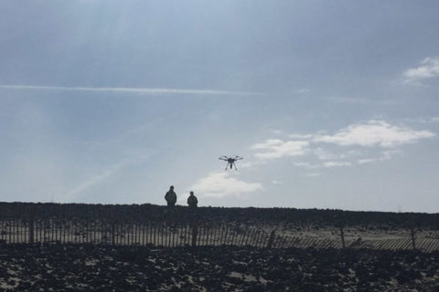
Airobotics automated drones permitted to go beyond line of sight in Australia

Airobotics has made Australia aviation history by obtaining the nation’s first and only Civil Aviation Safety Authority approval to operate automated multi-rotor drones from its remote operations centre (ROC) beyond visual line of sight (BVLOS) with no aircrew needed at the client site, the startup reports.

Alternatively, remote pilots can be located within Airobotics Australia’s ROC, at a designated remote pilot station, operating more than 1,000 km away from onsite systems at the customer sites. This new “man on the loop” level of operations enables human operators to supervise flights, but without requiring “man in the loop” pilots to intervene in flight operations, according to Airobotics.

Niv Russo, Airobotics’ Vice President of Aviation and Compliance, said the approval was a major achievement for the company and its future growth across Australia. “Removing aircrews from potentially dangerous environments, like mines, enables customers to extract maximum value and reduce risk from their business operations by leveraging technology and automation. This progression marks the next step for Airobotics as we continue to break new ground in unmanned drone technology to deliver safer and more accurate, data-driven solutions.”

Joe Urli, Airobotics’ Director of Flight Operations and Chief Remote Pilot, said the ROC approval set a new benchmark for unmanned drone operations for the Asia-Pacific region. “Airobotics’ unmanned drone platform significantly benefits our clients, providing them with operations that increase efficiency whilst saving operational costs and empowering flight crews to operate in secure locations hundreds of miles away from hazardous sites.”

Airobotics says its automated solution represents the next generation of drone operations, overtaking standard piloted services which can be prohibitive, imprecise and not always available.

The company claims to be the first and only drone solution worldwide permitted to fly without a human operator, having now added Australia approval to the certifications it had already received in Israel and the US.

Skeye is not the limit for Terra Drone as it continues globalisation drive

Terra Drone has continued its acquisition drive with the purchase of a majority stake in leading European drone service provider Skeye.

With this acquisition, Terra Drone has become one of the largest drone service companies with more than 250 employees and a presence in all continents. As part of the acquisition, Skeye will become the European headquarters of Terra Drone.

This is Terra Drone’s second acquisition in a matter of months. Back in October, it invested in Inkonova AB, a Swedish startup developing aerial robotics for underground mining and, earlier this month, it opened a branch in South Africa.

Terra Drone serves its clients with safer, better and more efficient surveys and inspections by using and developing cutting-edge technologies in the fields of unmanned aerial vehicles, better known as drones, the company says. It has 10 subsidiaries in Japan, APAC, EU, Africa, North America, and South America and focuses on mining, construction, energy utilities, and oil and gas applications.

Skeye, meanwhile, is an aerial survey and inspection company with a focus on drones in the oil and gas market. It has headquarters in the Netherlands and offices in the UK and Belgium.

Toru Tokushige, CEO of Terra Drone, said the company had discussions with many drone operators in Europe but were especially impressed with the track record and professionalism of Skeye.

“Skeye has an excellent track record and vast professional experience in the on- and offshore oil and gas market, in both inspections and 3D surveys using drones. We consider Skeye to be the best partner to bring our technologies to the European and African market.”

Pieter Franken, managing director of Skeye, said: “Terra Drone will bring a wealth of new technologies and a global network that we can use to better serve our international clients. This will ensure we can keep on providing our customers with the most cutting-edge technologies, now and in the future.

“The TerraUTM operating platform, 4G capabilities for guiding drones over large distances, in-house developed Terra-LiDAR, smart learning inspection software, and their proprietary mapping software, Terra-Mapper, are but a few of examples of technologies that this partnership will bring.”

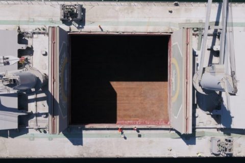
Drones go to sea at BHP’s ocean freight operations

BHP was an early adopter of drones across its mine sites, employing the aerial technology across the group for post-blasting clearance, traffic monitoring, building inspections and operation surveillance. Now, the major diversified miner is looking to drones to improve safety and provide efficiency gains at its ocean freight operations.

While still in the trial phase, BHP’s Vice President of Marketing Freight, Rashpal Bhatti, sees the potential for drones to be a key part of a tablet-based technological package, incorporating artificial intelligence that provides captains a digital view of their ship.

“All of our chartered ships receive a tablet when they berth. And on the tablet they can read the tension of the mooring line which has major safety benefits,” he said.

“The question now is: can the same tablet become a holistic technological package by also delivering ship hold inspection data, draft readings and other critical information captured by drones? It’s all a bit futuristic but that is the direction we are going.”

BHP ships more than 300 Mt/y of iron ore, coal and copper to customers around the world. More than 1,500 voyages are made, making BHP one of the largest charterers of dry bulk carriers in the world.

Like the drones being used across other parts of BHP’s operations, marine drones can be programed to carry a range of specific tasks, the company said.

“In the ocean freight business, there are clear and immediate advantages from using drones in the inspection of holds and in the taking of draft readings. Then there is their nimbleness in the seemingly simple but important task of advising the ship’s bridge on the water position of the rudder,” BHP said.

Hold inspection reports would continue to be independent assessments, but the use of drones promises to cut inspection times per hold from an hour to 15 minutes, according to the company.

Bhatti said: “The hold inspection process involves ships which have five to nine holds which a person checks by climbing down ladders. The inspector has to be physically fit, use fall protection, and carry a parrot (oxygen meter) to make sure there is enough air in the hold. And it takes a lot of time.

“With drones, we can fly them into a hold and capture 4K images, but also infra-red, and other types of cameras that can show cracks or other specific parameters that cannot be seen with the naked eye.”

There are essentially three or four types of ships with hold sizes about the same, according to Bhatti. “So once you programme a drone to go in to a certain ship, it can become an autonomous process.’’

This provides a better way to assess the condition of the hold, and removes a person from a potentially hazardous situation, Bhatti said.

BHP is also testing the use of drones to improve the safety, time and cost of ship draft readings. This is usually done from a boat when the ship is berthed and ready for a cargo.

One of the logistical challenges to overcome is to get the drones on ships when they are offshore at anchorage, as distinct from being berthed.

“We are working with ship owners on this and other ways to use technology to improve safety and productivity,’’ Bhatti said.