Join us at The Electric Mine 2026
The Electric Mine 2026
Get IM Free
DOWNLOAD IM
Videos/Webinars
Interviews
Webinars
Videos
2025 Media Pack
Events
Pay Online
Contact
The Electric Mine 2026
Get IM Free
DOWNLOAD IM
Videos/Webinars
Interviews
Webinars
Videos
2025 Media Pack
Events
Pay Online
Contact
IM Magazine
IM Magazine Archives
Past Events
The Electric Mine | Perth 2024 photos
The Electric Mine | Tucson 2023 photos
The Electric Mine | Toronto 2019 photos
Event Papers
The Electric Mine 2023 Conference Papers and Videos
The Electric Mine 2022 Conference Papers
The Electric Mine Virtual Conference 2020 Papers
The Electric Mine 2019 Papers
Helpful Links
Filter by:
All Topics
Automation
Base metals
Bulk handling
Careers in mining
Coal technology
Comminution of minerals
Communications in mining
Diamond mining
Energy minerals
Environmental
Equipment maintenance
Explosives and blasting
Gem stone mining
General
High tech minerals
History of mining
HOF
Industrial minerals
IoT
Marine mining
Metallurgy
Mine operation news
Mine shafts and equipment
Mine surveying
Mine ventilation
Mineral commodities
Mineral exploration
Mineral processing
Mineral project development
Mining consumables
Mining equipment
Mining events
Mining finance
Mining industry recognition
Mining maintenance
Mining mergers and acquisitions
Mining people
Mining policy
Mining project news
Mining safety
Mining services
Mining software
Mining techniques
Power supply for mines
Precious metals
Spotlight Feature Article
Steel and iron ore
Sustainable mining
Uncategorised
Uncategorized
Undersea mining
Videos
Water management
11 Dec 2019
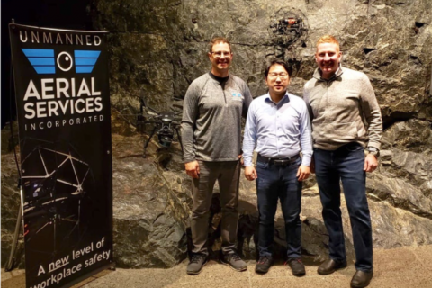
Terra Drone captures North America market share with UAS Inc deal
Japan’s Terra Drone is to form a new subsidiary in Canada, Terra Drone Mining, following...
Read More
22 Nov 2019
Doosan Infracore demonstrates Concept-X ‘construction site of the future’
This week Doosan Infracore unveiled ‘Concept-X’ at its Proving Grounds in Boryeong City, Korea, a...
Read More
23 Sep 2019
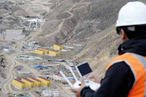
Mine sites testing out CSIRO, Mining3’s precision mining concept
CSIRO and Mining3’s wide-ranging precision mining concept looks to be gaining momentum with multiple mining...
Read More
13 Sep 2019
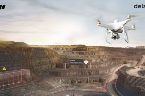
DJI and Delair team up to improve operational efficiencies using drones
DJI, a civilian drones and aerial imaging technology company, and Delair, a provider of visual...
Read More
01 Aug 2019
Kespry and DroneBase combine expertise for improved drone-based analytics
Kespry and DroneBase have announced a partnership that, they say, enables insurance, mining, and aggregates...
Read More
26 Jul 2019
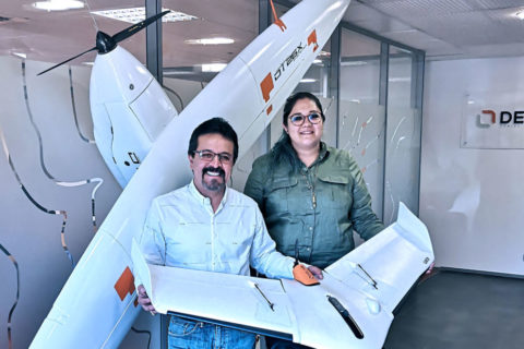
Geoforma helps Delair expand its Mexico offering
Delair, a supplier of commercial drone solutions to markets including mining, has announced an agreement...
Read More
18 Jul 2019
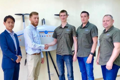
Terra Drone branches out into Kazakhstan UAV market
Japan-based Terra Drone has continued with its global expansion, having invested in a leading UAV...
Read More
10 Jul 2019
Airobotics Trion payload to improve drone inspection and security capabilities
Automated drone startup, Airobotics, has unveiled a highly “drone-stabilised” payload for inspection and security applications...
Read More
08 May 2019
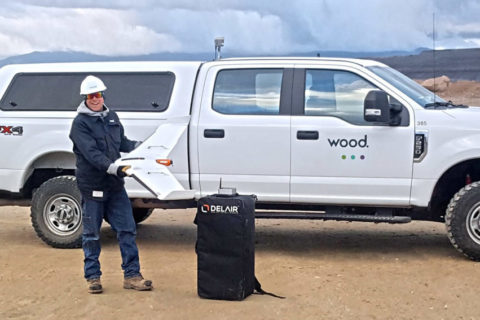
Wood takes flight in western US with Delair UAVs for mine surveying
Delair and its regional reseller Frontier Precision have signed an agreement with Wood that will...
Read More
05 Mar 2019
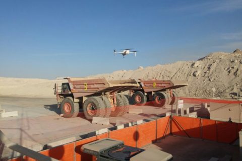
Drones continue to make mining activities safer, Anglo American says
Anglo American, in its 2018 annual report, says its use of drones for safety, surveying...
Read More
27 Feb 2019
Dundee Precious Metals to map underground mines with Exyn A3R autonomous drones
Exyn Technologies says it has signed up Dundee Precious Metals as the first commercial customer...
Read More
20 Feb 2019
Alpha Unmanned Systems to take part in Inmarsat UAV Pop-up lab
Alpha Unmanned Systems, a Spain-based designer and manufacturer of remotely piloted gasoline-powered unmanned aerial vehicle...
Read More
Prev
1
2
3
4
5
Next