Tag Archives: Drones

BEUMER Group’s conveyor and ship loading solutions to be highlighted at MINExpo

BEUMER Group is planning to highlight just how conveying and loading systems enable safe, efficient and environmentally friendly handling of bulk materials at the upcoming MINExpo 2021 event in Las Vegas, USA.

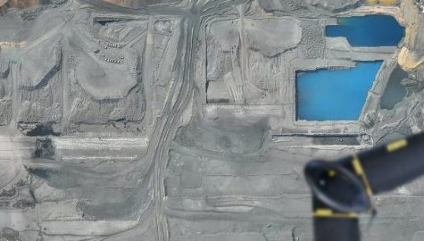
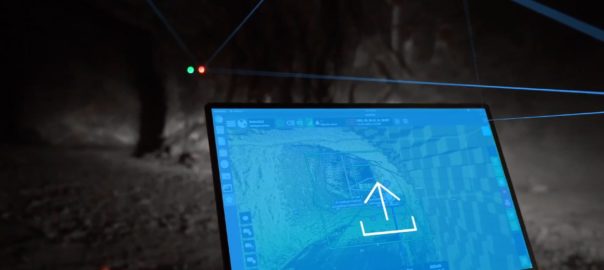
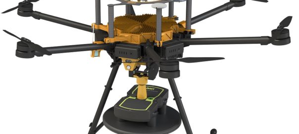
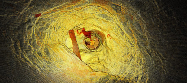
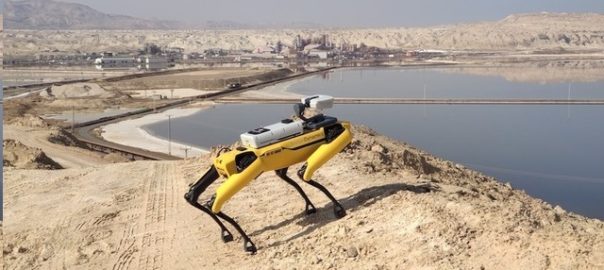
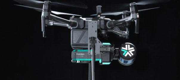
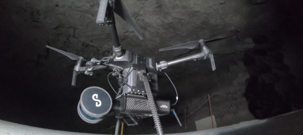
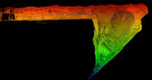
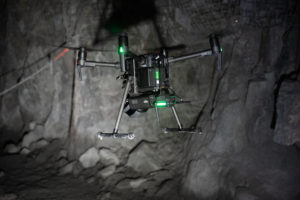
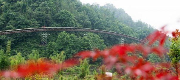
The company’s overland conveyors and pipe conveyors enable mine operators to create individual routes for the transport of raw material with steep angles of inclination and narrow curve radii that are adapted to the respective task and topography, BEUMER says. When planning these systems, the system provider also relies on camera-equipped drones for planning, implementation and documentation. Using special software solutions, the engineers evaluate the aerial photographs photogrammetrically to generate digital terrain models.

The product range includes stackers and bridge reclaimers for storage yards, with or without blending bed systems. These reclaimers stack bulk material and guarantee a maximum blending effect, according to the company. Users can also efficiently homogenise large quantities of different bulk materials and bulk material qualities and, thus, ensure the uniformity of the raw materials used. For efficient loading, BEUMER Group also offers ship loaders with fixed booms and extendable telescopic belt conveyors. To supplement these, users can also procure bulk loading heads to use when loading bulk materials into silo vehicles quickly and without dust.

The company will present efficient system solutions with overland conveyors, pipe conveyors and ship loaders from September 13-15 at MINExpo.

Delta Drone to use LiDAR-equipped UAVs at Barrick’s Mali operations

Delta Drone International is expanding its operations into Mali with a contract to deliver “advanced LiDAR services” to Barrick Gold.

For the first time in the region, the drone-focused company will use advanced light detection and ranging (LiDAR) solutions to examine mining site expansion options through its mining specialist brand, Rocketmine, it said. It will do this through a fleet of mining-specific drones and expert mining pilots.

Barrick operates the Loulo-Gounkoto mining complex in Mali, which comprises two distinct mining permits, Loulo and Gounkoto, and is situated in the west of the country, bordering Senegal and adjacent to the Falémé River. Both Loulo and Gounkoto are owned by Barrick (80%) and the State of Mali (20%). The complex produced 193,014 oz of gold in the March quarter.

The one-week operation of these drones will deliver Barrick the data required to guide decision making while continuing to focus on day-to-day mining operations, Delta Drone said. Rocketmine will also manage the necessary requirements by Mali’s local civil aviation authority to ensure all services conducted on the site are compliant.

Orbital Sidekick goes above and beyond to improve hyperspectral imaging

Orbital Sidekick (OSK) has announced the upcoming launch of its newest and most powerful hyperspectral imaging satellite, Aurora, which is set to expand contracts and pilot program opportunities for, among other things, sustainable mining practices.

Aurora leverages OSK’s previous experience collecting and analysing hyperspectral data to provide action-oriented insights, with a broad focus on sustainability, OSK says. The Aurora satellite will serve OSK’s customers in the energy, mining, and defence sectors, including expanding contracts and pilot program opportunities for oil and gas pipeline monitoring & methane mapping, clean energy resource exploration, sustainable mining practices and wildfire risk mitigation.

The Orbital Sidekick Aurora Satellite is a 30 kg precursor to the six 100 kg ESPA class GHOSt satellites scheduled for launch in 2022. Seattle-based launch services provider, Spaceflight, will be coordinating the launch with a total of 36 payloads onboard the SpaceX Transporter-2 rideshare mission, taking place June 25, 2021, at Cape Canaveral Air Force Base in Florida, USA.

Aurora will capture more than 450 spectral bands in the visible to shortwave infrared light spectrum (400 to 2,500 nm), OSK says, with a pixel size of approximately 30 m, making it the highest resolution commercial hyperspectral imagery available to date, the company claims.

“We’re excited to be launching Aurora to help provide consistent monitoring services across all of our clients as well as further the exploration for clean energy sources globally,” Dan Katz, CEO & Co-Founder of Orbital Sidekick, said. “Working with Astro Digital, OSK will be able to focus on the payload and extract information from our unique and proprietary hyperspectral data with the utmost precision.”

Exyn and Sandvik OptiMine auto drone integration tested at Rupert Resources project

Exyn Technologies has announced the expansion of its strategic partnership with Sandvik Mining and Rock Solutions to integrate its data into Sandvik’s analytics and process optimisation suite, OptiMine®.

By synthesising critical data and capabilities, Exyn and Sandvik are helping mining customers transform their underground operations to be safer, more productive and more efficient, the companies say.

Back in July, the two companies signed an agreement to work together “to provide efficient solutions for mapping and visioning underground mines, which will make a substantial difference when it comes to mine locations that are hazardous, hard to reach or conventionally time-consuming to survey and inspect”.

In the latest release, the two said: “Using Exyn’s industrial-grade autonomous drone, ExynAero, mining companies can harness completely pilotless flight to access impossible-to-reach data with maximum safety. The data collected is processed using Exyn’s on-board 3D mapping technology – powered by ExynAI – which is then integrated with Sandvik’s OptiMine Mine Visualizer solution for analysis and optimisation of underground mining production and process.”

The partnership allows mining customers to benefit from comprehensive underground aerial 3D mapping with progressive visualisation that increases overall transparency of mining operations – including for GPS-denied, hard-to-reach, or hazardous areas, or locations that would be time-consuming to survey and inspect using conventional methods, according to the companies.

Exyn and Sandvik deployed this integrated solution at gold exploration and development company Rupert Resources’ Pahtavaara project in Finland, using the ExynAero drone to autonomously create a 3D point cloud of an underground stope. This 3D data was then uploaded to Sandvik’s OptiMine Mine Visualizer and georeferenced to the CAD mine model for further analysis and visualisation.

David Hallett, Vice President, Business Unit Automation, Sandvik Mining and Rock Solutions, said: “This step in our partnership with Exyn is critical. Our teams have been working closely together to ensure the connection between Exyn and Sandvik’s systems would be seamless and easy for operators to use. When this feature gets rolled out to the market as part of OptiMine, it will allow our customers to analyse Exyn’s high-resolution, aerial maps in OptiMine.

“After this demonstration, we look forward to further developing our partnership and integrating our hardware and software systems in the coming months.”

Nader Elm, CEO and Co-Founder of Exyn Technologies, added: “We’re very proud to expand our partnership with Sandvik and to deliver the key benefits of safety and operational efficiency to all the humans involved in the mining industry.

“By offering world-class software and technology, we have given customers the ability to map areas underground they could never before reach. Our end goal is to be an integral part of fully autonomous mining operations and I’m confident that through our partnership with Sandvik, we’re one step closer.”

Exyn and Sandvik have more product integrations in the plans, they said.

Blast Movement Technologies bolsters post-blast data acquisition with FED 2.0

Blast Movement Technologies, part of Hexagon, has released a new flight enabled detector to safely and expediently retrieve post-blast location data.

FED 2.0 is a specially fitted UAV that comes with improved detection depths of up to 12 m. By adhering to strict ‘stand-off’ guidelines, it enables the swift retrieval of BMM (Blast Movement Monitor) location data, post blast, without the need to walk the muckpile, according to BMT.

BMT released its first UAV detector in November 2019, establishing an alternate, semi-automated solution to retrieve BMM sensor data.

Like its predecessor, FED 2.0 is based on the DJI Matrice M600Pro flying platform, but now features an automated Winch mechanism to lower the detector closer to the surface and away from the main UAV body. This not only ensures greater detection depths but also lessens the interference from the motor and blades, according to BMT.

The Winch was developed in partnership with Australia-based, unmanned systems specialist, Insitu Pacific, a subsidiary of The Boeing Company. Insitu ensured the new winch technology worked seamlessly with the existing FED ground control software, as well as introducing several other user experience improvements, BMT said.

FED 2.0 features an automated flight control and customisable flight plan. It has a built-in GNSS receiver to enhance positioning information and a vertical and horizontal collision detection system. It can also resume the mission after low battery replacement from the point where it was suspended. The on-board computer allows for immediate processing of incoming data, ensuring access to the movement data while resolving safety and environmental considerations.

BMT CEO, Jacques Janse, said: “With many mines focused on recovering more ore quickly and safely, our FED 2.0 continues our journey towards an autonomous future. This safety aspect, along with the increased detection depths, opens up the ability to use our BMM system in more mines.”

Emesent’s Hovermap aids ore pass decision making at Petra’s Finsch diamond mine

Highly accurate point cloud data sets from a Hovermap scan have allowed Petra Diamonds’ Finsch mine engineers to “see” the condition of ore passes for the first time and avoid an estimated five months and R5 million ($350,000) in remediation, Emesent says.

Finsch, in South Africa’s Northern Cape, uses ore passes and underground silos to transfer ore between levels or to redirect ore for load and haul to the surface. Blockages, hang-ups, overbreak or scaling can impact the structural integrity and result in extended downtime and significant remediation costs. Accurate imagery enables mine engineers to gauge the integrity of ore passes and plan timely and cost-effective remediation programs, according to Emesent.

Historically, however, scanning and mapping inaccessible shafts and voids has been a challenge for Petra.

The company’s management sought a means of obtaining accurate visualisations of underground voids, quickly and cost effectively, without endangering the safety of Petra personnel or contractors, Emesent says.

Petra management trialled the Hovermap multiple data capture methods with Emesent partner, Dwyka Mining Services, contracted to carry out multiple scans of an indoor stockpile, ore passes and vertical shafts, and a series of access tunnels and ramps.

Hovermap is a drone autonomy and LiDAR mapping payload. It uses the LiDAR data and advanced algorithms on-board, in real time, to provide reliable and accurate localisation and navigation without the need for GPS.

Dwyka spent a day on-site conducting a series of scans using Hovermap mounted to vehicles, a DJI drone, or lowered in a protective cage. Dwyka delivered point cloud data sets for Petra’s survey team to geo-reference and analyse, within 24 hours. It also provided visualisations of the ore passes, enabling the mine engineers to ‘see’ the condition of orepasses for the first time, Emesent said.

Alex Holder, Group Planning and Projects Lead at Petra Diamonds, explained: “We lowered Hovermap down ore passes, flew the drone into draw points and even scanned our shaft and ramps by fixing the scanner to one of our vehicles. The visualisation delivered exceeded all our expectations. The data captured in one ore pass saved us significant time and effort by confirming it was irreparable. That saved us millions.”

Using Hovermap led to an immediate decision to abandon plans to expend resources remediating a compromised ore shaft. This decision saved Petra an estimated five months and R5 million.

Heinrich Westermann, Mining Engineer at Petra Diamonds, said: “The ability to power and switch the Hovermap payload between the various applications meant that we were able to scan a considerable amount of the mine in one shift. Generally, this was either impossible and, if it were possible, it would take weeks to collect those datasets and months to see the final visuals.”

The data collected by Hovermap has become the basis of a data library for the site. It is augmented regularly and used to inform operational decision making by Petra’s mine planning and survey teams, according to Emesent.

Petra intends to deploy Hovermap scanning technology to map inaccessible locations at its other sites across Africa, Emesent says.

Percepto’s Autonomous Inspection & Monitoring platform receives funding boost

Percepto has announced a strategic investment of $45 million in funding to, it says, launch a transformative solution for remote, fully autonomous, asset monitoring, inspection and compliance of industrial sites.

The financing, led by Koch Disruptive Technologies, with contributions from new investors State of Mind Ventures, Atento Capital, Summit Peak Investments and Delek-US, plus existing investors U.S. Venture Partners, Spider Capital and Arkin Holdings, brings the total investment in the company to $72.5 million.

Percepto’s Autonomous Inspection & Monitoring (AIM) platform sets a new standard for how critical infrastructure and assets are monitored, end-to-end, paving the way for the remote operations centre of the future, according to the company.

“Operating a fleet of third-party robots alongside their autonomous Sparrow drone, Percepto AIM provides visual data management and analysis to report trends and anomalies and to alert of risks,” it said. “Any member of staff can request data and Percepto AIM will deploy the most suitable robot independently without human accompaniment to retrieve and stream the required data. The platform also seamlessly reports to assess risk, minimise downtime, drive efficiency and reduce operational costs without human intervention.”

Dor Abuhasira, CEO and Co-Founder Percepto, said: “Our customers, which include some of the world’s leading utility, oil and gas sites, mining and other critical infrastructure facilities, are eager to fully embrace automation across their operations and reap the benefits of driving efficiency, reducing costs and safeguarding staff. We’re excited to be the first to empower our customers with truly autonomous inspection and monitoring, driven by the management of multiple visual robotic data sources, together with other visual sources including piloted drones, CCTV and mobile cameras, on site or remotely.”

Percepto has integrated Spot, an agile mobile robot developed by Boston Dynamics, with AIM for the robot to automate inspection rounds completely, controlled remotely via the platform (see photo). Spot carries Percepto’s payloads for high resolution imaging and thermal vision to detect issues including hot spots on machines or electrical conductors, water and steam leaks around plants and equipment with degraded performance, with the data relayed via AIM.

Michael Perry, VP of Business Development at Boston Dynamics, said: “Combining Percepto’s Sparrow drone with Spot creates a unique solution for remote inspection. This partnership demonstrates the value of harnessing robotic collaborations and the insurmountable benefits to worker safety and cost savings that robotics can bring to industries that involve hazardous or remote work.”

ICL Dead Sea, a leading global speciality potash, mineral and chemicals company, has been operating Percepto’s drone-in-a-box solution to carry out inspection, safety and security missions at its operations at the Dead Sea site, and was the first to fly beyond the visual line of sight in Israel, according to Percepto.

Shay Hen, ICL Dead Sea Drone Program Manager, said: “With Percepto’s AIM, we can now live stream all of our missions and no longer have to be physically present on site to control decisions regarding maintenance and operations. Wherever we are, we know exactly what is happening on site.

“We are looking forward to examining the integration of additional robots, such as Boston Dynamics’ Spot, onto our site for holistic inspection capabilities beyond aerial inspection.”

Exyn Technologies expands mapping reach with two new products

Exyn Technologies has announced two new products to expand its ability to collect data from challenging and previously-unmappable environments, and enable customers to have better solutions.

The ExynAero (pictured) is the latest aerial robot and an upgrade from the previous generation’s A3R™. Fully autonomous, the ExynAero allows for mapping of any environment (including GPS-denied, human-inaccessible, industrial environments without a pilot), keeping employees safe and maximising beyond-line-of-sight-and-communications data collection, the company says.

This new technology builds on Exyn’s previous iterations based on its ExynAI software, which can mesh multiple data streams in real time. The ExynAero is also able to leverage various sensors and platforms that can be merged together via automated software to build a robust and complete map of an environment in real time, even with multiple units running simultaneously, the company says.

Its features include robust 270° view, providing detailed in-depth visuals of stopes in full HD colour, super-bright lighting and LiDAR to provide top acuity, shooting over 300,000 beams per second for highly accurate visualisations. The agile navigation and flight stack improve the ExynAero’s stability and robustness in tight spaces, and the ExynAero can easily transfer data to teams who can analyse it, Exyn says.

Nader Elm, CEO Exyn Technologies, said: “The ExynAero represents the future of data collection across a number of applications and industrial environments. The product is the first of its kind to offer true aerial autonomy.”

The ExynAero can fly itself in the most challenging and unknown environments, collect the data, and merge the streams with ExynAI on board, according to Elm. This allows for maximum data collection and a “radical improvement” in safety for workers around the world who are placed in difficult and sometimes potentially dangerous conditions, he said.

“We’re hoping with the launch of this product, and the additional modalities offered by the ExynPak, that our customers will be able to collect the data they need easily, regardless of limitations,” he said. “The benefits of this will lea

d to not only significantly greater worker safety, but also considerably improved productivity and efficiency.”

The ExynPak (left), meanwhile, provides a new portable format that enables users to unstrap the autonomy features of the ExynAero and capture data with the built-in tools via other modalities – such as hand carry or vehicle mount – for situations where complete autonomy is not needed or practical.

Exyn’s autonomous aerial robot systems are most commonly used for industrial applications such as mining, construction, nuclear power, and military surveillance/reconnaissance. The ExynPak will allow for an expansion of the potential uses of Exyn’s core technology applications and environments to existing infrastructure or transportation modes that don’t require an aerial or autonomous component, the company said.

The Exyn team plans to continue to develop new products that help support mapping and data collection regardless of format, with more products coming out in 2021, it said.

Emesent builds mining connections as Hovermap autonomy takes off

Having recently helped DJI’s M300 drone fly autonomously underground (through its Hovermap Autonomy Level 2 (AL2) solution) and signed an agreement with Deswik to provide surveyors and planners with more accurate data from inaccessible areas, Emesent has been on a roll of late. IM put some questions to CEO, Dr Stefan Hrabar, to find out more.

IM: First off, if no communications infrastructure is in place at an underground mine, how do Emesent’s drones stream a 3D map of the environment back to the operator’s tablet?

SH: Hovermap is smartly designed to operate beyond the communication range of the operator. The operator does not always need to see a live map since Hovermap is navigating by itself. The user can place a waypoint beyond the current limits of the map, and beyond line of sight and communication range. Hovermap self-navigates towards the waypoint, avoiding obstacles and building the map as it goes. Once it reaches the waypoint (or if the waypoint is impossible to reach), it automatically returns back to the operator. The map data is stored onboard Hovermap and when it returns back to within Wi-Fi range the new map data is uploaded to the tablet. The operator can then see the new areas that were mapped and place a new waypoint in or beyond that map, sending the drone back out again to explore further.

IM: What results have you so far received from using AL2 for Hovermap at mine sites? Were the results PYBAR got from trials at Dargues and Woodlawn in line with your expectations?

SH: Last year’s trials at Dargues and Woodlawn showcased some great outcomes for the PYBAR team, including the ability for Hovermap to capture valuable data using Autonomy Level 1 (AL1). The team saw great potential in the technology, leading to the purchase of two systems for their use. Earlier this year, AL2 flights were conducted at Dargues during the final pre-release testing phase. Even the first stope at Dargues that was mapped using AL2 highlighted the benefit of the system over traditional CMS (cavity monitoring systems). A large area of overbreak was identified in the Hovermap scan. The same stope had been mapped with a CMS, but this area was not visible from the CMS scan location so the overbreak was not identified.

A number of mines have been using AL2 to map their stopes and other areas beyond line-of-sight. With AL2, they can send Hovermap into places that previously would have been inaccessible, enabling them to obtain critical data in real time without risking the machine or personnel.

The AL2-based stope scans have been more detailed and complete (lack of shadowing) than ever before. A beyond line-of-sight flight down an ore pass was also conducted recently, with Hovermap guiding the drone down 120 m and returning safely to produce a very detailed scan.

The high level of autonomy provided by AL2 also allows remote operation of the drone. We recently completed a trans-continental demo, with a customer in South Africa operating a drone in Australia using our AL2 technology and standard remote collaboration tools. The remote operator in South Africa was able to use their laptop to experiment with the technology from the other side of the world, sending Hovermap exploring down a tunnel.

This is a taste of what’s to come, with drones underground being operated from the surface or from remote operation centres thousands of kilometers away. This will remove the need for skilled personnel on site, and reduce the time spent underground.

IM: What had been holding you back from achieving AL2 with drones/payloads? Is it the on-board computing power needed to that has been the issue?

SH: Flying underground where there is no GPS, the space is tight and there are hazards such as mesh, wires, dripping water and dust is very challenging. We overcame many of these with AL1, which makes it safe and easy for a pilot to operate the drone within line-of-sight (Hovermap provides collision avoidance, position hold and velocity control). AL1 has been deployed for 18 months with many customers around the world, clocking up thousands of hours of use. This helped to improve the robustness and reliability of the core flight capabilities.

Emesent CEO, Dr Stefan Hrabar

AL2 builds on this mission-proved base capability to provide additional features. AL2 allows the system to fly beyond line-of-sight and beyond commination range. This means it’s on its own with no help from the operator and needs to deal with any situation it comes across. There are many edge cases that need to be considered, addressed and thoroughly tested. A significant amount of effort was put into these areas to ensure Hovermap with AL2 is extremely robust in these challenging environments. For example, the drone downwash can kick up dust, blinding the LiDAR sensor. We’ve implemented a way to deal with this, to bring the drone home safely. Other considerations are returning in a safe and efficient way when the battery is running low, or what to do if waypoints cannot be reached.

IM: How do you anticipate your partnership with Deswik impacting the mine planning and survey process? Do you see this reducing the amount of time needed to carry out this work, as well as potentially cutting the costs associated with it? Have you already carried out work at mine sites that has proven these benefits?

SH: Our commitment is to help mining companies increase safety and production while reducing costs and downtime. We do this by providing surveyors and planners with more accurate data from inaccessible areas, allowing them to derive new insights. Our partnership with Deswik means we’re able to provide a more comprehensive end-to-end solution to the industry.

We see this as a very natural partnership that will improve the overall customer experience. Hovermap excels at capturing rich 3D data in all parts of the mine (whether drone based, hand-held, lowered down a shaft on a cable or vehicle mounted). Once the data is captured and converted to 3D, customers need to visualise and interrogate the data to derive insights. This is where Deswik and other mining software vendors come into play. They have powerful software tools for planning, survey, drill and blast, geotechnical mapping and a host of other applications. We’re partnering with these vendors to ensure seamless integration between Hovermap data and their tools. We’re working with them to build automated workflows to import, geo-reference, clean and trim the data, and convert it into formats that are suitable for various tasks.

Surveyors at Evolution Mining’s Mungari operation have been using this new process in Deswik. Previously they needed a third software tool to perform part of the workflow manually before importing to Dewik.CAD. The intermediate steps have been eliminated and others have been automated, reducing the time from more than 30 minutes per scan to five minutes per scan.

IM: Since really starting to catch on in the mining sector in the last five years, drones have gone from carrying out simple open-pit surveys and surveillance to drill and blasting reconciliation platforms to reconnaissance solutions carrying out some of the riskiest tasks in underground mining. In the next decade, how do you see them further evolving? What new tasks could drones carry out to improve safety, cut costs or increase productivity?

SH: Emesent’s vision is to drive forward the development of ‘Sentient Digital Twins’ of industrial sites to future-proof the world’s major industries, from mining to energy and construction. These industries will be able to move to more automated decision-making using high-quality, autonomously collected data across their sites and tapping into thousands of data points to make split-second decisions about potential dangers, opportunities and efficiencies using a centralised decision-making platform.

We see our Hovermap technology being a key enabler for this future. Drones and other autonomous systems will become an integral part of the mine of the future. Drones will be permanently stationed underground and operated remotely, ready for routine data collection flights or to be deployed as needed after an incident.

Hovermap is already addressing some of the biggest challenges in mining — including safety and operational downtime. It improves critical safety to mines, keeping workers away from hazardous environments while providing better data to inform safety related decisions such as the level of ground support needed. This then feeds into better efficiency by helping mines to more accurately calculate risks and opportunities, aid decision making and predict situations.

Hovermap can significantly reduce downtime after an incident. For example, it was used to assess the level of damage in LKAB’s Kiruna mine after a seismic event. More than 30 scans were captured covering 1.2 km of underground drives that were not safe to access due to fall of ground. In another case, one of our customers saved around A$20 million ($14.6 million) after an incident, as they could use Hovermap to quickly capture the data necessary to make a critical decision.

IM: In terms of R&D, what future payload developments are you investing in currently that may have applications in mining?

SH: We’ll keep adapting our Hovermap design to suit new LiDAR improvements as they are released. More importantly, we’ll improve the autonomy capabilities so that even more challenging areas can be mapped with ease. We’re also adding additional sensors such as cameras, as these provide additional insights not visible in the LiDAR data. Our colourisation solution is an add-on module for Hovermap, which uses GoPro video to add colour to the LiDAR scans. This allows the identification of geological and other features.

Komatsu iMC dozers, drone tech help RHT Contracting revolutionise tailings dam build

When long-time friends Joe Riccardo, Mike Heddon and Mark Tyler set up RHT Contracting in mid-2018, they knew they needed a winning edge when bidding for contracts – so they went for the most innovative and technically advanced construction equipment available, a Komatsu Australia case study reports.

That saw them choose Komatsu’s intelligent Machine Control (iMC) dozer and excavator technology when bidding for a large contract to construct tailings storage facilities (TSFs) for a major mining operation in Western Australia.

Currently RHT runs four Komatsu iMC machines: two D65PXi-18 swamp dozers, a D155AXi-8 dozer, and a PC360LCi-11, as well as Komatsu wheel loaders, dump trucks, graders, and other excavators on the one site.

Not only does using iMC technology give RHT significant safety, productivity, efficiency and accuracy advantages in TSF construction, it also provides the company’s mining clients the security and peace of mind that their critical facilities have been built to the highest and most exacting standards.

Today that is essential for any mining operation, following catastrophic failures of tailings dams in South America in the past five years, which have killed many people and caused widespread environmental devastation.

To ensure their integrity and long-term performance, it’s essential that TSFs be constructed following an established process, which involves placing the dam material in 300 mm thick layers; these are then compacted, and the top 100 mm scarified to ensure a strong lock with the subsequent 300 mm layer.

Using Komatsu iMC machines in this application, each 300 mm layer can be placed, quickly and efficiently, within tight tolerances, ready for compaction.

And unlike conventional ‘bolt-on’ machine control systems, the iMC system prevents dozer blades or excavator buckets from ‘over-digging’ into the already compacted and scarified layers, ensuring they are not compromised during placing of the next layer.

When RHT was formed, Riccardo, Heddon and Tyler (the company’s name comes from their surname initials) saw the opportunity to use Komatsu’s iMC technology as a real competitive advantage.

“These days, you’ve really got to innovate,” Heddon says. “Clients want to see that you are innovative and you’re not a dinosaur.

“I’ve been going to shows like CONEXPO and BAUMA for years, and I see all the latest stuff, and I was wondering how good it actually was. Then we spent some time with Dean Jones and Colin Brindle (from Komatsu Perth), to find out what their iMC technology could do.

“We were convinced enough to buy a D65PXi-18 swampy and a PC360LCi-11 excavator, plus a Topcon base station, which were delivered in February 2019, and took them to the site.

“We also put on Fraser Mead, a young surveyor, who’s passionate about technology, plus he’s really into drones and how they can really help with the whole mine infrastructure construction process.”

As of mid-June, Mead and RHT are trialling Komatsu’s EDD (EveryDay Drone) technology, a high precision UAV (drone) survey system providing industry-leading super-fast on-site processing using Komatsu SMARTCONSTRUCTION’s Edge technology.

“Initially the operators weren’t convinced about the iMC machines; they said ‘stuff this, I’m an operator, I don’t need that’, but then after a few days of seeing what the technology could do, they were going ‘wow!’,” Heddon says.

“On the first dam we built, we never put a grader on it, did the whole batter with just our first D65EXi dozer and the PC360LCi excavator. I have never, ever done that before; they are exceptionally good. The dams look great, the batters look great, we’re never having to do rework, we get it right – from the start to the end. It’s always spot on.”

Expanded fleet

Following the success of its first D65PXi-18, RHT bought a second D65PXi-18 in September last year, and the D155AXi-8 in February this year.

“At the moment, we’ve got all these machines working on site, building up to three dams at one time,” Heddon says.

“With the dozers, we are using them for winning material from borrow pits, while the excavator is pulling up batters.”

Building tailings dams for larger mines requires large amounts of earthworks – with dam walls up to 4-6 km around, along with haul roads, so there is a lot of earth to be moved.

RHT’s two smaller iMC machines, with their swamp tracks, are proving ideal for the precision final trim work to millimetre level accuracy, while the larger D155AXi-8 (pictured) is being used for the bulk earthworks on the dams and haul roads, according to Komatsu.

“On the newer dams we are building, we are using clay oxide materials, which are heavier to work with, which is why we brought in the D155AXi,” Heddon says. “Plus, we can also use it for building haul roads. We can just map in a haul road route and design, and the machine can go out and build it, even in rock and clay.”

One thing RHT has found is that the D155AXi-8 has not so far been giving quite the final trim accuracy of the D65PXi-18s.

“Certainly, it is extremely accurate compared with any conventional dozer next to it, but because we have seen how precise the D65s are to a few millimetres, we were expecting that with the D155. However, because it is bigger, it corrects slightly differently,” Heddon says.

“It’s still good, still within coo-ee of what we need, but we know at the moment it’s giving a slightly rougher surface, so you’ve got to take things a bit slower, use a lower gear to get there.

“On the bulk side, Komatsu’s intelligent Machine Control works really well, absolutely on this bigger dozer. You can just set it, and it does exactly what we need. It’s on the fine control, where I think we can get it going even better.

“Because this is all so new, it’s something we are working with Komatsu to perfect.”

Heddon also says iMC ensures that rework and over-excavation never occurs – eliminating overruns and field survey work.

“With Komatsu’s intelligent Machine Control acting as a rover, we know we are always building to the exact specs; we are never over-building, and everything is always exactly level and ready for rolling.

“We don’t require anyone to go out there with a dumpy level checking levels and all that stuff,” he says.

No micro managemenent

The other big advantage is having all the works designs already in the machines, ready for the operators as soon as they need them.

“That’s a big saving because the operators have everything at hand in the machines to do the work,” Heddon says.

“In the old days, we’d have two teams out there pegging the site, one for the day shift, and another for the night shift.

“Now we just put in a couple of reference pegs, then once the operator has the levels, it’s all good to go.”

And, as each part of the job is completed, it can be immediately checked and audited – and the records remain readily available at any time in the future for clients or geotechnical engineers.

“This technology means that the as-built track mapping is all there from the start. When you’re building a tailings dam, it’s essential that layers go down in 300 mm lifts, before the next one goes on top,” he says.

“We can see all this on the computer and know that it was done precisely. So, in future, if there is ever a question with a dam, we can go back in there and show that it was done exactly right. There’s no need for anyone to go in and micromanage. It is a great system.

“The other great thing about these iMC machines is that essentially they act as a mobile rover because everything is done within the machine.

“So, the surveyor can be away on another mine site, and if the operator finishes a job, the surveyor can jump in remotely, and work together with the operator to set things up for the next job. So, people are not sitting around waiting for someone to get back after lunch to start up again.”

Greatly increased site safety is another huge advantage with iMC, according to Komatsu.

“Safety is paramount for us,” Heddon says. “And not having people working on the ground around dump trucks, excavators, wheel loaders, dozers and other machines, is a major safety component. It’s just unreal.”

Heddon has also observed interesting reactions from operators using the iMC systems, and RHT’s clients.

“When these machines first came to site, people said it was just more stuff to go wrong. But then after a few days, they all agree the benefits are countless.

“And our clients have been really impressed with the quality, efficiency and technology the iMC machines offer.

“With this technology, we have the trucks deliver to the site, the dozers push it out – and it’s so level that the trucks can keep working, whereas before we’d have to call in a grader to give the trucks access.

“Everyone is stoked with it, the whole concept. We’ve since bought a second base station, and we’re putting that in our second site.”

The future

Heddon sees tremendous potential for Komatsu’s iMC technology in future projects.

“This is really moving into the future, that’s the only direction we want to go now.

“And particularly after those catastrophic dam failures in Brazil, the more you can prove the quality of your work and show that to the geotechs and the clients, the more successful we can be.

“They really need the confidence that these dams are getting built correctly at all times, not just some of the time.

“It’s giving the mining companies that security and peace of mind that their dams are built right, so they know they have their dams constructed to worlds best practice.

“We’re very committed to this technology. We want to see it on all our earthmoving machines, and we are very keen to see it on the larger excavators, at least up to PC490 size,” Heddon says.