Tag Archives: Drones

Terra Drone lifts off in South Africa with Sibanye-Stillwater underground demonstration

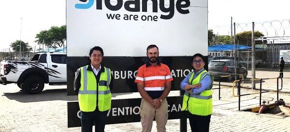
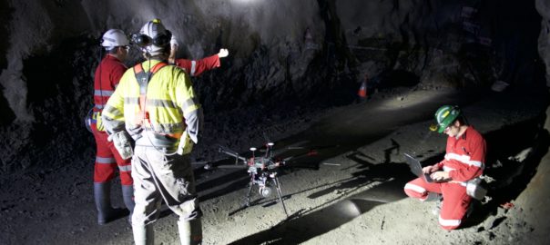
Terra Drone South Africa has shown off its surveying expertise to Sibanye-Stillwater, with one of its drones successfully navigating a 3m x 3 m tunnel at one of the gold and PGM miner’s underground assets.

A simultaneous localisation and mapping-equipped drone was able to realise “stable automatic navigation” under a “non-GPS environment,” Terra Drone said. The result was the generation of a highly accurate 3D model.

Terra Drone said the many injuries caused by fall of rock incidents in Africa could be somewhat alleviated through the use of accurate surveying and inspection.

“We believe that this technology (drone mapping) will improve safety and work efficiency in Africa’s mining industry in the future,” the company said.

Teppei Seki, Terra Drone Chief Operating Officer, said he was delighted to have carried out such a demonstration with Sibanye-Stillwater. He said the company would now focus on volume calculation by “making 3D measurements of stopes, survey and inspection for ore path and vertical shaft with Sibanye-Stillwater”.

The collaboration is expected to be a “giant step” towards opening up the development of more underground mines in Africa in the future, he added.

Terra Drone is a leading commercial drone technology company that is expanding. It has a branch in South Africa along with nine others in the world covering mining, oil & gas and electricity solutions.

Skeye is not the limit for Terra Drone as it continues globalisation drive

Terra Drone has continued its acquisition drive with the purchase of a majority stake in leading European drone service provider Skeye.

With this acquisition, Terra Drone has become one of the largest drone service companies with more than 250 employees and a presence in all continents. As part of the acquisition, Skeye will become the European headquarters of Terra Drone.

This is Terra Drone’s second acquisition in a matter of months. Back in October, it invested in Inkonova AB, a Swedish startup developing aerial robotics for underground mining and, earlier this month, it opened a branch in South Africa.

Terra Drone serves its clients with safer, better and more efficient surveys and inspections by using and developing cutting-edge technologies in the fields of unmanned aerial vehicles, better known as drones, the company says. It has 10 subsidiaries in Japan, APAC, EU, Africa, North America, and South America and focuses on mining, construction, energy utilities, and oil and gas applications.

Skeye, meanwhile, is an aerial survey and inspection company with a focus on drones in the oil and gas market. It has headquarters in the Netherlands and offices in the UK and Belgium.

Toru Tokushige, CEO of Terra Drone, said the company had discussions with many drone operators in Europe but were especially impressed with the track record and professionalism of Skeye.

“Skeye has an excellent track record and vast professional experience in the on- and offshore oil and gas market, in both inspections and 3D surveys using drones. We consider Skeye to be the best partner to bring our technologies to the European and African market.”

Pieter Franken, managing director of Skeye, said: “Terra Drone will bring a wealth of new technologies and a global network that we can use to better serve our international clients. This will ensure we can keep on providing our customers with the most cutting-edge technologies, now and in the future.

“The TerraUTM operating platform, 4G capabilities for guiding drones over large distances, in-house developed Terra-LiDAR, smart learning inspection software, and their proprietary mapping software, Terra-Mapper, are but a few of examples of technologies that this partnership will bring.”

CSIRO drone autonomy spin-out Emesent finds financial backing

Emesent, a drone autonomy spin-out from Australia’s CSIRO, has raised A$3.5 million ($2.5 million) in venture capital to commercialise its first product, Hovermap.

Main Sequence Ventures, which manages the CSIRO Innovation Fund, led the funding round along with long-time Bechtel mining executive Andy Greig.

Developed by former researchers from CSIRO’s Data61, Emesent’s Hovermap technology automates the collection of valuable data in underground areas too dangerous or difficult for people to survey or navigate, such as stopes or ore passes in mines, the technology arm of Australia’s national science agency said.

“Drones installed with Hovermap can be deployed in GPS-denied environments without a human controller to create 3D maps, and record gas readings, videos and images,” CSIRO said.

Hovermap draws on a decade of research by CSIRO’s Robotics and Autonomous Systems group into drone autonomy and 3D LiDAR-based simultaneous localisation and mapping (3D SLAM) techniques.

Dr Stefan Hrabar, Co-Founder and CEO of Emesent, said: “Hovermap enables the mining industry to safely inspect inaccessible areas of underground mines, while improving the type and quality of data collected to unlock new insights.

“This includes comparing the stope design to the actual post-blast shape to detect over-break and under-break, identification of geotechnical structures and accurate post-blast volume reconciliations.”

The data gathered improves a mine’s productivity and provides a better understanding of conditions underground, all without sending surveyors and miners into potentially hazardous areas, according to Hrabar.

Before being spun out of CSIRO, Hovermap enabled the world’s first fully autonomous beyond line-of-sight drone flight in an underground mine, 600 m below the surface of Western Australia. And the Hovermap system is already being used commercially for a variety of applications by early adopters in Australia, the US, Canada, China and Japan, according to CSIRO.

A new programme targeting the underground mining sector has now been rolled out, providing early access to Emesent’s mining-specific autonomy functions to selected participants.

“The investment will give us the opportunity to build out our team from seven to 25 and make Emesent a global leader in drone autonomy and automated underground data collection and analysis,” Hrabar said.

Queensland-based Emesent has also received support from CSIRO’s ON Accelerator programme. Both Main Sequence Ventures – CSIRO Innovation Fund and ON are supported by the Federal Government’s National Innovation and Science Agenda.

Larry Marshall, CSIRO Chief Executive, said Emesent is an example of a company who has hit the “innovation sweetspot”, combining its deep domain experience in mining with digital expertise.

“This has been harnessed by the environment we have created at CSIRO where deep science combines with innovative ideas and agile minds to create game-changing technologies,” he added.

The field of automated underground drone mapping has been growing recently. Just last month, drone major Terra Drone bought a large stake in Sweden-based startup Inkonova AB, a company focused on aerial robotics for underground mining.

Emesent is partnered with CSIRO’s Data61 to compete in the US Defense Advanced Projects Agency’s new Subterranean Challenge, which aims to develop innovative technologies to rapidly map, navigate and search underground environments.

It is one of seven funded teams competing and the only team selected from outside the US.

Airobotics raises more funds as it looks for further autonomous drone growth

One month on from launching its North American headquarters in Scottsdale, Arizona, automated drone startup Airobotics has announced a $30 million fundraising plan.

The M Series D round of funding, led by Pavilion Capital, will bring its total capital raised to $101 million.

The new round of funding will be used to further scale Airobotics operations in the US and Australia, plus to continue servicing the mining industry and other industrial facilities globally, Airobotics said.

Ran Krauss, CEO and Co-Founder of Airobotics, said: “We have a strong business pipeline and, to keep up with demand for our technology, we are continuing to expand operations across the countries in which we operate, specifically our new headquarters in the US.

“Additionally, the new funding will drive our continuous work with Aviation Authorities to obtain BVLOS (Beyond Visual Line of Sight) Certificate of Waiver in every geography we operate in, including in the US.”

Airobotics is the first and only drone solution worldwide certified to fly without a human operator.

Drone specialists Kespry and DJI combine forces to improve stockpile monitoring

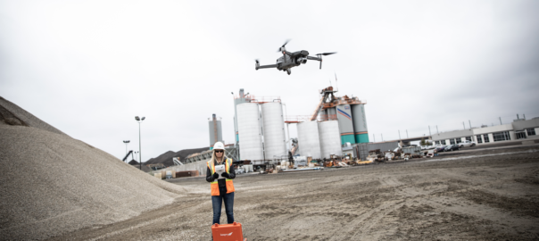
Kespry and DJI are pooling resources to offer the DJI Mavic 2 Pro drone as part of the Kespry stockpile measurement solution for mining and aggregates companies.

“This solution delivers the unique Kespry autonomous flight and aerial intelligence experience for stockpile measurement using a DJI drone,” according to Kespry.

“Adding this affordable, powerful and portable solution will enable large aggregates and mining companies to standardise and capture stockpile data across all their sites in the Kespry platform, while continuing to use the high-accuracy Kespry 2 drones to support mine and site planning operations.”

Integration of data captured from a DJI drone is the next innovation in the development of the Kespry industrial sensor platform, according to the company.

To date, Kespry has built a customer base of more than 200 mining and aggregates companies by providing drones for more accurate, easier to use, and safer ways to provide inventory management and mine planning data.

“As these customers scale their use of drone data, they are looking to standardise on a single platform to organise and analyse that data across sites, geographies, and product divisions – even when those sites are highly distributed,” Kespry says.

The addition of the DJI Mavic 2 Pro to the Kespry lineup is designed to enable even more site data to be centralised in the Kespry cloud.

George Mathew, CEO and Chairman of Kespry, said: “Drone data is now the standard approach for measuring stockpiles at mine sites, however, millions of dollars are wasted through reconciling inconsistent data from different platforms and the time involved getting that data ready for analysis.”

“Our goal with the addition of the Mavic 2 Pro to our solution is to respond to our customers wishing to use the Kespry aerial intelligence platform across all mine sites to standardise how stockpile data is generated – lowering their costs and helping drive the profitability of every site.”

Jan Gasparic, Director of Strategic Partnerships at DJI, said: “Pairing the Mavic 2 Pro with Kespry’s industry-leading AI, ML, and analytics capabilities will be of enormous benefit to mining companies that are looking to take advantage of drone technology in a portable and powerful package.”

The integration of DJI’s drone and sensors into the Kespry platform is the latest innovation in the delivery of an industrial sensor network, closely following Kespry’s recently-announced high-resolution thermal capabilities for industrial inspection.

The Kespry platform is now capable of processing and analysing a wide range of sensor data, enabling the future creation of industry-specific applications, including those under current development with leaders in the energy sector.

Kespry is offering the Mavic 2 Pro as part of its fully-managed, end-to-end annual subscription model. Kespry customers that choose the Mavic 2 Pro for stockpile measurement will benefit from the full Kespry experience, including its support, training, customer success team, and drone up-time guarantee.

The Kespry stockpile measurement solution with DJI will be available in the first quarter of next year.

Drones go to sea at BHP’s ocean freight operations

BHP was an early adopter of drones across its mine sites, employing the aerial technology across the group for post-blasting clearance, traffic monitoring, building inspections and operation surveillance. Now, the major diversified miner is looking to drones to improve safety and provide efficiency gains at its ocean freight operations.

While still in the trial phase, BHP’s Vice President of Marketing Freight, Rashpal Bhatti, sees the potential for drones to be a key part of a tablet-based technological package, incorporating artificial intelligence that provides captains a digital view of their ship.

“All of our chartered ships receive a tablet when they berth. And on the tablet they can read the tension of the mooring line which has major safety benefits,” he said.

“The question now is: can the same tablet become a holistic technological package by also delivering ship hold inspection data, draft readings and other critical information captured by drones? It’s all a bit futuristic but that is the direction we are going.”

BHP ships more than 300 Mt/y of iron ore, coal and copper to customers around the world. More than 1,500 voyages are made, making BHP one of the largest charterers of dry bulk carriers in the world.

Like the drones being used across other parts of BHP’s operations, marine drones can be programed to carry a range of specific tasks, the company said.

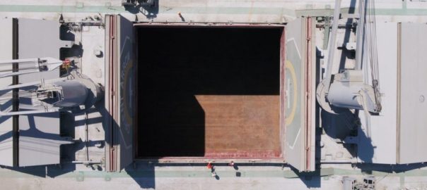
“In the ocean freight business, there are clear and immediate advantages from using drones in the inspection of holds and in the taking of draft readings. Then there is their nimbleness in the seemingly simple but important task of advising the ship’s bridge on the water position of the rudder,” BHP said.

Hold inspection reports would continue to be independent assessments, but the use of drones promises to cut inspection times per hold from an hour to 15 minutes, according to the company.

Bhatti said: “The hold inspection process involves ships which have five to nine holds which a person checks by climbing down ladders. The inspector has to be physically fit, use fall protection, and carry a parrot (oxygen meter) to make sure there is enough air in the hold. And it takes a lot of time.

“With drones, we can fly them into a hold and capture 4K images, but also infra-red, and other types of cameras that can show cracks or other specific parameters that cannot be seen with the naked eye.”

There are essentially three or four types of ships with hold sizes about the same, according to Bhatti. “So once you programme a drone to go in to a certain ship, it can become an autonomous process.’’

This provides a better way to assess the condition of the hold, and removes a person from a potentially hazardous situation, Bhatti said.

BHP is also testing the use of drones to improve the safety, time and cost of ship draft readings. This is usually done from a boat when the ship is berthed and ready for a cargo.

One of the logistical challenges to overcome is to get the drones on ships when they are offshore at anchorage, as distinct from being berthed.

“We are working with ship owners on this and other ways to use technology to improve safety and productivity,’’ Bhatti said.

Japan’s Terra Drone invests in underground aerial robotics startup Inkonova

Terra Drone, a leading global commercial drone technology company, has acquired a significant stake in Inkonova AB, a Swedish startup developing aerial robotics for underground mining.

The deal, comprised of a cash injection, will see changes to the management team, as well as technical, business development, and operational collaborations, Inkonova said.

Terra Drone’s UAV inspection, survey, and other service provisions cover various industries globally including mining, which just happens to be Inkonova’s main market.

Ahmed AlNomany, Inkonova AB Co-Founder and CEO, said: “Terra Drone’s global network of clients, post-processing domain, service-based business model, customer experience, technical personnel, and human and financial resources, will help us dramatically ramp up our business development and commercial-readiness efforts, taking our technology to the next level.”

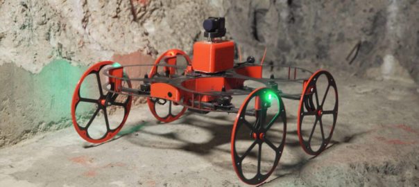
Under the deal, Inkonova will supply Terra Drone with its UAV core technology, including anti-dust and waterproof platforms (as in the TILT Ranger, pictured) and infrastructure-denied autonomous navigation (as in the Batonomous technology), while Terra Drone – apart from providing finance – will employ its global clients, local offices, pilots, post-processing capacity, and broader commercial and technical domain expertise.

Toru Tokushige, Founder and CEO of Terra Motors Corp and Terra Drone Corp, who will be appointed as an Inkonova board member, said the company had been looking to partner with other companies in the mining field in order to expand.

“Underground mining still has huge issues. According to the statistics from The National Institute for Occupational Safety and Health (NIOSH), the number of lost-time injuries in 2015 was 4,517 in America, and those of other developing counties were incomparably high.

“So, I hope the cooperation between Terra Drone, with its broad network and innovative technologies, and Inkonova, the eminent company for mining drone services, contributes to the rapid and further technical improvements for underground safety and productivity.”

In line with the partnership, Inkonova’s products will undergo rebranding to streamline with Terra Drone products, details of which will be announced later this month.

Inkonova’s products include aerial platforms, and aerial autonomous navigation/mapping solutions customised to the constraints of underground mines, and subterranean or constricted industrial spaces.

Earlier this year, Inkonova demoed the Batonomous navigation system for its TILT Ranger and TILT Scout underground drones in Gällivare with LKAB. It has since also worked with Barrick Gold on the Golden Sunlight mine in Nevada.

Automated drone specialist Airobotics sets up US launchpad

Israel automated drone startup Airobotics has launched its North American headquarters in Scottsdale, Arizona, where it will run all North America, South America and Central America operations.

The Scottsdale office is intended to become the company’s global headquarters as Airobotics continues to scale up, with the world’s largest mining company, BHP, the company’s first customer in the US.

Airobotics says it has created the only data-driven, fully automated drone solution enabling a new dimension of data collection and insights.

Ran Krauss, CEO and Co-Founder of Airobotics, said Arizona was the obvious choice for its new global headquarters.

“When deciding where to launch our first US office, Arizona was the top choice for us as it has a strong mining industry, great weather conditions for drone testing, and potential partners we’re excited to work with. The state and local governments are very supportive of autonomous and aviation technologies and the UAV industry specifically, aligning with our plans to operate UAVs beyond visual line of sight (BVLOS) in the US.”

The opening ceremony attendees were invited to tour the facility and observe a demonstration of Airobotics’ automated drone system. The company plans to grow the Scottsdale team to 80 employees by the end of 2019, focusing on recruiting local technology, operations and sales personnel.

Airobotics says its automated solution represents the next generation of drone operations, overtaking standard piloted services. It was the first company worldwide to be granted authorisation to fly fully automated pilotless drones, certified by the Civil Aviation Authority of Israel.

The company is headquartered in Israel and has offices in Australia, as well as additional operations in Chile and New Caledonia. It has raised $71 million in funding to date and grown from 80 to 200 employees in its first year.

Kumba Iron Ore seeing the benefits of drone use at Sishen mine

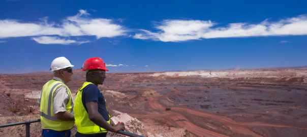
After two years of working through complex legal, governance and logistical challenges to earn an operating licence to fly its own remotely piloted drones, Kumba Iron Ore is making the most of these high-tech machines at its Sishen iron ore mine in South Africa.

Bongi Ntsoelengoe, Technology Manager at Kumba Iron Ore (an Anglo American subsidiary), says the drones have optimised surveying processes in terms of time and coverage, including being able to gain access to constricted areas.

“Routine tasks historically carried out by surveyors, such as measuring the volume of waste dumps and stockpiles, are now being done by our drones. The drones collect digital imagery that is pieced together to perform volume calculations, giving us reliable data without having put anyone at risk,” he said.

The company has recently used the drones to conduct engineering inspections for hard to access equipment, dramatically reducing safety risk. They can also be used to survey accident scenes and areas deemed unsafe for workers to enter.

Glen Mc Gavigan, Executive Head of Technical and Projects at Kumba, said the new drones had enabled the company to collect and process much more data than in the past, which was “pushing innovation mine-wide as data management processes are enhanced to ensure that other functional areas also benefit from the technology”.

Various subsidiaries of Anglo American have been using drones at their operations since late-2015, but have leased the units and, thus, been reliant on outside service providers. The licence to operate its own drones – with its own pilots and at heights of up to 1,000 feet (305 metres) above ground – is, Kumba says, the result of diligent groundwork and millions of rands worth of investment.

Kumba’s majority-owned Sishen iron ore mine, in the Northern Cape province, produced 31.1 million tonnes of high-grade ore last year.

So far, five employees have been trained to pilot the drones, all of whom are licensed by the SA Civil Aviation Authority to use the technology.

Anglo American has also established new working practices, such as scheduling flights, flight navigation and craft maintenance to make the most of these drones.